
If you’ve been eyeing Presidents Day weekend as a window for a Tahoe trip, a coastal hike or a long-overdue backyard project, Friday looks great. After that, California turns unsettled and, in the mountains, potentially treacherous.
Friday should be the nicest day of the stretch in the state as a short-lived ridge of high pressure slides overhead. Northern California skies will clear out under sunshine. The Bay Area should stay dry, sunny and mild, while sunny Southern California warms into the upper 60s and low 70s.
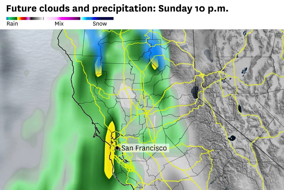
Saturday will be a transition day. Clouds will thicken across Northern California through the morning, and by late afternoon, light rain will break out in the North Bay before spreading south overnight. Coastal California from the Bay Area to San Diego will stay mostly dry through midday, though beach goers should expect rough surf.
Then the coldest storm of the season so far will arrive in California on Sunday, diving south from the Gulf of Alaska. Temperatures in the upper atmosphere will drop well below freezing, cold enough to drag snow levels down into the Sierra foothills by early next week.
For the thousands headed to Tahoe or Big Bear for one of the busiest ski weekends of the year and for valentines escaping to Santa Barbara or San Diego, the travel advice is simple: get there by Friday or early Saturday. Those are the safest windows.
On Sunday, weather disruptions will be harder to avoid. Rain chances are forecasted to climb through the day and winds increase, with gusts approaching 40 mph at times in the Bay Area and along the Central Coast. Southern California will start relatively quiet Sunday morning but turn wetter and windier by afternoon and especially into Sunday night.
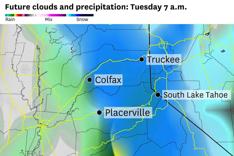
By Tuesday morning, moderate snow will be falling along the major Sierra passes, with snow levels dropping below 5,000 feet. (Baron/Lynx )
For travelers headed to the Sierra, the bigger story is snow. Snow levels will start around 5,000 feet over the weekend but drop to around 3,000 feet by Tuesday, potentially bringing accumulating snow into the Sierra foothills for the first time in two seasons. Southern California passes will see some snowflakes as well, with Kern County passes like the Grapevine and Tehachapi in line for a few inches of snow by Monday and Tuesday.
Hazardous travel impacts are expected from Sunday night through at least Tuesday, colliding directly with holiday return traffic. Caltrans is already warning anyone heading home Monday to be prepared for a long haul.
What initially looked like a single storm now resembles a parade of low-pressure systems that will keep much of the state wet from Sunday into at least midweek. That means periods of steady rain, occasional heavier bursts and limited dry windows once the pattern locks in.
Friday breakdown
San Francisco: Friday morning will start partly cloudy with patchy fog possible, especially near the coast. Any morning fog will clear and it will be a mostly sunny day across the city, with just a few high-level clouds sneaking in during the afternoon. Temperatures will rise into the low 60s downtown, while areas west of Twin Peaks will stay in the upper 50s. Winds will become northerly in the afternoon at 5 to 10 mph. Friday night will be mostly clear with lows dropping into the upper 40s to low 50s.
North Bay: Patchy dense fog will spread across the valley floors through mid-morning.The fog should lift by 10 or 11 a.m., giving way to mostly sunny skies for the afternoon. Highs will reach the mid-60s in Healdsburg and Santa Rosa, while Novato and San Rafael will be a few degrees cooler. Friday night will be mostly clear early, but fog will redevelop overnight in the North Bay valleys. Overnight lows will drop into the upper 30s to low 40s.
East Bay: Friday will have the best weather of the long weekend. Morning clouds will clear to sunshine by mid-morning, with highs reaching the low 60s in Oakland and Berkeley and warming to the mid-60s inland in Walnut Creek, Concord and Livermore. Winds will be light out of the north at 5 to 10 mph. Skies will remain mostly clear overnight, with lows falling to the mid- to upper 40s near the bay and dipping to the low 40s farther inland toward the Tri-Valley.
Pacific Coast and Peninsula: Patchy morning fog is likely along the immediate coast near Half Moon Bay and Pacifica, burning off by late morning. Otherwise, expect sunny skies through the afternoon with highs in the upper 50s at the beaches and in the low 60s on the Peninsula in Redwood City, San Mateo and Burlingame. A Beach Hazards Statement is in effect through late Friday night along northwest-facing beaches for sneaker waves, strong rip currents and 14- to 19-foot breaking waves. Friday night will be mostly clear with lows in the upper 40s to low 50s.
South Bay: Friday will be a sunny and mild day in the South Bay. Patchy morning fog is possible in low spots around Gilroy and Morgan Hill but should burn off quickly. Highs will reach mid- to upper 60s in San Jose, Sunnyvale and Mountain View. Clear skies will hold into the evening and overnight, with lows falling into the upper 40s.
This article originally published at California’s coldest storm of the season to hit holiday weekend. Here’s when travel turns risky.