
SAN DIEGO, Calif. – Enjoy a sunny, mildly warm Valentine’s Day Saturday because big changes are coming to the San Diego area by Monday.
Saturday will start with mostly sunny skies and temperatures in the mid to upper 60s for the beaches and valleys.
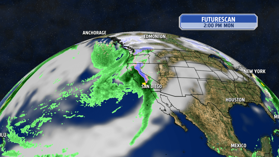
Clouds will gradually increase for Sunday as a large area of low pressure moves south along the coast. There could be a few leading sprinkles by the end of the weekend, but Monday and Tuesday are the highest storm impact days.
Widespread light to moderate rain moves in on Monday afternoon in San Diego County, with periods of heavy rain expected. The heaviest rain rates are likely in the afternoon for northern areas and early evening in the south county.
More weather: ➡️ Forecast | ⚠️ Alerts | 🗺️ Live Radar | 📧Newsletter
The exact path of the storm is still uncertain, but scattered shatters are expected to linger into Tuesday and become lighter and more isolated for Wednesday.
There are concerns for flooding, especially on Monday night if higher rainfall rates produce excessive rainfall.
By the end of next week, beaches and valleys could end up with two to three inches of rain, with up to five inches of rain for the mountains and up to two inches of rain for the deserts.
Snow levels look to drop to 4,000 to 5,000 feet in elevation for Tuesday evening, meaning Big Bear, Mt. Laguna, Palomar Mtn. and Julian are finally favored for some snow accumulations! Watch out for chain controls and tricky driving conditions in local mountain communities.
Cold air will be setting in for Wednesday and Thursday with daytime highs for the coast and valleys expected to top out in the upper 50s and low 6s with mid 40s for the mountains and deserts in the low 60s.
Another weaker storm system is possible for Thursday into Friday.
Copyright 2026 Nexstar Media, Inc. All rights reserved. This material may not be published, broadcast, rewritten, or redistributed.
For the latest news, weather, sports, and streaming video, head to FOX 5 San Diego & KUSI News.