
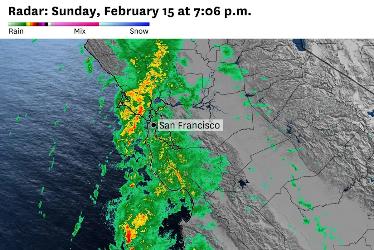
Heavy rain was moving toward San Francisco on Sunday evening, setting the stage for potential flooding overnight into Monday morning.
It was a shift from earlier forecasts that indicated the heaviest rain would be focused south and east of the city. But the cold front was moving slower than anticipated, meaning downpours could stall over the same area and cause flooding.
High resolution weather models predicted rainfall rates up to a half-inch per hour over portions of Marin, Sonoma, Napa, San Mateo and San Francisco counties Sunday night. Western Alameda and Contra Costa counties could also be drenched by heavy rain.
“Highly localized rates around 0.75 (inches per hour) along the immediate coast” were possible, the National Weather Service said in an excessive rainfall forecast. “These rainfall amounts will result in isolated flood impacts through the overnight hours, especially across more susceptible urban areas.”
Some areas could record up to 2 inches of rain by 6 a.m. Monday.
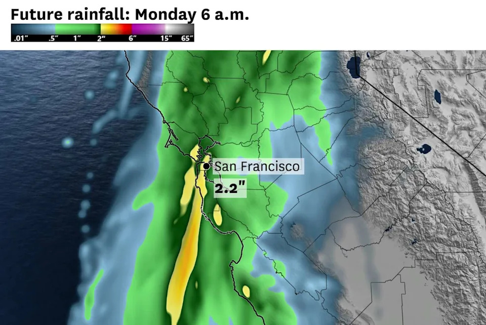
The high-resolution rapid refresh weather model predicted bullish rainfall totals in San Francisco on Sunday night, with more than 2 inches by 6 a.m. Monday. (Baron/Lynx)
A southerly gale accompanied the rain Monday evening, delaying inbound flights to San Francisco International Airport by more than two hours. Outbound flights were delayed by more than an hour.
Rain was predicted to continue on Presidents Day, which was shaping up to be very wet in the Bay Area. Up to an additional inch was possible between 6 a.m. and 6 p.m., after which steady precipitation was forecast to transition to off and on showers. The South Bay and East Bay were forecast to pick up the most rain, with even higher totals along the Central Coast.
Scientists said downpours could be enhanced by anomalously warm sea surface temperatures off the California coast. That water, 2 to 4 degrees above normal for mid-February, was adding instability to the lower atmosphere and making thunderstorms and heavy rain more likely.
“Extremely warm ocean temperatures of this kind of magnitude can certainly ‘juice up’ existing storms,” said Daniel Swain, a climate scientist at the UC Agriculture and Natural Resources center.
Pouring rain was forecast to be accompanied by swirling winds.
Easterly breezes Monday morning were expected to turn northerly by noon before eventually blowing out of the northwest in the afternoon and evening.
That’s because a low-pressure system was predicted to make landfall along the Central Coast, with counterclockwise-swirling winds around it. Gusts of 25 to 40 mph were forecast in the Bay Area, with San Francisco’s strongest winds likely in the afternoon and evening.
There’s a chance the low makes landfall as far north as San Mateo County. If that happens, wind gusts could reach 50 mph along the Peninsula, East Bay and South Bay.
South of the center of the low-pressure system, the weather service warned of severe wind gusts up to 60 mph, though most areas were forecast to experience much lower speeds. There was even a low chance of tornadoes from roughly Santa Barbara to San Diego.
Forecasters warned of a colder storm Tuesday into Wednesday with potential hail and snow in the Bay Area.
This article originally published at San Francisco forecast shifts to heavier rain, potential flooding.