

The California coast is bracing for heavy thunderstorms on Monday that could lead to dangerous flash flooding and debris flows.
A flood watch is in effect for more than 10 million people along the Southern California coast, from Santa Barbara to Los Angeles.
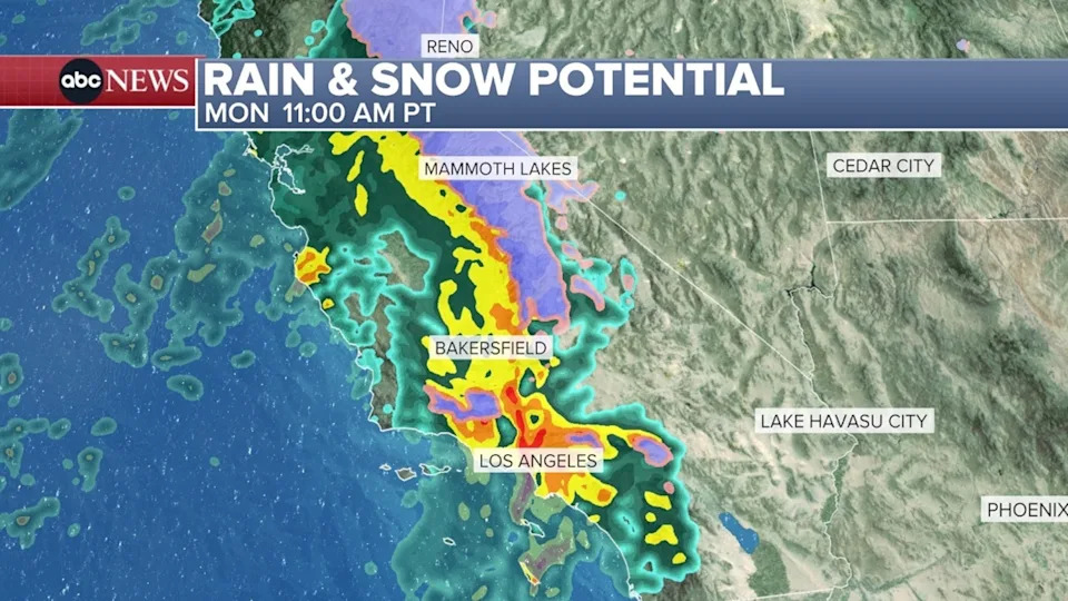
ABC News – PHOTO: Rain and snow potential on Monday.
3 life-saving tactics to use if in a car during a flash flood
The heaviest rain across Southern California will hit from 9 a.m. to 1 p.m. Monday, possibly causing flooding, rock slides, mudslides and debris flows on burn scar areas.
Most of California’s central and southern coast can expect 1 to 2 inches of rain on Monday, though some areas could see more than 2 inches and higher elevations could get more than 4 inches.
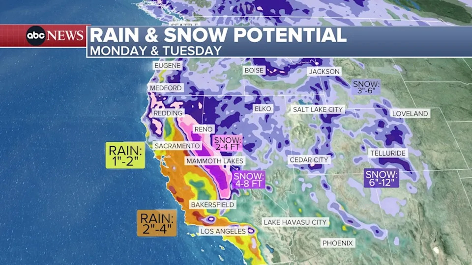
ABC News – PHOTO: Rain and snow potential on Monday and Tuesday.
Wind gusts, especially in the coastal mountains, could reach 50 to 70 mph.
Strong thunderstorms may impact the central and southern coasts Monday afternoon and evening, which could bring damaging wind gusts and even a brief tornado.
The rain will become more scattered in the evening and will continue off and on overnight.
On Tuesday morning, another round of heavy rain will push into central California, including the Bay Area, and this will slowly move south through the day, reaching Southern California by Tuesday evening.
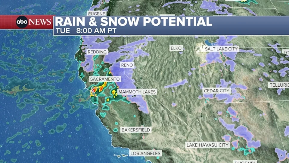
ABC News – PHOTO: Rain and snow potential on Tuesday.
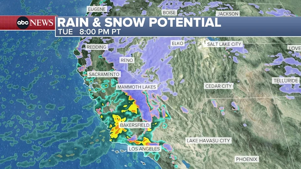
ABC News – PHOTO: Rain and snow potential on Tuesday.
Later in the week — on Thursday, Friday and Sunday — the rain and snow will hit further north, in Northern California, Oregon and Washington.
The highest elevations of California’s Sierra Nevada Mountains could see more than 4 feet of snow through Tuesday, and over the next week, parts of Sierras could see more than 8 feet of snow.