
The first of two powerful winter storm systems continues Monday in Northern California, bringing heavy snow to the Sierra, along with rounds of rain and wind for the Valley and lower Foothills. The KCRA 3 weather team issued Weather Alert Days for Monday and Tuesday because of snow reaching lower elevations, extended duration of rain, and strong winds. Travel is discouraged on Alert Days because of risky conditions posed by the weather. Wednesday is a KCRA 3 weather Impact Day; conditions will not be as risky, but travel and outdoor activities are likely to be affected. Snow will continue to fall, but the intensity will ease. Long delays are still likely throughout the day. When enough snow falls in the region, road officials are likely to issue chain controls, meaning all vehicles except those with four-wheel-drive and snow tires equipped are required to install chains. If chain controls are in effect, that also means speed limits are reduced. On Interstate 80, the speed limit becomes 30 mph, while on Highway 50, it becomes 25 mph.The Valley and Foothills will have stormy weather to deal with each of these days, too. Below is a breakdown of what the KCRA 3 weather team is expecting. SnowMountain snow began Sunday night and is expected to continue through Wednesday. Snow will be heaviest on Monday but more widespread on Tuesday. During Monday, snow could accumulate at one to two inches per hour. This, combined with strong winds, could create blizzard-like conditions with near-zero visibility. By Monday, the snow level will drop to 4,000 feet. It continues dropping to 2,000 feet by Tuesday and bottoms out Wednesday as some snow accumulates as low as 2,000 feet. Residents living at elevations above 7,000 feet should prepare for 3-5 feet of snow from Monday through Wednesday. At elevations around 5,000 feet, people can expect 2-3 feet of snow.At 4,000 feet and above, about 2 feet of snow is possible, while those at 2,000 feet and above could see up to a foot of snow. People living at 4,000 feet should prepare for the possibility of disruptive snowfall and closures next week. A foot of snow is possible at this elevation. RainRainfall totals will pale in comparison to snow numbers.The storm will bring systems in from the north, where air tends to be dry, rather than from the south, which tends to breed warm, wet storms. There is no atmospheric river connection with next week’s pattern. Rain began Sunday and continued through the overnight hours, becoming more widespread. The Sacramento Valley will see 1-3 inches of rain from Monday through Wednesday. Lower numbers are forecast for the San Joaquin Valley. The Foothills will see up to 2-5 inches of rain from that same time period.Rain totals in these ranges are enough to keep things wet for several days, and there may be some street flooding in poor drainage areas. Creeks, streams and rivers will not flood. WindWhile winds can be expected on both Monday and Tuesday, the strongest winds will arrive as the second colder system barrels through the region.The Valley and Foothills may experience wind gusts near 45 mph for a few hours at a time. Sierra wind gusts will peak near 50 mph. Gusts over the Sierra summits could top 100 mph.Wind gusts of 45 mph can make a mess of any yard furniture, décor or trash bins, but major damage is not currently expected.Winds could trigger outages in the Sierra. See more coverage of top California stories here | Download our app | Subscribe to our morning newsletter | Find us on YouTube here and subscribe to our channel
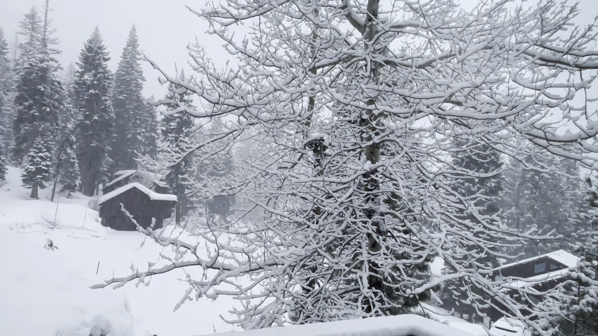
The first of two powerful winter storm systems continues Monday in Northern California, bringing heavy snow to the Sierra, along with rounds of rain and wind for the Valley and lower Foothills.
The KCRA 3 weather team issued Weather Alert Days for Monday and Tuesday because of snow reaching lower elevations, extended duration of rain, and strong winds. Travel is discouraged on Alert Days because of risky conditions posed by the weather.
Wednesday is a KCRA 3 weather Impact Day; conditions will not be as risky, but travel and outdoor activities are likely to be affected. Snow will continue to fall, but the intensity will ease. Long delays are still likely throughout the day.
When enough snow falls in the region, road officials are likely to issue chain controls, meaning all vehicles except those with four-wheel-drive and snow tires equipped are required to install chains.
If chain controls are in effect, that also means speed limits are reduced. On Interstate 80, the speed limit becomes 30 mph, while on Highway 50, it becomes 25 mph.
The Valley and Foothills will have stormy weather to deal with each of these days, too.
Below is a breakdown of what the KCRA 3 weather team is expecting.
Snow
Mountain snow began Sunday night and is expected to continue through Wednesday.
Snow will be heaviest on Monday but more widespread on Tuesday. During Monday, snow could accumulate at one to two inches per hour. This, combined with strong winds, could create blizzard-like conditions with near-zero visibility.
By Monday, the snow level will drop to 4,000 feet. It continues dropping to 2,000 feet by Tuesday and bottoms out Wednesday as some snow accumulates as low as 2,000 feet.

Residents living at elevations above 7,000 feet should prepare for 3-5 feet of snow from Monday through Wednesday. At elevations around 5,000 feet, people can expect 2-3 feet of snow.

At 4,000 feet and above, about 2 feet of snow is possible, while those at 2,000 feet and above could see up to a foot of snow.

People living at 4,000 feet should prepare for the possibility of disruptive snowfall and closures next week. A foot of snow is possible at this elevation.
Rain
Rainfall totals will pale in comparison to snow numbers.
The storm will bring systems in from the north, where air tends to be dry, rather than from the south, which tends to breed warm, wet storms.
There is no atmospheric river connection with next week’s pattern.
Rain began Sunday and continued through the overnight hours, becoming more widespread.
The Sacramento Valley will see 1-3 inches of rain from Monday through Wednesday. Lower numbers are forecast for the San Joaquin Valley.
The Foothills will see up to 2-5 inches of rain from that same time period.

Rain totals in these ranges are enough to keep things wet for several days, and there may be some street flooding in poor drainage areas.
Creeks, streams and rivers will not flood.
Wind
While winds can be expected on both Monday and Tuesday, the strongest winds will arrive as the second colder system barrels through the region.
The Valley and Foothills may experience wind gusts near 45 mph for a few hours at a time. Sierra wind gusts will peak near 50 mph. Gusts over the Sierra summits could top 100 mph.

Wind gusts of 45 mph can make a mess of any yard furniture, décor or trash bins, but major damage is not currently expected.
Winds could trigger outages in the Sierra.
See more coverage of top California stories here | Download our app | Subscribe to our morning newsletter | Find us on YouTube here and subscribe to our channel