
A cold storm moving over the Bay Area on Tuesday will bring a chance of snow to the region’s peaks, along with downpours, gusty winds and small hail in some places.
Frigid air from the Gulf of Alaska will spill toward California, moving over relatively warmer Pacific Ocean waters on its way to the coast. This temperature differential between the sea and air above will generate rapid rising motion in the lower atmosphere necessary for thunderstorms.
Lightning won’t be the main hazard. Rather, small hail, downpours and erratic wind gusts are the main threats in the Bay Area.
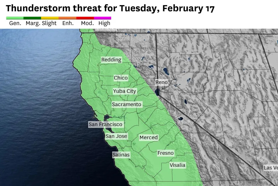
The National Weather Service Storm Prediction Center forecasts a general risk of thunderstorms across much of California on Tuesday, with small hail and gusty winds being the main threat. (Baron/Lynx)
Showers are expected to start in the North Bay before dawn before moving toward San Francisco, Oakland and San Jose during the morning commute. Hit-or-miss downpours will continue for the rest of the day, with equal chances across all Bay Area cities.
Hail isn’t common in the Bay Area because of the stubborn marine layer that limits thunderstorm energy. But the air mass moving over the region Tuesday is forecast to be the coldest in three years, wiping out the marine layer and opening the door for unusual weather.
Snow will probably be limited to elevations above 2,500 feet, but hail is heavier than snowflakes and may reach sea level before melting. Previous Bay Area hail storms have covered San Francisco and Oakland enough to turn neighborhoods into a winter wonderland. It can be slick, so drivers caught in a hail shower should slow down or pull off the road.
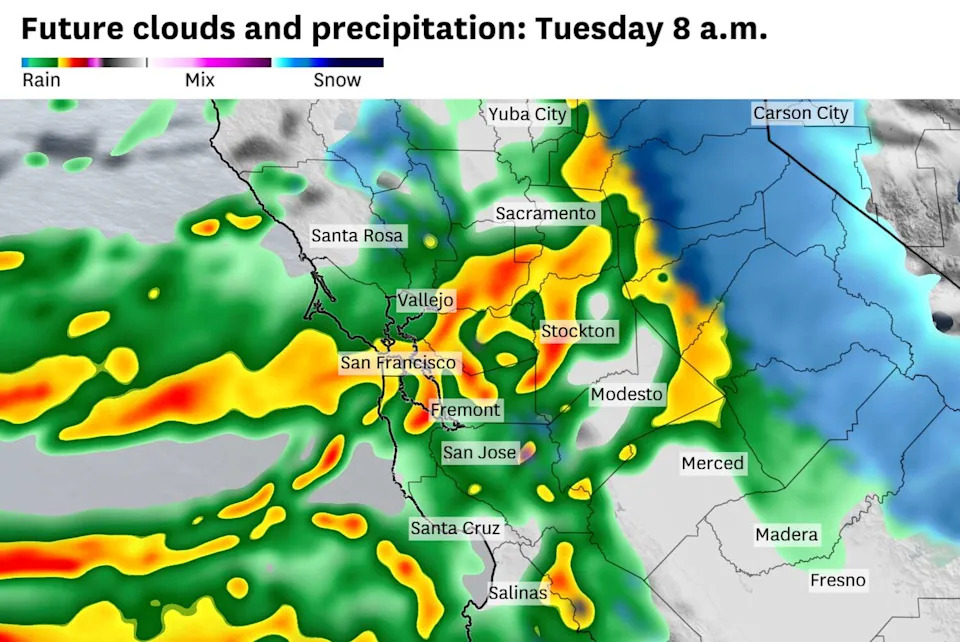
Weather models predict heavy rain and hail showers over the Bay Area on Tuesday morning. Precipitation could fall as snow above 2,500 feet. (Baron/Lynx)
Cold, unstable air masses can spawn funnel clouds, waterspouts and even short-lived tornadoes.
“Trends will continue to be monitored regarding potential for a … brief tornado threat associated with this strong system,” the National Weather Service Storm Prediction Center said.
Most areas won’t see hail or a twister, but even then, weather will be unusual for Bay Area standards.
Showers will be moving faster than 50 mph, so blue skies may suddenly turn dark before a downpour hits. If heavy showers linger over the same area for an extended period, urban flooding is possible.
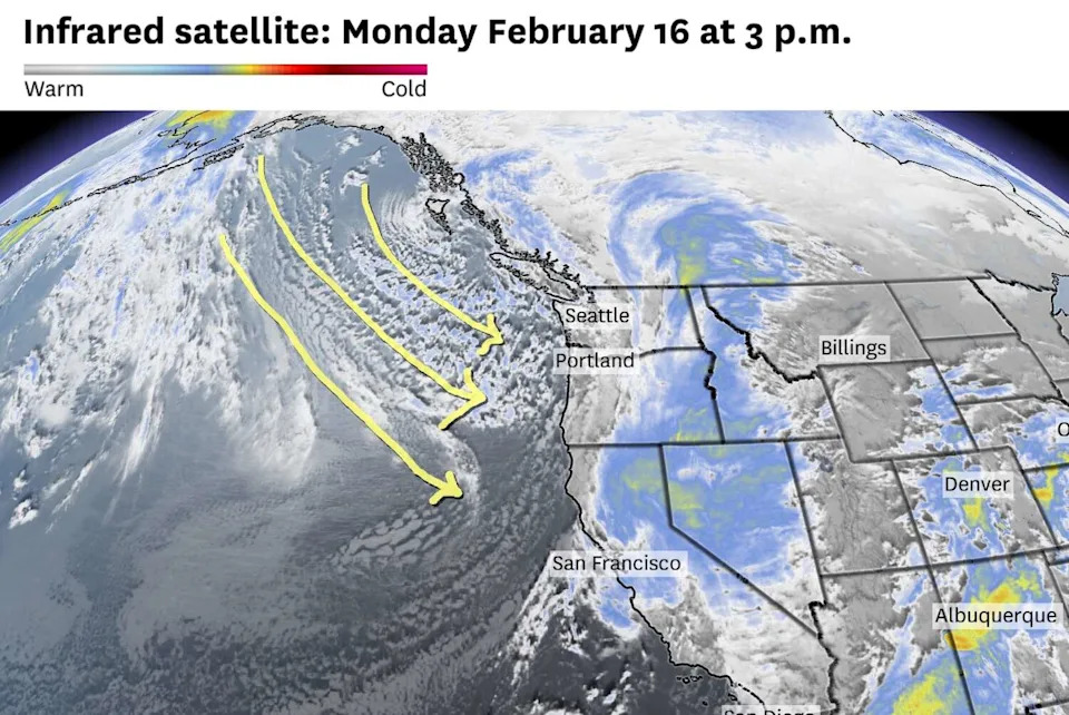
Infrared satellite imagery captured cold clouds taking a direct path from the Gulf of Alaska toward the West Cost on Monday. (Baron/Lynx)
Wind gusts of 30 to 40 mph are likely. Localized gusts could exceed 50 mph, particularly in and around thunderstorms. A few power outages are possible.
Tuesday will be cold, too.
High temperatures will only be in the mid-40s to low 50s, dropping into the 30s to low 40s overnight. It could be the coldest day since February 2023 in parts of the North Bay, with highs in the mid- to upper 40s.
Showers won’t be as plentiful Wednesday, but the overall weather will be similar, with below normal temperatures, occasional downpours and gusty winds.
This article originally published at Worst of the storms is about to hit S.F. Here’s when to expect downpours and hail showers.