
Heavy snow and rain hit Northern California hard on Monday. That was round one. Round number two begins around sunrise Tuesday.Tuesday’s storm will be colder and breezier. The snow level will drop below 2,000 feet at times with disruptive accumulations at and above 2,500 feet. Meanwhile, the Valley will see another round of heavy rain. The KCRA 3 weather team issued another Weather Alert Day for Tuesday because of the continuing dangerous travel conditions in the mountains and the waterlogged roads in the lower elevations. Heavy precipitation will taper off to rain and snow showers on Wednesday. Even though snow accumulations will slow down significantly, all roads above 4,000 feet will likely still be a mess midweek. Wednesday is a KCRA 3 weather Impact Day; conditions will not be as risky, but travel and outdoor activities are likely to be affected. Leer en español. A reminder to drivers that when chain controls are in effect, that also means speed limits are also reduced. On Interstate 80, the speed limit becomes 30 mph, while on Highway 50, it becomes 25 mph. Below is a breakdown of what the KCRA 3 weather team is expecting. Snow Mountain snow began Sunday night and is expected to be heavy through Tuesday. Additional accumulation is in the forecast for Wednesday and Thursday. Tuesday’s snow level will be lower than Monday, with places as low as 2,000 feet and above seeing 4-10 inches. Places above 4,000 feet could see 12-18 inches. At elevations above 5,000 feet, people could see up to 2 feet of snow, while areas above 7,000 feet may see 3-5 feet of snow. There will be significant travel impacts on Highway 20, Highway 70, Highway 49 in Sierra County as well as Highway 50 and Interstate 80. Ski resorts in Northern California are also reporting how much snow they’ve received in the last 24 hours. Below are the amounts as of 6 a.m. Tuesday.Lighter snow is expected on Wednesday, but roads will still be snow-covered, and travel will be very slow. The KCRA 3 weather team is also watching the potential for a colder system Thursday with more accumulating snowfall at low elevations. RainRainfall was impressive throughout the Valley and Foothills on Monday. The Valley had nearly two inches of rain in some spots. Foothills communities had even higher numbers. Another round of widespread, heavy rain will come through early Tuesday morning. Sacramento and areas north could see another half inch to an inch of rain. The Foothills could see up to two inches of rain as that band of precipitation stalls. Rain totals in these ranges are enough to keep things wet for several days, and there may be some street flooding in poor drainage areas. Creeks, streams and rivers will not flood. There’s also the possibility of thunderstorms Tuesday from late morning through sunset.Some storms may produce heavy downpours and small hail.WindWhile winds can be expected on both Monday and Tuesday, the strongest winds will arrive as the second colder system barrels through the region.The Valley and Foothills may experience wind gusts near 35-40 mph for a few hours at a time. Wind gusts around Lake Tahoe will peak near 50 mph. Winds could trigger outages in the Sierra.Wind gusts of 40 mph in the Valley can make a mess of any yard furniture, décor or trash bins, but major damage is not expected.See more coverage of top California stories here | Download our app | Subscribe to our morning newsletter | Find us on YouTube here and subscribe to our channel
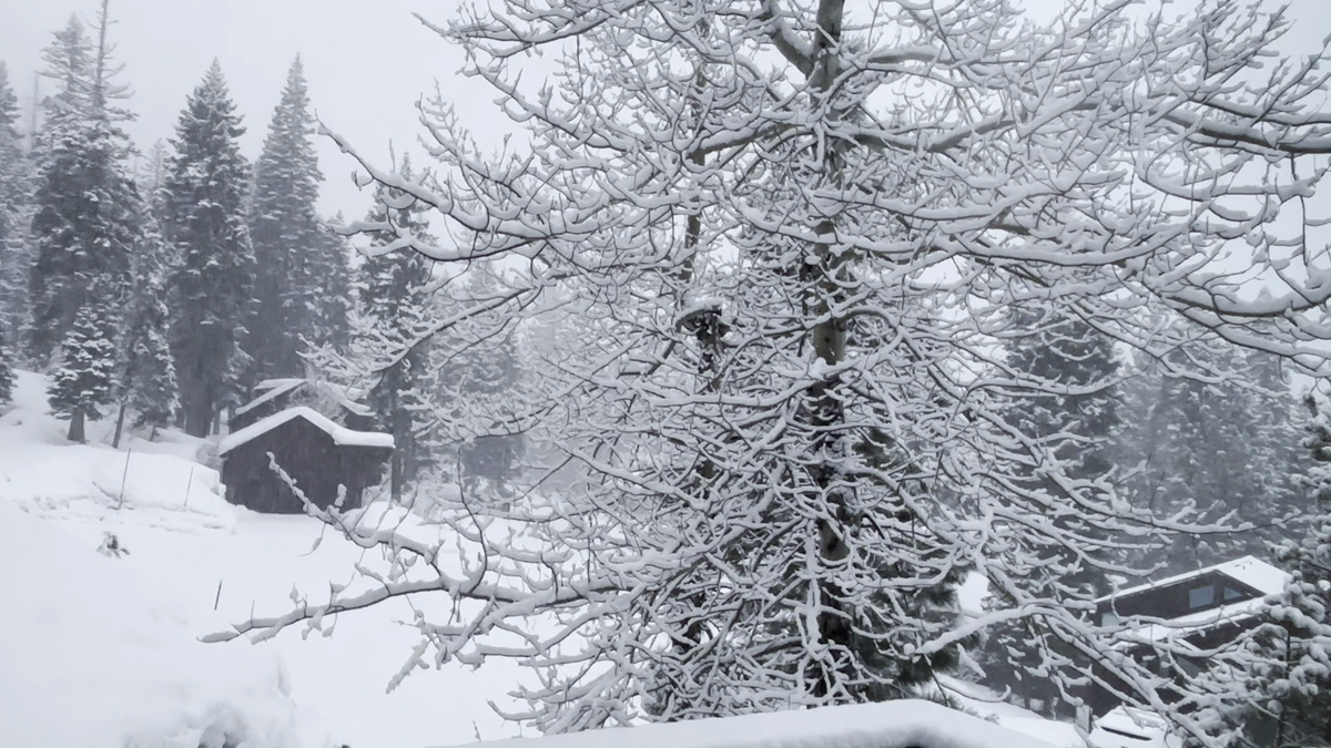
Heavy snow and rain hit Northern California hard on Monday. That was round one. Round number two begins around sunrise Tuesday.
Tuesday’s storm will be colder and breezier. The snow level will drop below 2,000 feet at times with disruptive accumulations at and above 2,500 feet. Meanwhile, the Valley will see another round of heavy rain.
The KCRA 3 weather team issued another Weather Alert Day for Tuesday because of the continuing dangerous travel conditions in the mountains and the waterlogged roads in the lower elevations.
Heavy precipitation will taper off to rain and snow showers on Wednesday. Even though snow accumulations will slow down significantly, all roads above 4,000 feet will likely still be a mess midweek.
Wednesday is a KCRA 3 weather Impact Day; conditions will not be as risky, but travel and outdoor activities are likely to be affected.
A reminder to drivers that when chain controls are in effect, that also means speed limits are also reduced. On Interstate 80, the speed limit becomes 30 mph, while on Highway 50, it becomes 25 mph.
Below is a breakdown of what the KCRA 3 weather team is expecting.
Snow
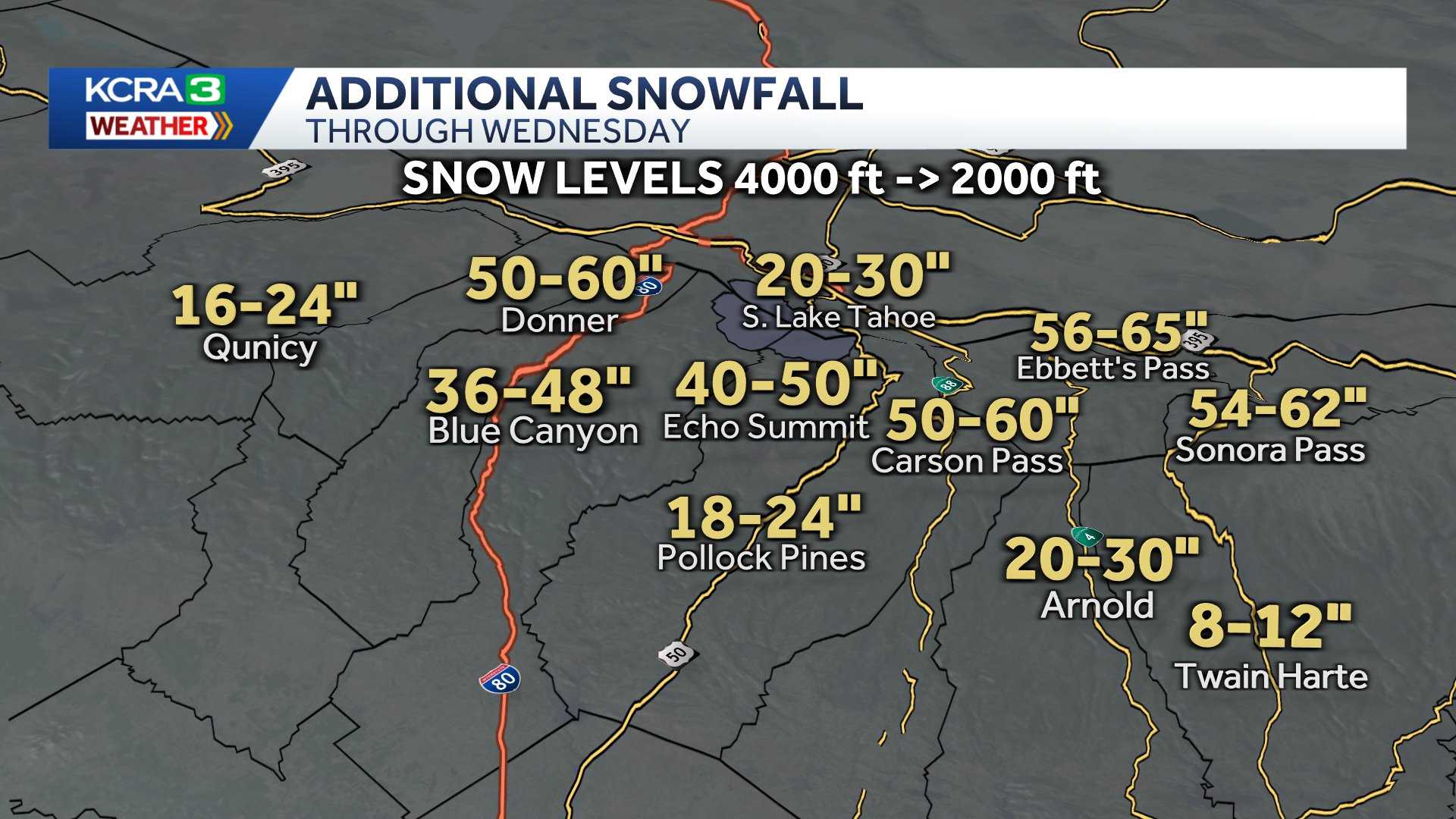
Mountain snow began Sunday night and is expected to be heavy through Tuesday. Additional accumulation is in the forecast for Wednesday and Thursday.
Tuesday’s snow level will be lower than Monday, with places as low as 2,000 feet and above seeing 4-10 inches. Places above 4,000 feet could see 12-18 inches.
At elevations above 5,000 feet, people could see up to 2 feet of snow, while areas above 7,000 feet may see 3-5 feet of snow.
There will be significant travel impacts on Highway 20, Highway 70, Highway 49 in Sierra County as well as Highway 50 and Interstate 80.
Ski resorts in Northern California are also reporting how much snow they’ve received in the last 24 hours. Below are the amounts as of 6 a.m. Tuesday.

Lighter snow is expected on Wednesday, but roads will still be snow-covered, and travel will be very slow.
The KCRA 3 weather team is also watching the potential for a colder system Thursday with more accumulating snowfall at low elevations.
Rain
Rainfall was impressive throughout the Valley and Foothills on Monday. The Valley had nearly two inches of rain in some spots. Foothills communities had even higher numbers.
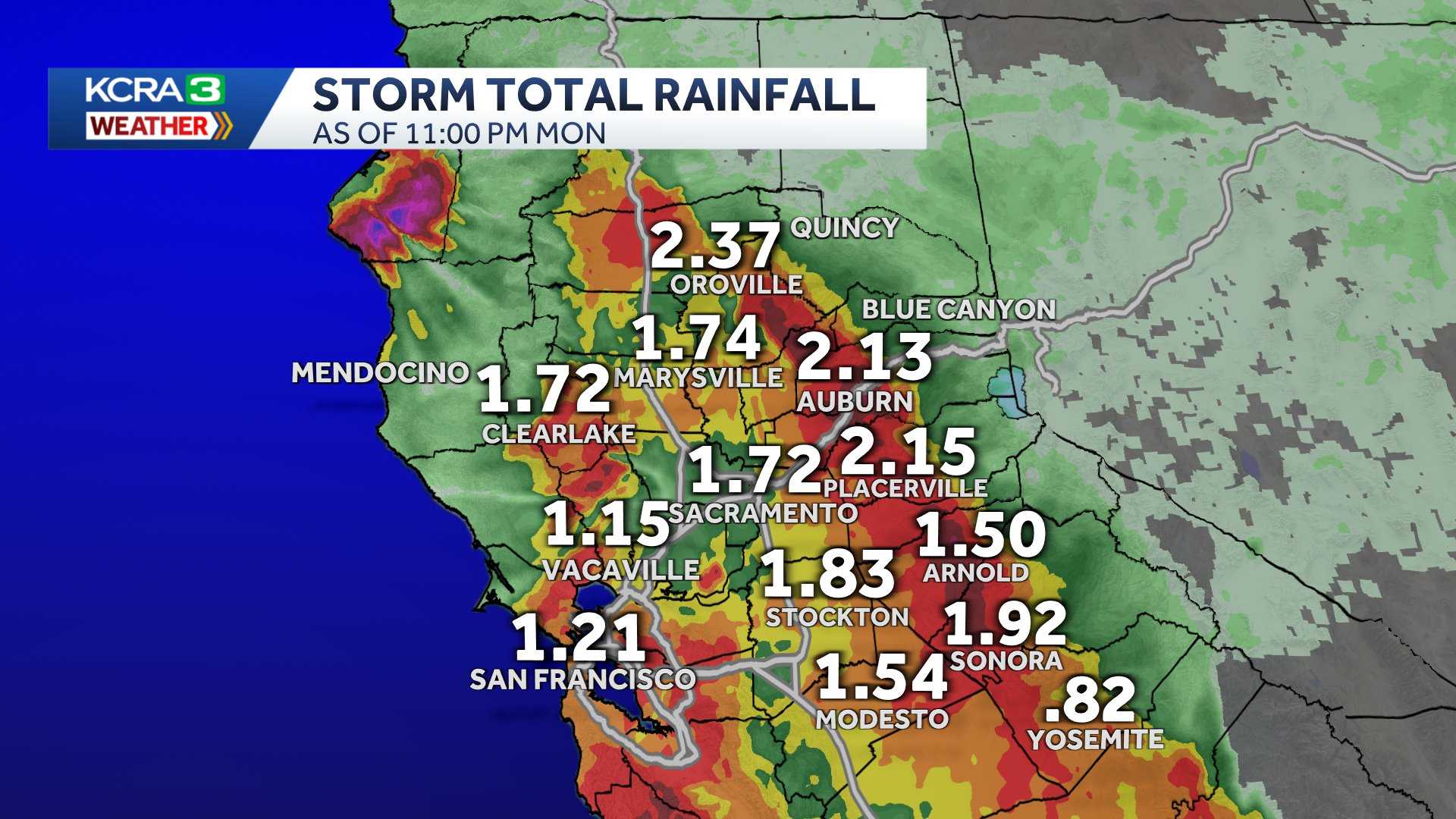
Another round of widespread, heavy rain will come through early Tuesday morning. Sacramento and areas north could see another half inch to an inch of rain. The Foothills could see up to two inches of rain as that band of precipitation stalls.
Rain totals in these ranges are enough to keep things wet for several days, and there may be some street flooding in poor drainage areas.
Creeks, streams and rivers will not flood.
There’s also the possibility of thunderstorms Tuesday from late morning through sunset.

Some storms may produce heavy downpours and small hail.
Wind
While winds can be expected on both Monday and Tuesday, the strongest winds will arrive as the second colder system barrels through the region.
The Valley and Foothills may experience wind gusts near 35-40 mph for a few hours at a time. Wind gusts around Lake Tahoe will peak near 50 mph. Winds could trigger outages in the Sierra.

Wind gusts of 40 mph in the Valley can make a mess of any yard furniture, décor or trash bins, but major damage is not expected.
See more coverage of top California stories here | Download our app | Subscribe to our morning newsletter | Find us on YouTube here and subscribe to our channel