
After two days of heavy rain and snow in Northern California, Wednesday will offer a slight reprieve, but low snow and lingering showers are expected.The KCRA 3 weather team issued an Impact Day for Wednesday. Those are issued when conditions could affect outdoor activities and travel. Snow has been heavy enough that highways in and out of the Sierra that closed Tuesday are still closed as of Wednesday morning. Even though snow accumulations will slow down significantly in the Sierra, all roads above 4,000 feet will likely still be a mess.The Valley saw another round of torrential rain Tuesday morning. That has tapered to hit-and-miss showers for the evening. The Valley on Wednesday will be dry for much of the day, bringing breezy and cool conditions. A third storm with snow levels down to 1,000 feet will hit the region early Thursday morning. Thursday is another KCRA 3 weather Impact Day. It will be another day with long travel delays and shoveling for many on the West Slope. Leer en español. Below is a breakdown of what the KCRA 3 weather team is expecting. Snow Ski resorts in Northern California reported how much snow they’ve received from recent storms. Below are the amounts as of 6 a.m. Tuesday.These numbers will be updated again with new reports on Wednesday morning. On-and-off snow showers will bring lighter accumulation to places above 3,000 feet in the Sierra on Wednesday. Drivers should still expect chain controls and long delays, even though conditions will be much friendlier compared to Tuesday.Snow will become more widespread again starting early Thursday morning. This is when the snow level will drop to 1,000 feet. Auburn, Cameron Park, Grass Valley, Sonora and Groveland all could see some slushy accumulation, mostly on the grass.Snow will stick to pavement at and above 2,500 feet. Places between 3,000 and 4,000 feet will pick up another 3 to 8 inches on Thursday alone. Locations at and above 5,000 could see up to an additional foot of powdery snowfall. Friday and Saturday will be dry.RainRainfall was impressive throughout the Valley and Foothills on Monday and Tuesday. The Valley had nearly three inches of rain in some spots. Foothills communities had even higher numbers. Most places in the Valley and Foothills will get a break in the rain on Wednesday. Hit-and-miss showers will pop up late in the morning and spread east through the afternoon. A brief downpour or some small hail is possible with these showers. Rain will be more widespread again early Thursday morning. Most places will see an additional quarter-inch of rain Thursday morning. The afternoon will be showery with rain chances dropping through the evening. Friday and Saturday will be dry.WindWinds will be lighter on Wednesday but the breeze will pick up again with the next round of rain Thursday. The Valley could see gusts close to 40 mph, mainly south of I-80 and east of I-5 in the San Joaquin Valley. The National Weather Service office in Sacramento issued a Wind Advisory that continues through 10 p.m. Thursday for the Sacramento Valley.Wind gusts of 40 mph in the Valley can make a mess of any yard furniture, décor or trash bins, but major damage is not expected.See more coverage of top California stories here | Download our app | Subscribe to our morning newsletter | Find us on YouTube here and subscribe to our channel
After two days of heavy rain and snow in Northern California, Wednesday will offer a slight reprieve, but low snow and lingering showers are expected.
The KCRA 3 weather team issued an Impact Day for Wednesday. Those are issued when conditions could affect outdoor activities and travel.
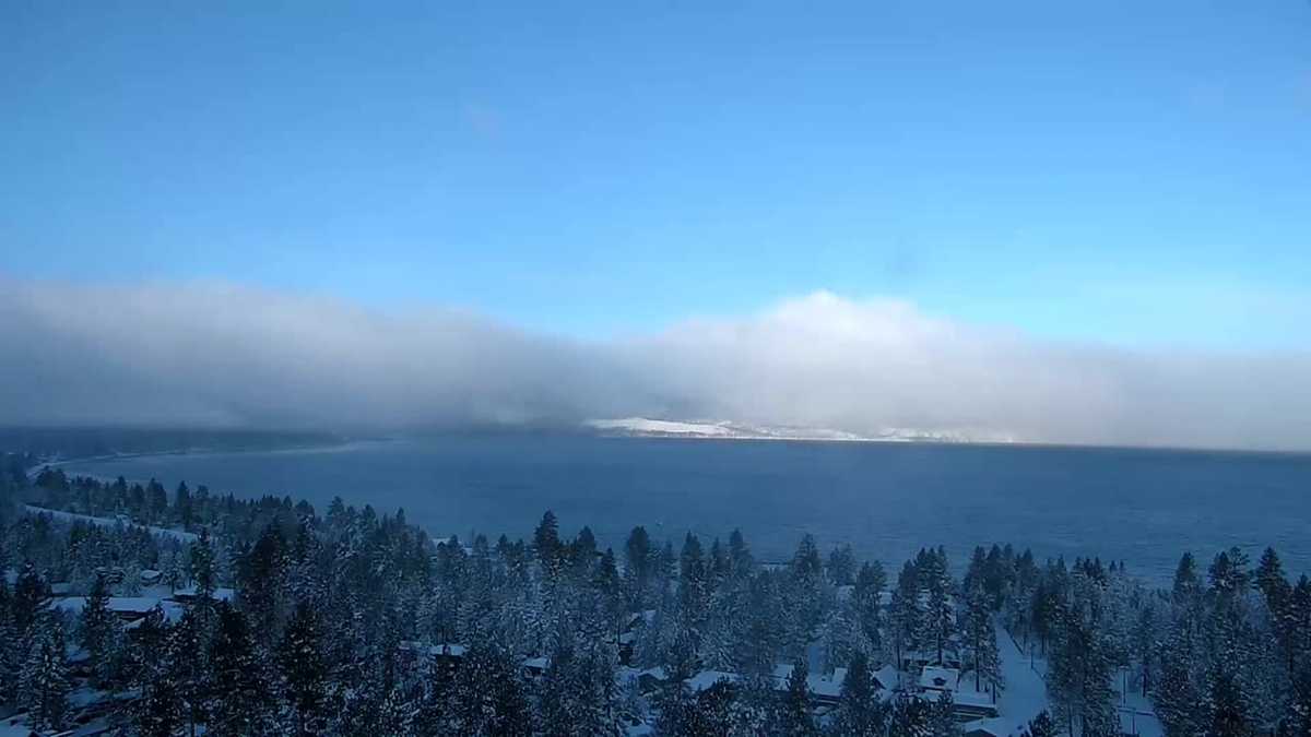
Snow has been heavy enough that highways in and out of the Sierra that closed Tuesday are still closed as of Wednesday morning. Even though snow accumulations will slow down significantly in the Sierra, all roads above 4,000 feet will likely still be a mess.
The Valley saw another round of torrential rain Tuesday morning. That has tapered to hit-and-miss showers for the evening. The Valley on Wednesday will be dry for much of the day, bringing breezy and cool conditions. A third storm with snow levels down to 1,000 feet will hit the region early Thursday morning. Thursday is another KCRA 3 weather Impact Day. It will be another day with long travel delays and shoveling for many on the West Slope.
Below is a breakdown of what the KCRA 3 weather team is expecting.
Snow
Ski resorts in Northern California reported how much snow they’ve received from recent storms. Below are the amounts as of 6 a.m. Tuesday.

These numbers will be updated again with new reports on Wednesday morning.
On-and-off snow showers will bring lighter accumulation to places above 3,000 feet in the Sierra on Wednesday. Drivers should still expect chain controls and long delays, even though conditions will be much friendlier compared to Tuesday.
Snow will become more widespread again starting early Thursday morning. This is when the snow level will drop to 1,000 feet. Auburn, Cameron Park, Grass Valley, Sonora and Groveland all could see some slushy accumulation, mostly on the grass.
Snow will stick to pavement at and above 2,500 feet. Places between 3,000 and 4,000 feet will pick up another 3 to 8 inches on Thursday alone. Locations at and above 5,000 could see up to an additional foot of powdery snowfall.
Friday and Saturday will be dry.
Rain
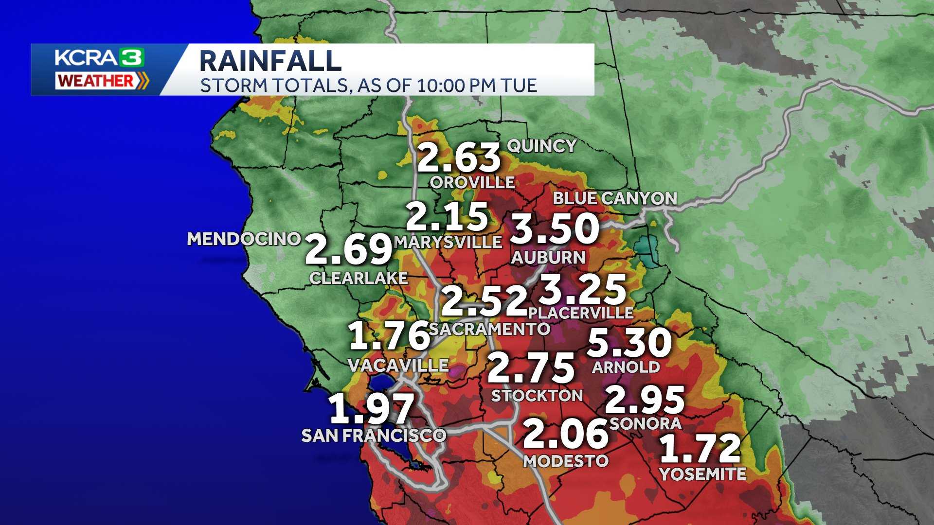
Rainfall was impressive throughout the Valley and Foothills on Monday and Tuesday. The Valley had nearly three inches of rain in some spots. Foothills communities had even higher numbers.
Most places in the Valley and Foothills will get a break in the rain on Wednesday. Hit-and-miss showers will pop up late in the morning and spread east through the afternoon. A brief downpour or some small hail is possible with these showers.
Rain will be more widespread again early Thursday morning. Most places will see an additional quarter-inch of rain Thursday morning. The afternoon will be showery with rain chances dropping through the evening.
Friday and Saturday will be dry.
Wind
Winds will be lighter on Wednesday but the breeze will pick up again with the next round of rain Thursday.
The Valley could see gusts close to 40 mph, mainly south of I-80 and east of I-5 in the San Joaquin Valley.
The National Weather Service office in Sacramento issued a Wind Advisory that continues through 10 p.m. Thursday for the Sacramento Valley.

Wind gusts of 40 mph in the Valley can make a mess of any yard furniture, décor or trash bins, but major damage is not expected.
See more coverage of top California stories here | Download our app | Subscribe to our morning newsletter | Find us on YouTube here and subscribe to our channel