
California’s Sierra Nevada has measured over 90 inches of snow from the ongoing onslaught of storms, and more heavy snow is on the way.
Published Feb 19, 2026 2:01 PM CST
|
Updated Feb 21, 2026 4:58 AM CST
AccuWeather’s California Expert Ken Clark joins the network to talk about what has been an exceptionally wet season for California since last October from significant rainfall to heavy snowfall.
Another storm is lining up for California, starting later this weekend, arriving just days after the latest storm unloaded significant snow in the mountains and rain at lower elevations. The next round could bring drenching rain and more heavy mountain snow, especially to Northern California.
Before the start of Thursday’s storm, the 72-hour snowfall over parts of the Sierra Nevada ranged from a little over a foot of snow in the southern areas to nearly 8 feet in the central and northern parts of the mountain range, according to ski resorts. In the past seven days, 92.5 inches of snow has fallen at the Central Sierra Snow Lab.
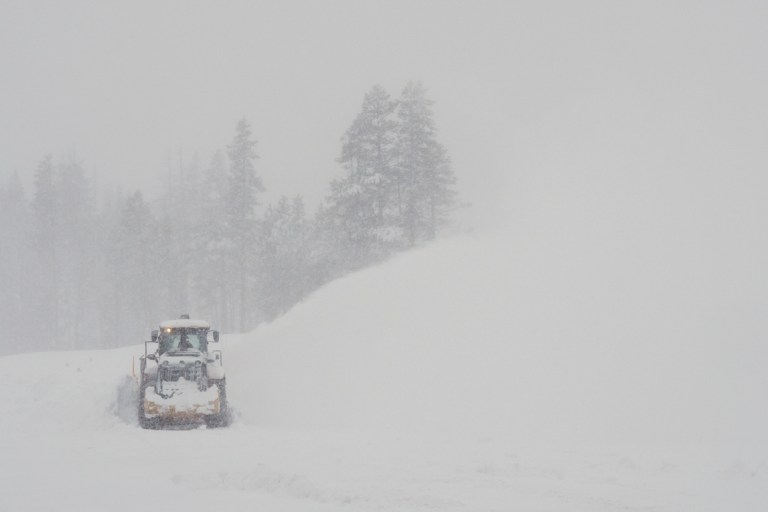
A road is cleared during a snowstorm on Wednesday, Feb. 18, 2026, near Soda Springs, California. (AP Photo/Brooke Hess-Homeier)
The amount of snow is not unheard of in the Sierra Nevada, but it is excessive nonetheless and resulted in deadly avalanches and multiple road closures, including along the busy Interstate 80 and Donner Pass, California, area.
Crews in the northern Sierra Nevada and Siskiyous will have 48-72 hours to clean up after the storm through Sunday. During much of this period, little to no snow or rain will fall over most of California. Areas mainly south of Interstate 80 should remain mostly dry through at least Monday.
A new storm is forecast to spin slowly onshore and spread southward from Sunday to Tuesday. Initially, rain may fall only on the northwestern corner of California Sunday and Monday, but more for coastal Oregon and Washington.
The southward extent of the rain and mountain snow will depend on the track of the storm. The intensity of the rain and snow may hinge on the development and forward speed of a long plume of Pacific moisture, called an atmospheric river.
At this time, it appears the heaviest low-elevation rain and mountain snow will focus on the northern half of California, rather than the southern half, and will likely include parts of Oregon. Where the moisture plume persists in the atmospheric river, feet of snow may pile up in the mountains.
The bulk of the rain and mountain snow for the Siskiyous and northern Sierra Nevada will be from Monday night to Tuesday night, with little or no rain or snow in Southern California.
The latest barrage of snow is providing a much-needed boost to the overall winter snowpack in the Sierra Nevada. This frozen water, locked in the snow, will gradually melt during spring and summer, replenishing and feeding area streams and rivers.
None of California is currently in drought due to the extensive storms last winter and the occasional stormy periods this winter.
While soil drought will undoubtedly return during the heat of the summer and into the autumn of 2026, there should be an ample supply of water to the state through at least 2026 and beyond.