
Northern California forecast: Monday will be dry for much of the region
Those who enjoyed Sunday’s weather will also like Monday’s seasonable temperatures, light breezes and clouds.
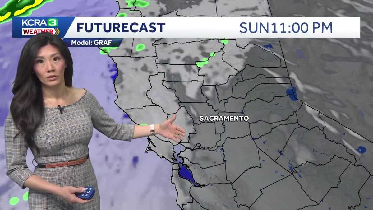
METEOROLOGIST OPHELIA YOUNG. SO, OPHELIA, YOU’RE TRACKING THE CONDITIONS RIGHT NOW. NOT JUST HERE AT HOME, BUT ACROSS THE COUNTRY. SO WHAT ARE WE SEEING? WELL, WE’RE TRACKING A HUGE NOR’EASTER THAT’S MOVING THROUGH THE EAST COAST RIGHT NOW. AND THAT’S BRINGING MORE THAN A FOOT OF SNOW TO PARTS LIKE NEW YORK BACK HERE ON THE WEST COAST, HOWEVER, IT’S ALL SMILES AS THIS WEEKEND ENDS WITH CALM CONDITIONS AND A FEW CLOUDS THAT ARE ROLLING IN. BUT AS FOR TONIGHT AND TOMORROW, MAINLY DRY FOR THE REGION, CURRENT TEMPERATURES IN THE LOW 60S UP AND DOWN THE VALLEY STILL IN THE MID 60S IN MODESTO AND STOCKTON. AUBURN AND PLACERVILLE CLIMBED INTO THE 60S, NOW INTO THE 50S, TRUCKEE AND SOUTH LAKE TAHOE PRETTY QUICKLY. COOLING INTO THE 30S NOW MADE IT UP TO 66 DEGREES AT THE SACRAMENTO EXECUTIVE AIRPORT TODAY, BACK ABOVE THE NORMAL. THAT WAS THE PLAN THIS MORNING, HOWEVER, DID START OFF A LITTLE CHILLY AS WE GOT DOWN TO 36 DEGREES, BUT WE CERTAINLY MADE UP FOR IT THIS AFTERNOON. AT THE TIME THAT WE HIT THOSE HIGHS, WE WERE ANYWHERE FROM 6 TO 9 DEGREES WARMER THAN 24 HOURS PRIOR IN THE VALLEY. EVEN TRUCKEE AND SOUTH LAKE TAHOE HIGHS WERE A FEW DEGREES UP RIGHT NOW, STILL HOLDING ON TO THAT TEMPERATURE TREND. IT IS A REALLY NICE EVENING TO GO ON A WALK, MAYBE HAVE DINNER ON THE PATIO. THE WINDS HAVE LIGHTENED UP. WE HAVE SEEN A BREEZE FROM TIME TO TIME, BUT GENERALLY BELOW 15MPH. NOW FURTHER NORTH, THERE HAS BEEN SOME ACTIVE WEATHER, A FEW SHOWERS MOVING THROUGH THE COASTAL RANGE AND THE VERY NORTHERN PORTIONS OF THE VALLEY THAT IS SPILLING IN FROM MORE STORMS, RAIN AND SNOW MOVING INTO THE PACIFIC SOUTH NORTHWEST. AGAIN, WE ARE WATCHING A LARGE AREA OF LOW PRESSURE. YOU CAN SEE IT SPLITTING PRETTY MUCH INTO TWO. THAT’S SPINNING OFF THE WEST COAST, AND THIS IS GOING TO BRING US A RAINY MIDDLE OF THE WEEK. SO LET’S WALK YOU THROUGH FUTURECAST HERE TONIGHT. DRY MAYBE A FEW MORE SHOWERS IN THE VERY NORTHERN PORTIONS OF THE STATE. BUT MONDAY IS GOING TO BE MAINLY DRY FOR THE FORECAST AREA AS WELL. HOWEVER, BY THE END OF TOMORROW WE’RE GOING TO BE LOOKING TO OUR NORTHWEST FOR RAIN THAT WILL BE MOVING PAST THE COASTAL RANGE OVERNIGHT. GOING INTO TUESDAY, RAIN WILL REALLY SETTLE INTO THE VALLEY. THIS IS WHAT YOUR TUESDAY MORNING COMMUTE MIGHT LOOK LIKE. YEAH, WE HAVE SCATTERED SHOWERS, PERIODS OF LIGHT TO MODERATE RAINFALL, SCATTERED SHOWERS ALL THE WAY THROUGH YOUR TUESDAY EVENING. BY THEN, RAIN WILL BECOME HEAVY FOR THE FOOTHILLS. AND AS YOU CAN TELL IN THE SIERRA, DOESN’T REALLY TURN INTO MUCH SNOW BECAUSE AGAIN, THIS IS REALLY WARM RAIN MOVING IN FROM THE TROPICS, SO IT WON’T BE AS READY TO TURN INTO SNOW. A FEW SHOWERS WILL LINGER INTO FIRST HALF OF YOUR WEDNESDAY. BY THEN WE’LL BE DRY AND GETTING READY FOR A NICE REST OF THE WEEK. BUT TUESDAY IS A WEATHER IMPACT DAY FOR STEADY RAIN. WET SNOW ABOVE 6500FT, MAYBE EVEN ABOVE 7000FT. AND THE WINDS, NOT AN ISSUE MIGHT BE BREEZY AT TIMES. AT LEAST WE’RE NOT EXPECTING ANY THUNDERSTORMS. HOW MUCH RAIN ARE WE EXPECTING FROM TUESDAY TO WEDNESDAY, UP TO A HALF INCH OF RAIN IN THE VALLEY, ONE AND A HALF IN THE FOOTHILLS AND THE COASTAL HILLS AND THE SIERRA. MAINLY RAIN AGAIN, THAT SNOW LEVEL STAYING PRETTY HIGH. IN FACT, IT’S GOING TO CLIMB THROUGH THE PROGRESSION OF THE STORM UP TO 10,000FT. SO MAINLY RAIN, ABOUT 2.5IN AND TEMPERATURES AREN’T GOING TO BE AS BRUTAL AS THEY WERE WITH THE LAST STORM. WE ARE GOING TO KEEP IT AT NORMAL OR ABOVE. IN FACT, BY THE END OF YOUR SEVEN DAY FORECAST WILL BE FLIRTING WITH THE 70S THAT IS ON FRIDAY. SATURDAY WILL BE A NICE DAY AS WELL, BUT WE’RE LOOKING AT THE RETURN OF SHOWERS BY THE END OF NEXT WEEKEND, SO WE DO HAVE A FEW SHOWERS THAT ARE MOVING IN. AT LEAST WE GET THESE NIC
Northern California forecast: Monday will be dry for much of the region
Those who enjoyed Sunday’s weather will also like Monday’s seasonable temperatures, light breezes and clouds.

Updated: 7:05 PM PST Feb 22, 2026
Those who enjoyed Sunday’s weather will also like Monday’s seasonable temperatures, light breezes and clouds.Highs in the Valley will reach the mid to upper 60s. Temperatures will also peak in the mid 60s in the foothills and the upper 40s to low 50s in the Sierra. Those in the coastal hills can expect a few scattered showers. Winds will be light, with breezes at times up to 15 mph.Showers will spill into the rest of the region, however, as a large trough of low pressure drives tropical moisture inland. The chance of rain increases overnight into Tuesday morning, and Tuesday will be an Impact Day for widespread rain.Because this system will be enhanced by an atmospheric river, precipitation is expected to be relatively warm. Snow levels will start around 6,500 feet and eventually climb to 10,000 feet as more warm moisture arrives. Even at the peaks, only a few inches of wet snow are forecast.The Valley may receive 0.25 to 0.50 inches of rain, with as much as 1.5 inches forecast in the foothills. Precipitation will mainly be rain in the Sierra, where as much as 2.5 inches may fall.A few showers will linger into the first half of Wednesday, and the weather will dry out for the rest of the week. While some cloud cover will stick around, high temperatures are expected to warm into the upper 60s by the end of the week.Our next round of showers is expected to arrive by the end of the upcoming weekend.
SACRAMENTO, Calif. —
Those who enjoyed Sunday’s weather will also like Monday’s seasonable temperatures, light breezes and clouds.
Highs in the Valley will reach the mid to upper 60s. Temperatures will also peak in the mid 60s in the foothills and the upper 40s to low 50s in the Sierra. Those in the coastal hills can expect a few scattered showers. Winds will be light, with breezes at times up to 15 mph.
Showers will spill into the rest of the region, however, as a large trough of low pressure drives tropical moisture inland. The chance of rain increases overnight into Tuesday morning, and Tuesday will be an Impact Day for widespread rain.
Because this system will be enhanced by an atmospheric river, precipitation is expected to be relatively warm. Snow levels will start around 6,500 feet and eventually climb to 10,000 feet as more warm moisture arrives. Even at the peaks, only a few inches of wet snow are forecast.
The Valley may receive 0.25 to 0.50 inches of rain, with as much as 1.5 inches forecast in the foothills. Precipitation will mainly be rain in the Sierra, where as much as 2.5 inches may fall.
A few showers will linger into the first half of Wednesday, and the weather will dry out for the rest of the week. While some cloud cover will stick around, high temperatures are expected to warm into the upper 60s by the end of the week.
Our next round of showers is expected to arrive by the end of the upcoming weekend.