
We’re used to seeing California snow in places like the Sierra and mountains of the Los Angeles Basin, leading to epic ski conditions in the high country.
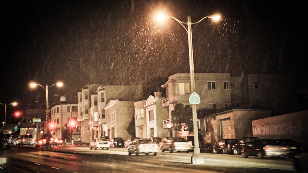
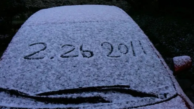
But 15 years ago on Feb. 26, 2011, an unusually cold storm system produced a rare sight: falling snow at sea level in San Francisco.
These early morning flakes didn’t amount to much. Officially, it went into the records as a “trace” of snow.
But the spectacle of snowflakes in the city, rather than just atop Twin Peaks or in the East Bay Hills, was quite a sight as temperatures plunged to new daily records in the low-mid 30s.
Snow did accumulate in several other locations unaccustomed to it, including Carmel Valley, just southeast of Monterey, and along the Big Sur Coast, where 3 inches was seen on the ground.
According to Bay Area meteorologist Jan Null, it has been 50 years since the last measurable snowfall in San Francisco, a 1-inch event on Feb. 5, 1976. Null noted 10 other such snow events prior to 1976.
The city’s heaviest snowfall on record was on Feb. 5, 1887, when 3.7 inches was measured downtown, with some 7-inch totals in other parts of the city.
(MORE: The Weirdest Places It Has Snowed)
NWS-Monterey, California
Jonathan Erdman is a senior meteorologist at weather.com and has been covering national and international weather since 1996. Extreme and bizarre weather are his favorite topics. Reach out to him on Bluesky, X (formerly Twitter) and Facebook.