
SIERRA NEVADA, Calif. — California’s snowpack got a boost from a run of cold, snow-producing storms in mid-February, but state water officials say it still isn’t enough to bring conditions back to normal for this time of year.
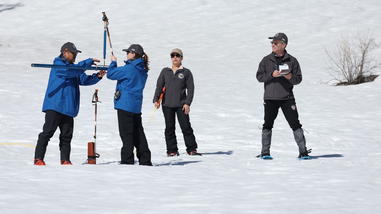
The Department of Water Resources conducted the third snow survey of the season at Phillips Station on Thursday.
The manual survey recorded 28 inches of snow depth and a snow water equivalent of 11 inches, which is 47 percent of the average for that location.
[RELATED] Cash prizes offered for innovations to stop invasive mussels spread in California
Snow water equivalent measures the amount of water contained in the snowpack and is a key component of the department’s water supply forecast. Statewide, the snowpack is 66 percent of average for this date.
The latest results show an increase from last month’s measurements after a series of cold, major snow-producing storms ended a five-week dry period.
But officials said the recent storms were not enough to return the state to average conditions for this time of year. Warmer storms early this week also caused snowmelt at lower elevations.
“Although the storms we saw in mid-February were some of the coldest and best snow-producing storms we have seen since 2023, they were not enough to get us back to average conditions,” said Andy Reising, manager of DWR’s Snow Survey’s and Water Supply Forecasting Unit. “The snowpack is in better shape than it was one month ago, but we only have a month left of our snow-accumulation season and time is rapidly running out to catch up. Statewide, we are only about 57 percent of where we hope to be by April 1.”
Storms this season have been unevenly distributed across the Sierra Nevada.
The Southern Sierra Nevada is 90 percent of average for Thursday, while the Northern Sierra Nevada — where several of the largest major water supply reservoirs are located — is only 46 percent of normal for this date.
“Water supply in California increasingly depends on a small number of big storms,” said DWR Director Karla Nemeth. “We face higher drought risk when they don’t arrive and greater urgency to modernize infrastructure to capture water when they do. The dramatic wet-dry swings this winter remind us again that ever-warmer average temperatures have reshaped the California water cycle. We must adapt.”
On average, the largest snow-producing months in the Sierra Nevada are December, January, February, and March.
Historically, the snowpack peaks on or near April 1, after which it transitions to generating runoff into California’s rivers and reservoirs.
While the snowpack remains below average, major reservoirs statewide are currently 122 percent of average.
On average, the Sierra snowpack supplies about 30 percent of California’s water needs and is often referred to as California’s “frozen reservoir.”
The next survey is tentatively scheduled for April 1.