
San Francisco is one of America’s best walking cities, with one caveat — really, 48 — in the form of hills. Many a tourist has called a robotaxi from halfway up a peak they’d underestimated. But for those who stick it out, there are eucalyptus groves in the middle of the city, hidden staircases, and vistas that explain why people move here and never leave.
The 415-mile Bay Area Ridge Trail is being considered for National Scenic Trail designation: dramatic landscapes and dense neighborhoods, coexisting. You don’t need to hike all of it to feel that magic, though.
For this edition of Pro Tips, we asked locals who regularly share their walking routes online (yes, walking influencers) to tell us which loops they return to again and again. Here are the lesser-known gems — the coffee-to-cable-car climbs that make you feel like a tourist in your own backyard.
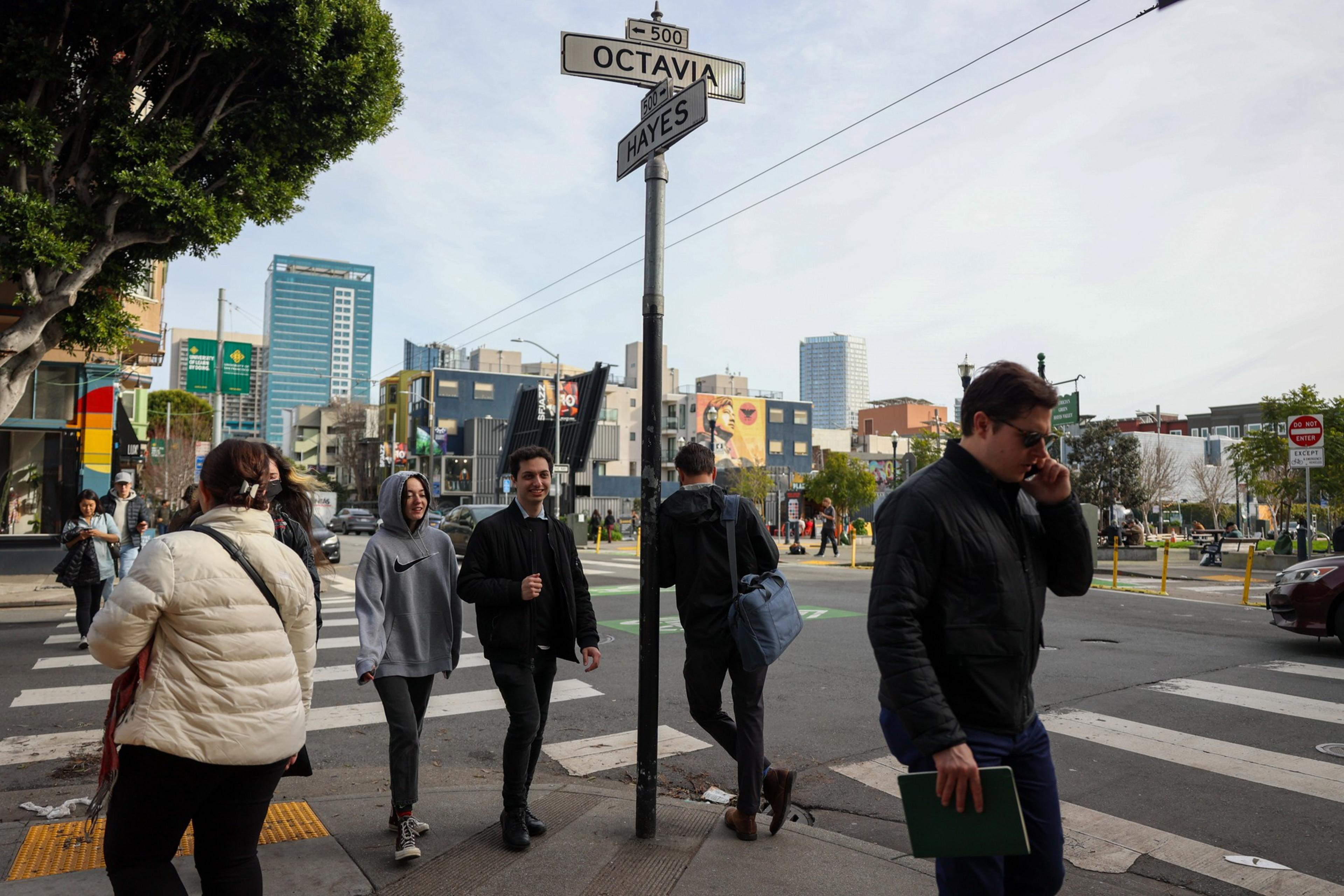 Chai’s recommended walk ends in trendy Hayes Valley. | Source: Camille Cohen/The Standard
Top pick: Mission Rock Park to Hayes Valley
Length: 6 miles
For her 40,000 followers on TikTok, Chai spends weekends documenting urban hikes with her fiancé, Chris, and mini goldendoodle, Pepper. Her favorite walk starts near Mission Rock Park and traces the Embarcadero, then leads down Market Street and up California. “This is when the stroll turns into a workout. It’s a steady uphill climb,” she said. Chai likes to stop at Huntington Park and Lafayette Park before winding through Japantown and finishing with “a well-deserved pup cup from Salt & Straw” in Hayes Valley. “By the end, we’ve covered a perfect mix of hills, neighborhoods, and treats.”
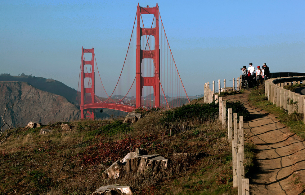
Top pick: Hawk Hill
Length:
Caesar, a Bay Area firefighter, tries to do a new hike once a week. His goal: find the best views of the Golden Gate Bridge. Ceasar has been broadcasting his quest to his 10,000 TikTok followers, and Hawk Hill, he found, has the best view of the bridge, hands down. (This is the only walk on the list that is not in the city proper.) “You get to watch all the cargo ships coming in and out, you can see the entirety of SF, and all the ocean around you,” he said. The recently reopened path is 900 feet above the bay, only a mile from the parking lot, close enough to add to a walk by Black Sands Beach, which he describes as “literally something you would see in Hawaii.”
Top pick: Vallejo Street
Length: 3 miles
When she moved here two years ago, Rauch decided the fastest way to get to know her new home would be to walk all of it. Calling herself “the girl walking every street in SF,” she documents her journeys to 16,000 Instagram followers. She recommends trekking Vallejo Street from west to east. “It has some quick-burn elevation, but it’s a fantastic way to watch the architecture change as the neighborhoods blend together,” she said. The route starts at the Lyon Street steps and passes historic landmarks like the Casebolt House before hitting the scenic Vallejo stairs. The walk ends just a few blocks from the Ferry Building for a post-walk treat and easy transit home.
Top pick: JFK Drive loop
Length: 3 miles
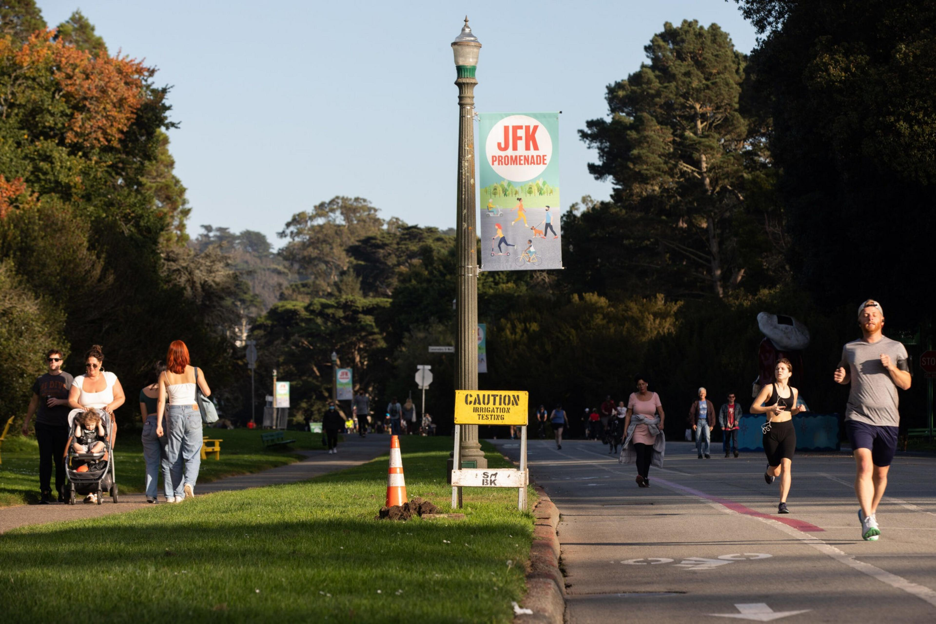 Check out the bison while you stroll. | Source: Benjamin Fanjoy for The Standard
The woman who dubbed the Marina Green “the sluttiest mile on the west coast” recommends what she calls the JFK Drive Loop. Walk down JFK Drive at the mouth of the park, turn into the plaza by the de Young and the Cal Academy, then loop around the back. If you want to extend your walk, Witchel recommends going big: “You can walk the entire length of Golden Gate Park, all the way down to Andytown Coffee Roasters, and walk along the beach with your coffee, and then Muni back for a really long Saturday walk.”
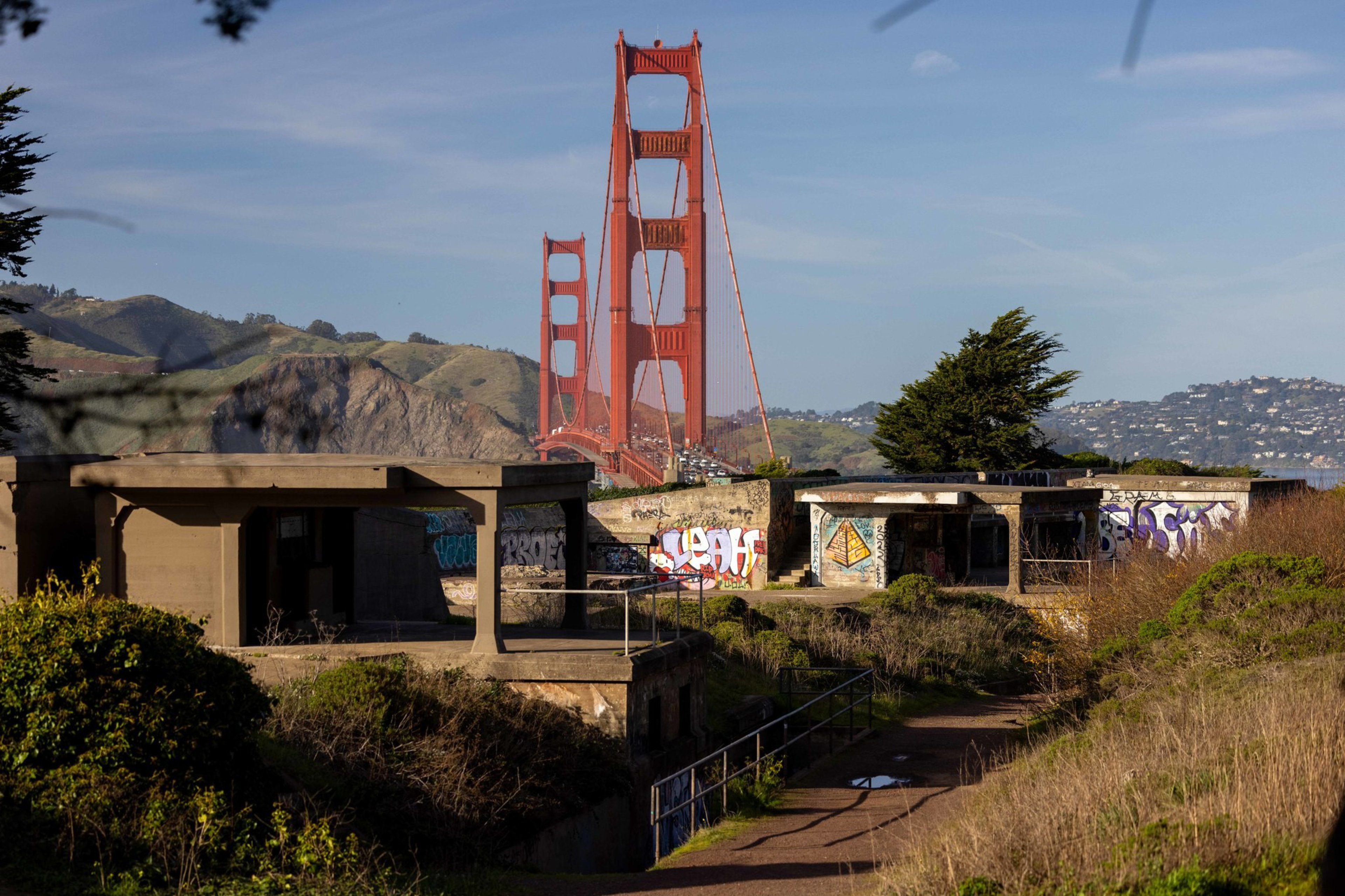 The Batteries to Bluffs trail is a less-known alternative to the Land’s End route. | Source: Amanda Andrade-Rhoades/The Standard
Pick: Batteries to Bluffs (opens in new tab)
Length: 0.7 miles
Miller, who shares hiking tips to more than 100,000 followers and hosts community hikes in the Bay Area, says the Batteries to Bluffs Trail in the Presidio is a classic starter hike that you “don’t have to be in your best peak shape to do.” “One of the most special parts about living here is you can literally go on a hike in the city, not know that you’re in the city for a mile, and then the second mile, you’re seeing all the views of the Golden Gate Bridge.”
Pick: Crosstown Trail:
Length: 17 miles
The Crosstown Trail seems designed specifically for Volek, who grew up in the Outer Sunset and now lives in the Bayview and hikes the city every weekend. “It literally connects two really important places in my life,” she said, beginning near Lands End, where she got married, and stretching toward her current neighborhood. Still, the first time she undertook the eight-hour trek, she learned new things about her own city, such as the route behind Laguna Honda Hospital and the existence of Glen Canyon.
Pick: Double Cross Trail
Length: 14 miles
Johnson loves to find hidden gems on her weekly explorations of the city, and she isn’t afraid of long hikes. Her 16,000 TikTok followers have watched her complete both the San Francisco Crosstown Trail and the San Francisco Double Cross Trail. She recommends the Double Cross. “It has so much city in it,” she said. “The first half feels naturey and secluded, but the second half you’re going through Chinatown and Alamo Square.” Don’t be intimidated. “You’re on your own pace. You can stop anytime you want. You can quit. It’s self-meditative time.”
 When Snow’s friends visit, she likes to them up to the scenic heights of Twin Peaks, via the long gradual way up from Noe Valley to experience the neighborhood charm | Source: Amanda Andrade-Rhoades/The Standard
Pick: Pemberton Street stairs
Length: ~3 miles
On her blog Wayfaring Architect, Snow documents her on-foot explorations of San Francisco. Her go-to hike takes visitors from the charm of Noe Valley to the summit of Twin Peaks via the Pemberton Street stairs at Romaine and Market. “It’s so underrated and even has a small arbor to pass under on the way up,” she said. After taking in the panoramic views at the top, descend toward Elizabeth Street, eventually winding along 24th Street to explore the local shops and cafes. “San Francisco’s hidden stairways are part of what I love about the city,” she said.