

BAKERSFIELD, Calif. (KBAK/KBFX) — THE COOLDOWN COMES IN
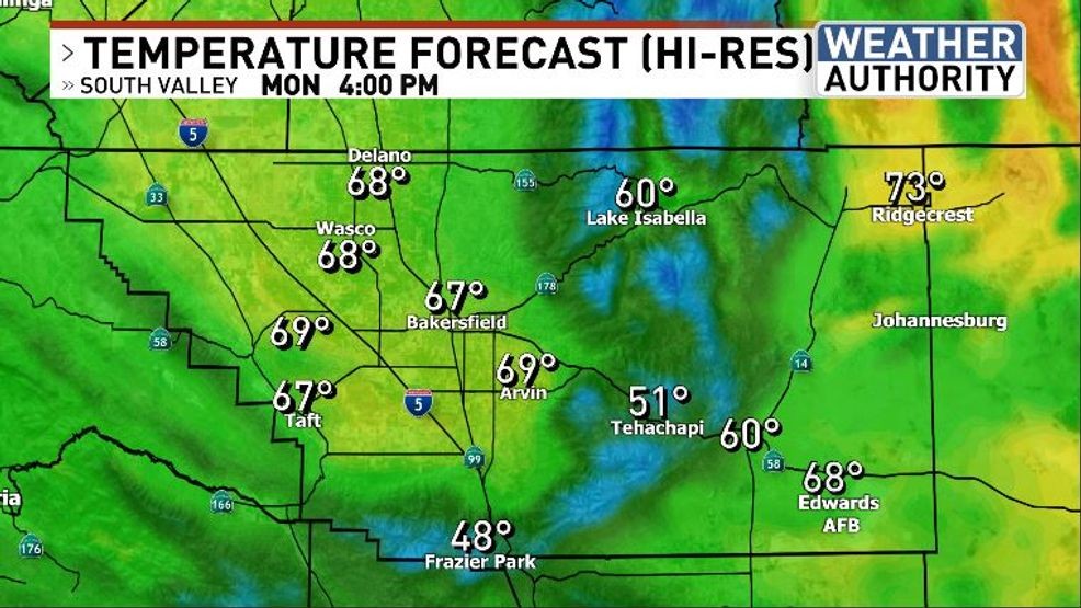
It sure was a warm weekend and the cooler air didn’t make much headway across our area until later on Sunday. This morning we have a weakening weather system, in the form of an upper low off moving across northern California and Nevada, that will help usher in lower temperatures today. Monday afternoon readings could be around 15 degrees lower than Sunday’s. Additionally, westerly winds will continue blowing across the mountains, Kern River Valley and desert areas. As such, a Wind Advisory is up for the desert side of Kern County.
MOSTLY DRY BUT COULD BE BRIEFLY DAMP IN SPOTS
As the Pacific airmass returns to our region enough cooling and moistening of a shallow sliver of our airmass is anticipated to bring some cloud cover to bank up against the west and northwest facing mountains slopes, leading to the possibility of some light drizzle or rainfall, primarily on Monday morning. Most areas will probably stay dry, some with hardly any clouds in the sky.
NO STORMS FOR THE NEXT 7-10 DAYS AT LEAST
Another cooldown is expected around midweek as northwesterly flows allows another system to skirt our area. Again, this one could lead to an uptick in winds, a downturn in temperatures and bring an additional opportunity of light rainfall to part of the area.
Have a great day!
Comment with Bubbles
BE THE FIRST TO COMMENT
Chief Meteorologist Ilya Neyman