
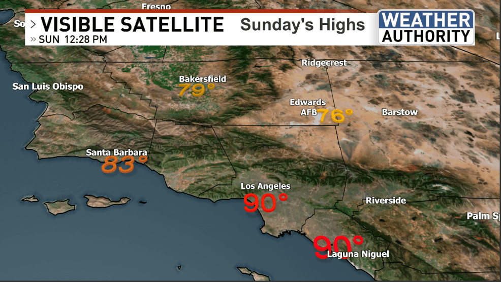
BAKERSFIELD, Calif. (KBAK/KBFX) — Kern County finds itself sandwiched between a ridge of high pressure to the northwest and an area of low pressure to the south. Enough space now exists between the two to relax the pressure gradient, which means the winds across our region quieted down substantially closing out the weekend yesterday compared to beginning it the day before. The “offshore” flow bumped up the afternoon temperatures substantially with thermometers hitting 90 from Santa Monica to Huntington Beach. Kern County was warm with a high just shy of 80 in Bakersfield.
Computer models continue to paint a stormless scene consisting of one area of high pressure handing it off to another one anticipated to take over where the previous ridge left off. The result: continued quiet and sunny conditions through this new week, with very little if any “change” from day-to-day. Nightly readings should range from the 40s to the low 50s with daily highs from the 60s to the 70s – the lowest numbers across the higher elevations and the highest temperatures for the lowlands.
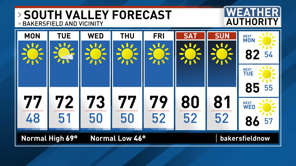
There continues to be a trend of warmer air waiting in the wings for the latter part of the week which could bump up the digits into the 80s for the valleys and solidly into the 70s for the mountains. Our “rainy season” continues with almost no prospect of any additional precipitation for now. Looking way ahead, there may be some gradual changes in the upper atmospheric pattern around the 3rd quarter of the month, that could lead to that changing toward the final lap of March but all this does is emphasize that most of the next 2 weeks could be a status quo weatherwise.
Comment with Bubbles
BE THE FIRST TO COMMENT
I hope you have a pleasant week ahead!