
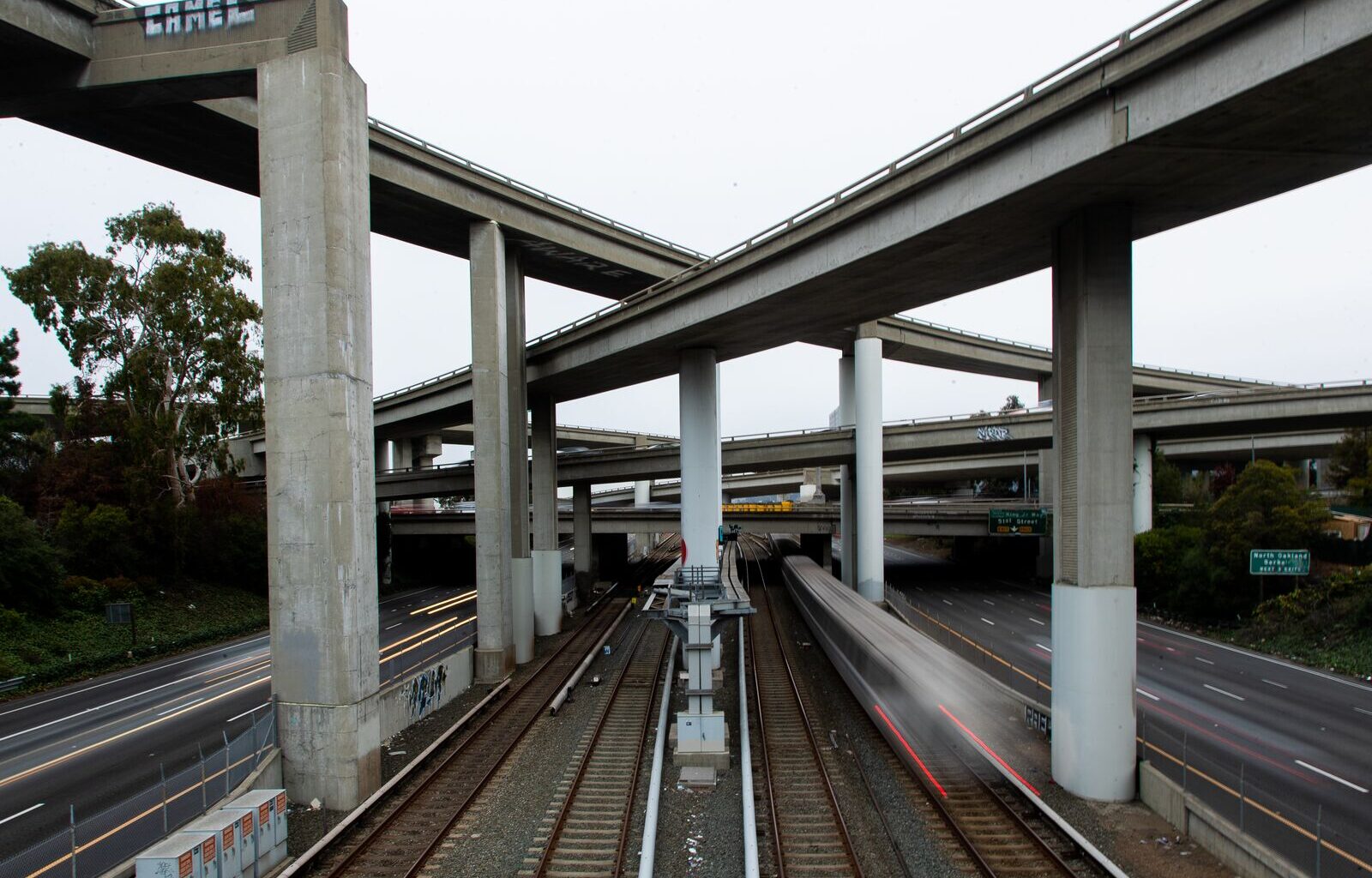
Oakland is crisscrossed by freeways, the multi-lane arteries that massively expanded in the 1950s and reshaped city life.
A new report, “The Atlas of Inner-City Highway Impacts,” found that those highways have not lived up to their mission of facilitating traffic and are instead squatting on highly valuable land that could be better used for economic development.
Patrick Kennedy, an engineering lecturer at Southern Methodist University and longtime highway critic, found that the use of urban land for highways costs cities hundreds of millions of dollars in property taxes every year.
By his calculations, Oakland would benefit more than any of the 142 cities he studied by removing freeways within a three-mile radius of downtown, with a potential gain of $23.9 billion in new development.
To come up with his analysis, Kennedy told the Oaklandside, he drew two circles, one with a radius of one mile from each city’s downtown, and one with a radius of three miles. Then he looked up county tax assessment data to calculate the average tax revenue generated by recent property development. This allowed him to calculate the average per-acre value of the land if the freeways were removed and a little over half of the recovered land was used for development.
“Let’s say 55% of it becomes developable as new private investment that’s taxable, and that 45% would be new surface streets, parks, schools, that might be tax-exempt,” he said. “So the two things that go into making a really high number like Oakland has are high-value real estate and lots of highway land. As you can imagine, with California land prices and costs, you get to a really big number when you have a lot of highway land.”
His approach doesn’t account for how freeways degrade the value of surrounding land, due to pollution and road safety concerns, and how their removal might increase that land value — and further boost tax revenue.
Kennedy’s research found that other cities have much more land in freeways than Oakland, including Newark, New Jersey, and Houston, Texas, but their lower property values put them lower on the list for the potential benefits of removal and development. Other cities he analyzed with land roughly as valuable as Oakland’s, such as San Francisco, have fewer freeways crisscrossing densely populated areas.
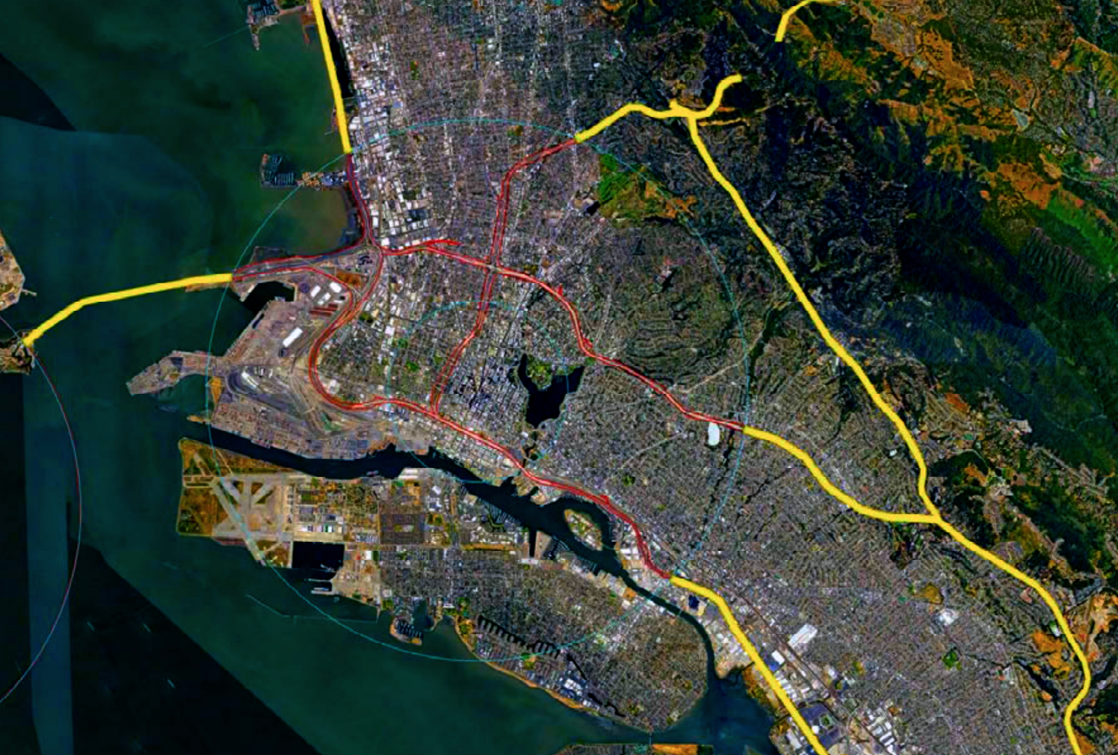 Engineer Patrick Kennedy’s analysis of Oakland starts with the area around City Hall as its center and extends outward in one- and three-mile rings. Credit: Patrick Kennedy
In his rankings, Oakland ranks in the top five across multiple metrics.
Oakland ranked third in the nation for cities with the most development potential within one mile of downtown, at $8.1 billion, behind Dallas ($10.7 billion) and San Diego ($10 billion). Miami ($7.2 billion) and Portland ($7.2 billion) rounded out the Top 5.
Oakland ranked first for the most development potential within three miles of downtown, at $29.9 billion. The other top-ranked cities were Boston ($23.4 billion), Washington, D.C. ($23.1 billion), San Jose ($20.3 billion), and Miami ($19.1 billion).
Oakland ranked second for cities with the largest amount of foregone property taxes within that three-mile radius at $181 million per year, behind Dallas at $217 million. Chicago ranked third ($169 million), Minneapolis fourth ($161 million) and Houston fifth ($158 million).
Removal of the I-980 is under review
Kennedy’s research comes on the heels of two decades of research assessing the potential of freeway removals to accelerate economic development, especially as old highways get older and costlier to maintain and more young people want to live in denser downtowns that don’t rely on highway transit.
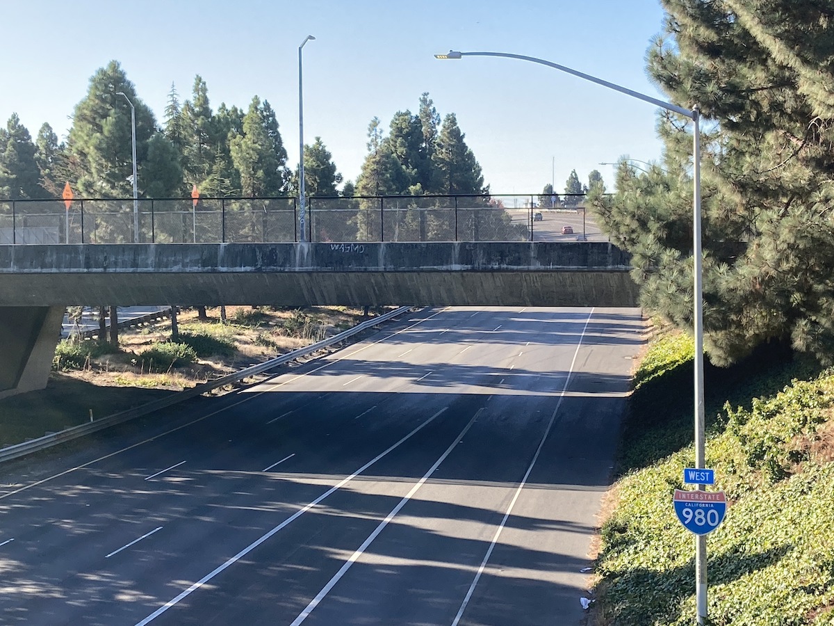
In Oakland, the removal of the I-980 highway in particular has in recent years gone from a daydream to a strong possibility.
In 2020, the Biden administration sought to reconsider the long-term use of highways. Its Reconnecting Communities program, managed by then transportation secretary Pete Buttigieg, awarded billions of dollars in funding to state agencies to study how the potential removal of highways could affect the communities displaced by their construction. The gist of the idea, built on a community equity model, was to develop plans that would financially benefit those communities — which in Oakland and elsewhere were majority Black and low-income — and also benefit the city as a whole.
In California, Caltrans, the state transportation agency, has been studying the I-980, which began construction in the 1950s and over more than two decades uprooted the residents of West Oakland, many of whom had migrated from the American South seeking new jobs and opportunities.
“From the 1960s through the 1970s, the interstate system was displacing over 100,000 people per year every year, which is just an insane number,” Kennedy said. “I wanted to chart what the impact on population density in various cities across the country was, and could I learn from that, and then say, ‘Okay, I see this data point says this city lost population in downtown, dropped to 20%, and how does that relate to where the highways were built?’”
 I-980 cuts West Oakland off from downtown Oakland. Only a few car and footbridges pass over the wide interstate. Credit: Darwin BondGraham/The Oaklandside
During a tour of Oakland in 2022, Buttigieg told The Oaklandside that the I-980 was like a “gash” across the urban landscape, creating a physical separation between low-income communities in West Oakland and the growing job opportunities downtown. This separation, he said, led to decades of disinvestment in West Oakland.
Since Buttigieg’s visit, Caltrans has been working with city officials, the local community, academics, and design and construction companies to study the potential effects of removing the I-980. RBA Creative, an Oakland company led by Randolph Belle, the main community partner for Caltrans’ I-980 outreach, has been raising the question of how economic reparations might be provided to affected communities.
Besides the potential economic benefits of I-980 removal, experts have found that it’s underused by drivers.
Kennedy’s report cites John Stewart Bragdon, a key player at the U.S. Bureau of Public Roads, the main agency in charge of constructing the nation’s highway system, saying in a 1960 report that cities “should actually invest in high-capacity transit, rail transit, to solve local issues and let us build the interstate system outside of cities,” according to Kennedy. That recommendation appears to have gone unheard, and freeway construction has bisected cities for decades.
Kennedy told us that the European model of building freeways around major city centers and then using public transit for intra-city travel is still the best, most cost-effective way for people to get around — and the system that most benefits a city’s economy. If a highway today, like I-980, is not well used by city residents to get around, he said, it’s just a shortcut that’s not truly necessary.
“For Oakland, I-880, that swings around by the port, you’re probably not gonna be able to get rid of that,” he said. “But on the other hand, I-980, that’s a local road, and has no business being an interstate or part of the interstate system.”
Last year, the Reconnecting Communities federal program was “zeroed out” by the Trump administration, according to the National Association of City Transportation Officials, cutting off $200 million in funds that had been expected to be allocated through national grants to cities. A month ago, on February 3, Trump signed the $1.2 trillion act that ended the partial government shutdown, which included only $30 million for the Reconnecting Communities programs.
“*” indicates required fields