
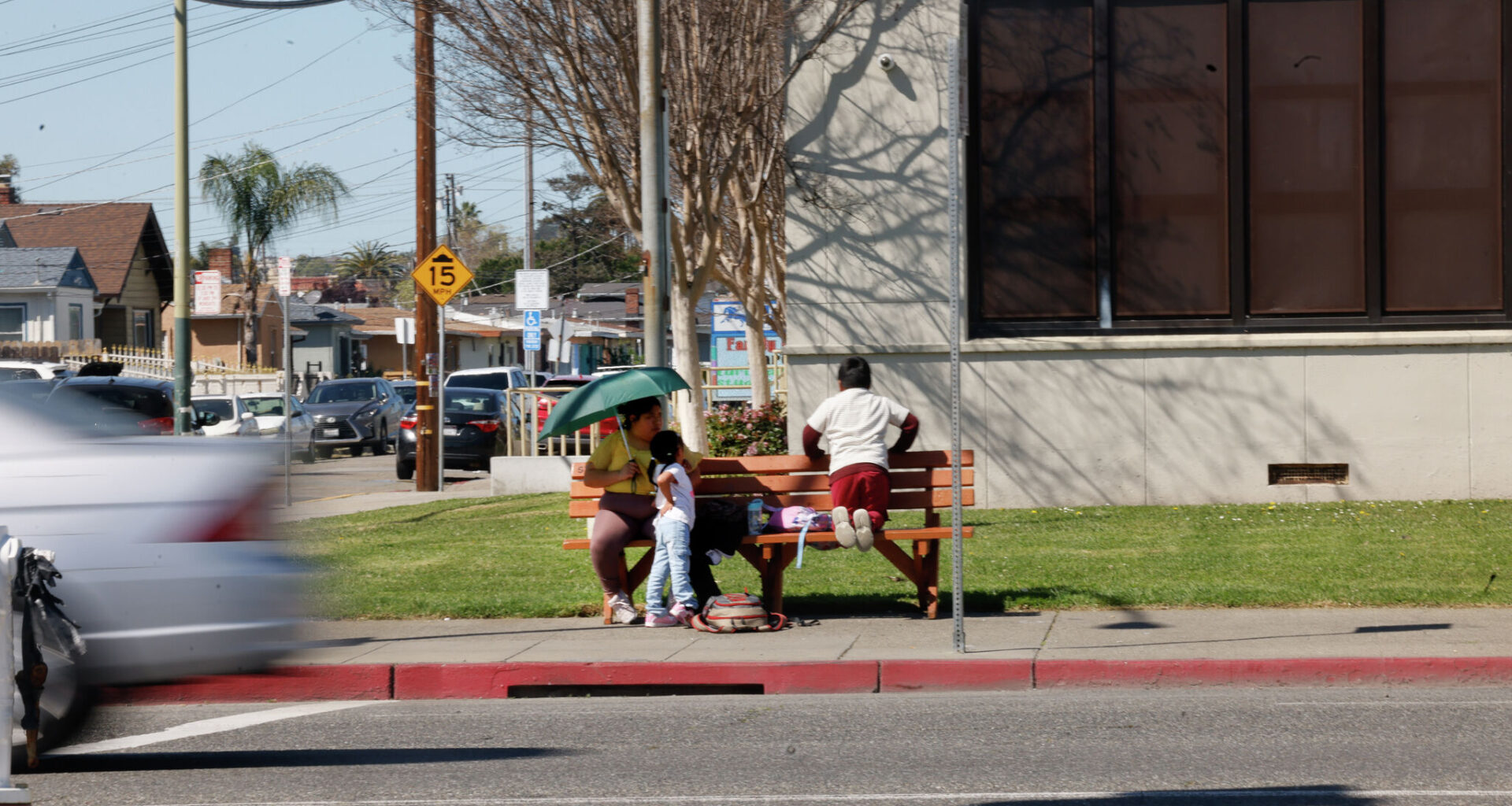
A car drives past a woman and children waiting at a bus stop along 73rd Avenue on Thursday in Oakland.
Lea Suzuki/S.F. Chronicle
David Bay was stunned.
A month after moving into his new East Oakland home off of Edwards Avenue, he pulled into his driveway and saw a smoking car wreck just feet from his front door, his brown fence and orange tree crushed underneath.
“I was in disbelief,” he told the Chronicle in a recent interview.
Bay had heard about the dangers of Edwards Avenue, which winds down the hill from Interstate 580 to become 73rd Avenue, before turning into a mini-expressway between Hegenberger Road and Interstate 880.
Article continues below this ad
Newly released statistics now confirm his suspicion: city-installed cameras placed along this stretch of road caught an unusually large number of speeding drivers during a five-week pilot program from late January to mid-February.
Down the hill from the Bay family, Oakland placed two automated speed cameras — one at 73rd Avenue below MacArthur Boulevard and another farther down on Hegenberger Road near International Boulevard.
A speed camera is seen at the intersection of 73rd and Krause avenues.
Lea Suzuki/S.F. Chronicle
Out of 35 cameras installed across town, the highest number of motorists caught speeding were going southbound on 73rd Avenue, between Fresno Street and Krause Avenue, with more than 12,000 warnings issued. And the fourth-busiest camera was just a mile down the road on Hegenberger near Spencer Street.
It’s that speeding that could be contributing to the corridor’s place on Oakland’s “high-injury network,” the 8% of city roads where 60% of its severe and fatal crashes happen. But that report only reinforces what neighbors have known for years: The road isn’t safe.
Article continues below this ad
San Francisco Chronicle Logo
Make us a Preferred Source to get more of our news when you search.
Add Preferred Source
“I essentially don’t let my kids play in the front anymore,” Bay said. “It makes you worry.”
Bay isn’t alone. His neighbors who spoke to the Chronicle said speeders are a persistent nuisance as they get off Interstate 580 and wind through their neighborhood past two sharp corners on Edwards Avenue.
Revving cars, screeching tires, honking, arguments — sometimes crashes so bad they shake homes — are a constant for people living along this stretch.
Fading double yellow lines along 73rd Avenue are seen as cars navigate the road in Oakland.
Lea Suzuki/S.F. Chronicle
Residents relived heart-stopping crashes that they have seen bend guardrails, tear down trees and light poles, damage retaining walls and even total parked cars. They hope the cameras will keep people from speeding, but many longtime residents have dealt with the road’s dangers for decades.
A Chronicle review of old street plans shows this stretch of road was never meant to handle the kind of traffic it does today. Before the Oakland International Airport opened in 1927, the Oakland waterfront was served by an old country road near where Hegenberger now runs. The street expanded in the 1960s and officials planned to integrate it into its freeway system as the East Oakland Crosstown Arterial.
But plans for a major freeway never materialized, and residents have long fought against widening plans, including as recently as the ’90s.
Article continues below this ad
Instead, the town was left with a freeway-style road barreling through residential neighborhoods where homes often sit close by. The road starts narrow and winding through the hills and drops sharply down to the flatlands, becoming a four-lane mini-freeway toward the Oakland Coliseum and airport. Attempts to make it safer are clear — the road is replete with crosswalks and signs warning motorists to slow down.
Large rocks line the sidewalk next to the road in front of a home along 73rd Avenue as a car drives past.
Lea Suzuki/S.F. Chronicle
Neighbors also have taken to protecting their own property with do-it-yourself safety measures. At Bay’s home, previous owners installed two thick concrete bollards out of fear another car would barrel into their house — apparently it had happened twice in the home’s history, Bay said.
Some residents have built fences, sometimes of sturdy brick and metal, while others place massive boulders in their front yards just in case a car slides off the road. Another frequent sight are traffic cones beside utility poles that neighbors say have been replaced more than once in recent years. And debris from cars — a fender here, a hubcap there — litters the area.
The constant crashes have also taken a toll on the neighborhood’s vibrancy.
Resident Bob Langfelder still misses the old corner store across from Burckhalter Elementary School, at the corner of Edwards Avenue and Greenly Drive, that was badly damaged in 2005 after a produce truck skidded off the road and smashed into the building.
The crash terrified its owners and left them paranoid another crash could happen any moment, the Oakland Tribune reported at the time. The store closed for good years later and never reopened.
Bob Langfelder, who is concerned by the speeding along the Edwards/73rd Avenue corridor, stands for a portrait at his home in Oakland.
Lea Suzuki/S.F. Chronicle
“It’s a shame,” Langfelder said.
And near the fastest sections of the cut-through — around where officials placed the cameras — the danger is evident by the number of high-speed crashes, some of them fatal, that occur in the area.
Article continues below this ad
Between 2018 and 2022, Hegenberger Road saw over 200 crashes — 80% of the collision victims were Black or Hispanic, according to city statistics.
The neighborhoods around Hegenberger are some of Oakland’s most diverse and disenfranchised. The population of the 94621 ZIP code, which surrounds the southern portion of the road, is 62% Hispanic, 22% black and 7% white, and the median household income is $52,000, about half of the median citywide.
Bends in a barrier along 73rd Avenue are seen on Thursday.
Lea Suzuki/S.F. Chronicle
There are more plans to make the road safer.
In 2022, the city began a redesign of the corridor between the Coliseum BART Station and the Eastmont Transit Center that would add new protected bike lanes along the median of the road, improve bus boarding islands and extend curb bump-outs to better protect pedestrians.
But the plan would cost some $44 million, which the Oakland Department of Transportation plans to fund with $40 million from Caltrans and an extra $4 million in city funds.
Article continues below this ad
Caltrans has yet to approve funding for the project.