

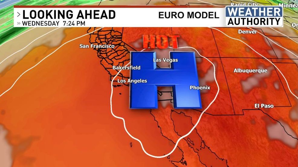
BAKERSFIELD, Calif.(KBAK/KBFX) — A rare winter “Heat Dome” will set up shop over the southwestern corner of the United States this week, with record heat likely across MANY locations in the days to come.
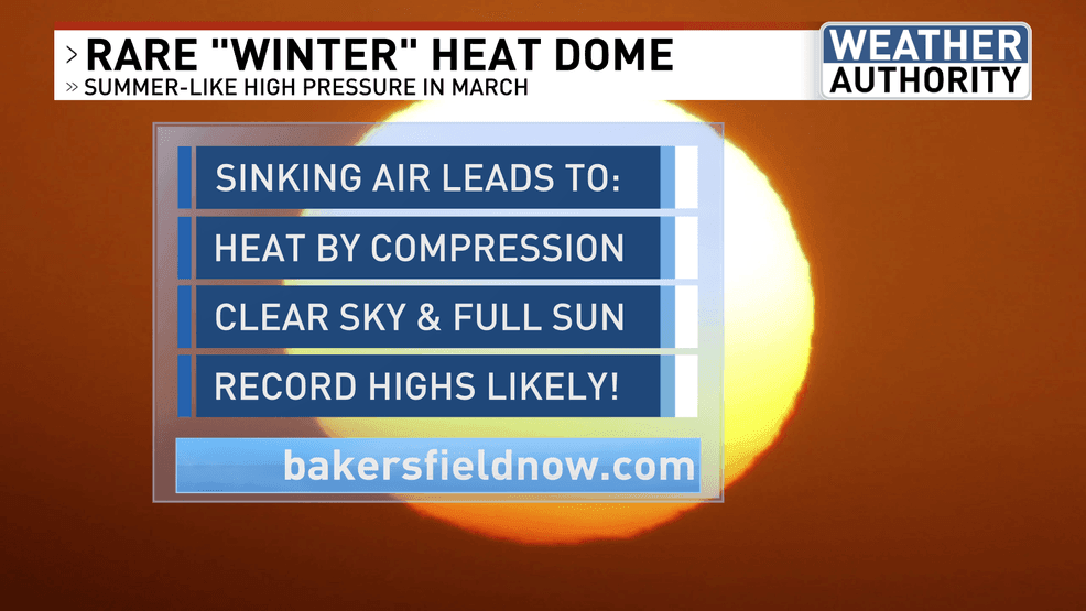
We’re leaving the “warm” and heading straight for the HOT as summer weather takes over several days before the official start of spring. There is a chance that we could squeeze out one more sub-90-degree day on Monday. After that, a summer-like ridge is expected to traverse southcentral California, bringing temperatures more characteristic of June than March. As high pressure intensifies in the upper atmosphere, large-scale sinking air will be the dominant atmospheric motion over our region. As the air sinks, it will compress and heat up. In addition, very little in the way of cloudiness will reinforce the warming atmosphere with strong sunshine, further boosting temperatures.
The hot stuff is poised to really take up residence over the area, with Tuesday the most likely candidate for Bakersfield’s first 90-degree day of the season. It should be quite easy to set a new temperature record for that date, as it has never surpassed 88 on the 17th since 1893. The highest March temperature that Bakersfield has experienced during the modern period of record is 94, which was scored 3 times on different days of the month. The verdict is still out as to whether we will approach that reading this week. Some models say no, others say yes. This will be a wait-and-see.
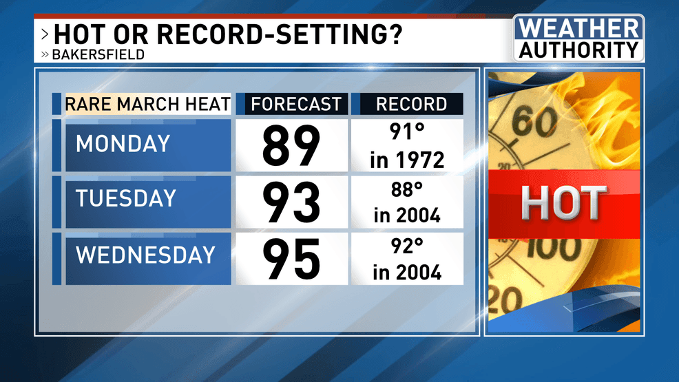
The scope of this “heat dome” will reach across much of the Southwestern US, with record heat likely across MANY locations in the days to come. This will be a good time to practice heat safety and patience, as the 90s could be with us all the way into the next weekend!
 Comment with Bubbles
BE THE FIRST TO COMMENT
Chief Meteorologist Ilya Neyman