
Northern California forecast: Record warmth for St. Patrick’s Day
Temperatures will be 15-25 degrees above normal Tuesday with several records set to fall in the Central Valley.
GOFUNDME FOR THEM BACK HERE. NOW TAKING A LIVE LOOK HERE. LAKE TAHOE SKY CAMERA THIS MORNING. AND AGAIN, WE’RE TALKING ABOUT RECORD HIGH TEMPERATURES, AT LEAST IN THE VALLEY. BUT TAHOE IS GOING TO WARM UP SOON. YEAH, EVEN TAHOE COULD BREAK A RECORD TODAY. AND I’M GOING TO SHOW YOU THAT KIND OF ALL PLAYED OUT ALL ACROSS THE REGION. WE’RE LOOKING AT TEMPERATURES GOING WAY UP TODAY AND MUCH WARMER THAN EVEN YESTERDAY. SO YOU THOUGHT YESTERDAY WAS QUITE TOASTY. WAIT FOR THE SAINT PATRICK’S DAY FORECAST. THE MORNING IS COMFORTABLE. LIVE. LOOK OUTSIDE AND RANCHO CORDOVA SKIES ARE CLEAR. WINDS ARE CALM. WE’RE IN THE MID AND UPPER 50 SACRAMENTO, STOCKTON AND MODESTO TO 32 RIGHT AT THE FREEZING MARK FOR YOU SOUTH LAKE TAHOE. BUT ACROSS THE ENTIRE REGION, 24 HOUR TEMPERATURE CHANGE. YOU SEE A LOT OF THE ORANGE CONTOURING INDICATING TEMPERATURES ARE UP THIS MORNING, ANYWHERE FROM ABOUT 4 TO 6 DEGREES WARMER SACRAMENTO, FAIRFIELD, AND STOCKTON WERE BUMPED UP BY ABOUT FOUR DEGREES THIS MORNING IN AUBURN AND TWO DEGREE JUMP IN TRUCKEE. SO HOW MUCH WARMER ARE WE GOING TO GET TO TODAY? WELL, TODAY OF COURSE, SAINT PATRICK’S DAY ON THE SEVENTH DAY OF MARCH 87TH IS THE FORECAST HIGH NORMAL THIS TIME OF YEAR. AGAIN, KEEP IN MIND WE’RE 20 PLUS DEGREES ABOVE NORMAL AROUND THE AREA 66 IS WHAT WE SHOULD BE PLAYING OUT FOR THE MIDDLE OF MARCH. THE RECORD ON THIS DAY, I THINK WE’RE EASILY GOING TO SEE THAT FALL IS 83, BROKEN BACK IN 1972, AND ELSEWHERE AROUND THE REGION. LET’S CHECK IN ON STOCKTON, MODESTO AND TAHOE FORECAST TODAY IN TAHOE 68 DEGREES. IF WE GET THERE, WE’RE GOING TO BREAK THE OLD RECORD OF 65 BROKEN BACK IN 2007. MODESTO ALSO IN THE RECORD PLAYING FIELD ALONG WITH STOCKTON FORECAST UPPER 80S CLOSE TO 90. WE COULD BREAK THOSE OLD RECORDS 86 AND 87. ALSO GOING BACK TO ABOUT THE 1970S. BIG PICTURE VIEW HERE. MOST OF THE ACTIVE STRETCH OF WEATHER, ALL OF THIS MOISTURE SQUEEZED OUT THERE ALONG THE CASCADES AND THE OLYMPICS AND ALONG THE PACIFIC NORTHWEST WHILE WE’RE UNDER THIS DOME OF HIGH PRESSURE, IT CONTINUES TO BUILD. AND IT’S JUST CAMPING OUT HERE ACROSS OUR AREA. WEDNESDAY, THURSDAY, FRIDAY. SO THE NUMBERS WILL CONTINUE TO GO UP. I THINK THE PEAK OF THIS WARMTH THIS WEEK WILL BE THURSDAY AND AGAIN ON FRIDAY. AND THEN WATCH THAT RIDGING MOVE OFF TO THE EAST. THAT WILL OPEN THE DOOR FOR A FEW MORE CLOUDS BY THE BACK HALF OF THE WEEKEND, A TOUCH COOLER, AND THEN EVEN COOLER AIR AND POTENTIAL POTENTIAL FOR MAYBE SOME RAIN AND MOUNTAIN SNOW BY THE MIDDLE OF NEXT WEEK. BUT IT IS GOING TO TAKE SOME TIME TO GET THERE. RIGHT NOW WE’RE IN THAT UPWARD ROLLER COASTER RIDE. TEO OF THOSE TEMPERATURES HEATING UP, AND YOU JUST TOLD ME THIS MORNING AS WE WERE GETTING READY FOR THIS SHOW, WHAT DID YOU DO YESTERDAY? TURN THE AC, TURN THE AC. I KNEW IT, IT WAS STILL AT ABOUT FOUR, 4:00. YEAH, YEAH, YEAH. AND EVEN YESTERDAY WE HIT THE DAYTIME HIGH AROUND 6 P.M. YES. LIKE IT WAS JUST HOW WARM THINGS BUILD THROUGHOUT THE DAY. I KNOW LIKE THE SUNLIGHT IS STILL, I’M NOT USED TO IT, YOU KNOW WHAT I 4:00 SEEMS LIKE LIKE TWO OR SOMETHING LIKE THAT
Northern California forecast: Record warmth for St. Patrick’s Day
Temperatures will be 15-25 degrees above normal Tuesday with several records set to fall in the Central Valley.

Updated: 5:18 AM PDT Mar 17, 2026
The morning will be delightful under clear skies, light winds, and cool temps. As the day wears on however, temperatures will be unseasonably warm. Many Valley locations can expect highs 20+ degrees above normal, peaking int he upper 80s and shattering records.
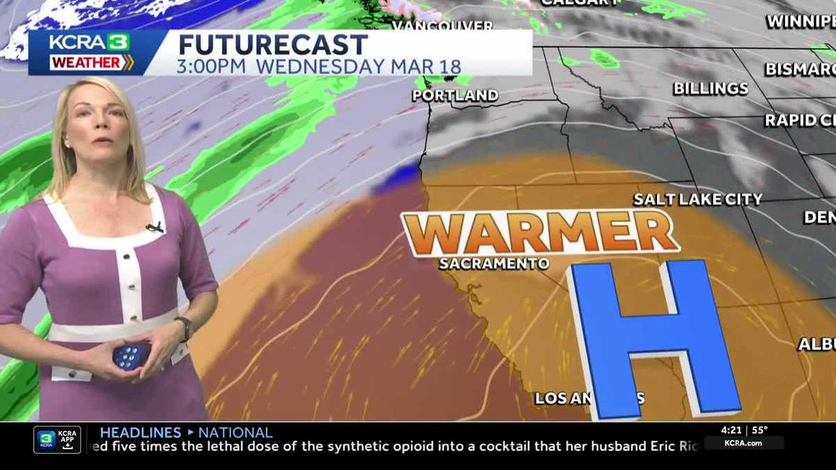
The warm winter stretch holds throughout the week with Thursday and Friday looking like the warmest days.
Friday is also the first day of Spring. The Vernal Equinox will occur at 7:46 am PDT marking the sun’s position directly over the equator and equal hours of sunlight and darkness
The 7-day forecast is dry with no rain or snow in sight.
Tuesday’s forecast
Temperatures will take another jump Tuesday afternoon. Stockton and Modesto will flirt with 90 degrees for the first time this year.
St. Patrick’s Day Records
Temperatures this afternoon will be unseasonable warm and several records are set to fall. If you plan to celebrate the holiday outside, be sure to wear sunscreen and drink plenty of water.
Record Breaking Week Ahead
One or two days in the upper 80s would be remarkable enough for this time of year, but the forecast calls for at least eight days with a high of 80 degrees or more in Sacramento, Stockton and Modesto. For Sacramento this would be the most 80 degree days recorded during the month of March.
Foothills & Sierra 7-day forecast
Summerlike temperatures are in the forecast for the Foothills and Sierra all week, too. There aren’t any official record keeping sites recognized by the National Weather Service in the Foothills, but locals know these temperatures are very unusual for this time of year.
Valley 7-day forecast
Record-shattering high temperatures are in the forecast through Saturday in the Valley. the heat will slowly ease early next week.