
NorCal forecast: Very warm first half of the week
As our warm weather system weakens, high temperatures will drop a few degrees on Sunday.
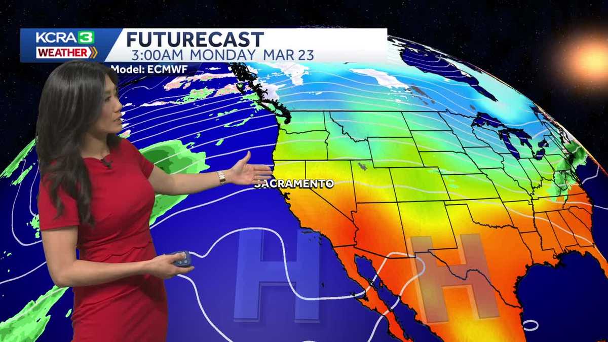
WE WANT TO CHECK IN NOW WITH METEOROLOGIST OPHELIA YOUNG AND OPHELIA YOUNG. A REALLY NICE NIGHT FOR A BASEBALL GAME. YEAH REALLY NICE. AND THIS AFTERNOON WASN’T AS HOT AS IT’S BEEN THE LAST FEW DAYS. BUT EVEN WITH TEMPERATURES A LITTLE BIT COOLER, STILL MAKES NUMBER EIGHT FOR DAYS, 80 DEGREES AND WARMER, MAKING THIS MONTH OUTRIGHT. THE MARCH WITH THE MOST 80 DEGREE OR WARMER TEMPERATURE DAYS. AND HERE’S ALL 80 IN A ROW. EVER SINCE SUNDAY. TODAY WE DID TIE A DAILY RECORD HIGH, SO OUR RECORD STREAK DOES CONTINUE. AND UNFORTUNATELY, IT’S GOING TO CONTINUE FOR A COUPLE MORE DAYS. IN FACT, WE’VE GOT 80S ALL THE WAY THROUGH WEDNESDAY. NOT TO BEAT A DEAD HORSE, BUT WE’RE CERTAINLY GOING TO STAY AT THE TOP OF THAT LIST AS WE LOOK OUT AT OUR FLAG AND STOCKTON, YOU CAN SEE THE FLAG, LIKE ANDREA SAID, MOVING EVER SO SLIGHTLY. WE DID HAVE A LITTLE WIND THIS WEEKEND. LOOKS LIKE IT’S CALMED DOWN IN PARTS OF THE VALLEY NOW, BUT IT’S REALLY DONE US A FAVOR BY CLEARING OUT THE POLLUTION IN OUR AIR. AND NOW OUR AIR QUALITY IS BACK TO BEING GOOD. THAT WIND IS STILL LINGERING THROUGH SAN FRANCISCO AND FAIRFIELD. LOOKS LIKE IT IS SLOWING DOWN IN THE VALLEY. HOWEVER, MOST SPOTS WITH WIND SPEEDS BELOW TEN MILES PER HOUR, BUT IT CONTINUES TO USHER IN THAT COOLER AIR VERY GRADUALLY. MOST SPOTS THIS EVENING A COUPLE DEGREES COOLER THAN THIS TIME YESTERDAY, SO WE ARE ALREADY IN THE UPPER 60S AND LOW 70S IN THE VALLEY. WE HAVE LOW 60S IN THE FOOTHILLS WITH THE SIERRA COMING IN IN THE 50S AND LOW 60S AS WELL. SAN FRANCISCO DOWN TO 55 DEGREES RIGHT NOW. SO HIGH PRESSURE RESPONSIBLE FOR OUR WEEK OF RECORD HEAT THAT CONTINUES TO DETERIORATE. THE JET STREAM CONTINUES TO DROP DOWN AND FLATTEN OVER THE NORTHWEST AND BEHIND IT. SOME COOLER AIR CONTINUES TO FILTER IN SO LONG AS THAT HIGH CONTINUES TO DRIFT OFF TO THE SOUTHEAST, YOUR MONDAY WILL START A LITTLE COOLER. HOWEVER, ON TUESDAY AND WEDNESDAY. AREA OF HIGH PRESSURE REGAINS A LITTLE INFLUENCE AND WE ARE BACK IN RECORD TERRITORY FOR A COUPLE OF DAYS AT THE VERY MOST BECAUSE WE HAVE SOME WINDS THAT KICK UP ON THURSDAY █AND THATWILLMOVE THAT HIGH ESSENTIALLY OFF TO THE EAST, BRINGING IN SOME MORE IMPACTFUL AND SIGNIFICANT COOLER AIR. THIS SETS THE STAGE FOR A COOLER WEEKEND, AND BY THE START OF THE NEXT WEEK, I’M TALKING VERY END OF MARCH, MAYBE A FEW SHOWERS AND MAYBE SOME SNOW FLAKES AT OUR VERY, VERY PEAKS BEYOND MARCH. WE ARE HOPING FOR TEMPERATURES TO RETURN TO START OF APRIL. NORMALS. SO HOPEFULLY STARTING OFF THE NEW MONTH IN A MUCH MORE NORMAL WAY. BUT UNTIL THEN, WE HAVE A FEW MORE DAYS OF ABNORMALLY WARM TEMPERATURES TO GO IN THE FOOTHILLS. THAT MEANS HOVERING CLOSE TO 80 DEGREES FOR AT LEAST THE FIRST HALF OF THIS WEEK, BEFORE DROPPING BACK INTO THE LOW TO MID 70S SATURDAY AND SUNDAY. IN THE SIERRA, WE’VE GOT CLOSE TO 70. WE’LL HUG 70 MONDAY, TUESDAY, AND WEDNESDAY. LOW 60S BY THE WEEKEND, AND IN THE VALLEY WE HAVE A FEW MORE DAYS OF 80S. SO I THINK ALL SAID AND DONE, WE ARE GOING TO HAVE A TOTAL OF 1180 DEGREE DAYS THIS MONTH, WHICH IS INCREDIBLE. SOME BREEZES ON THURSDAY TO FINALLY RESCUE US AND MID 70S ON SATURDAY AND SUNDAY. SOUND NICE RIGHT? YEAH. SOUNDS AMAZING. AS WARM AS IT IS, I’M SCARED FOR SUMMER. I GET NER
NorCal forecast: Very warm first half of the week
As our warm weather system weakens, high temperatures will drop a few degrees on Sunday.

Updated: 7:33 PM PDT Mar 22, 2026
Our warm weather system continues to weaken, and the heat will ease a few more degrees Monday, though temperatures will still challenge daily record highs.
Monday’s forecast
Monday will mark this month’s ninth 80-degree-or-warmer day in the valley, even though most areas will be a few degrees cooler than Sunday. Winds will be light, and clouds will clear for a mostly sunny afternoon.
Streak of 80s continues
As high pressure aloft regains some influence, our streak of 80-degree days will likely continue through Wednesday afternoon, though the current daily record for Wednesday is much too high to be reached.
Tracking some changes, finally
Breezes return Thursday as we anticipate a larger weather pattern shift toward the end of the month. This may set the stage for a few showers as we transition into April.
Foothills & Sierra 7-day forecast
The last weekend of the month will still be a few degrees warmer than normal, but it should remain very pleasant and comfortable.
Valley 7-day forecast
Weather will gradually cool through the week, and clouds will increase, but the valley can still enjoy mid-70s by the weekend.