
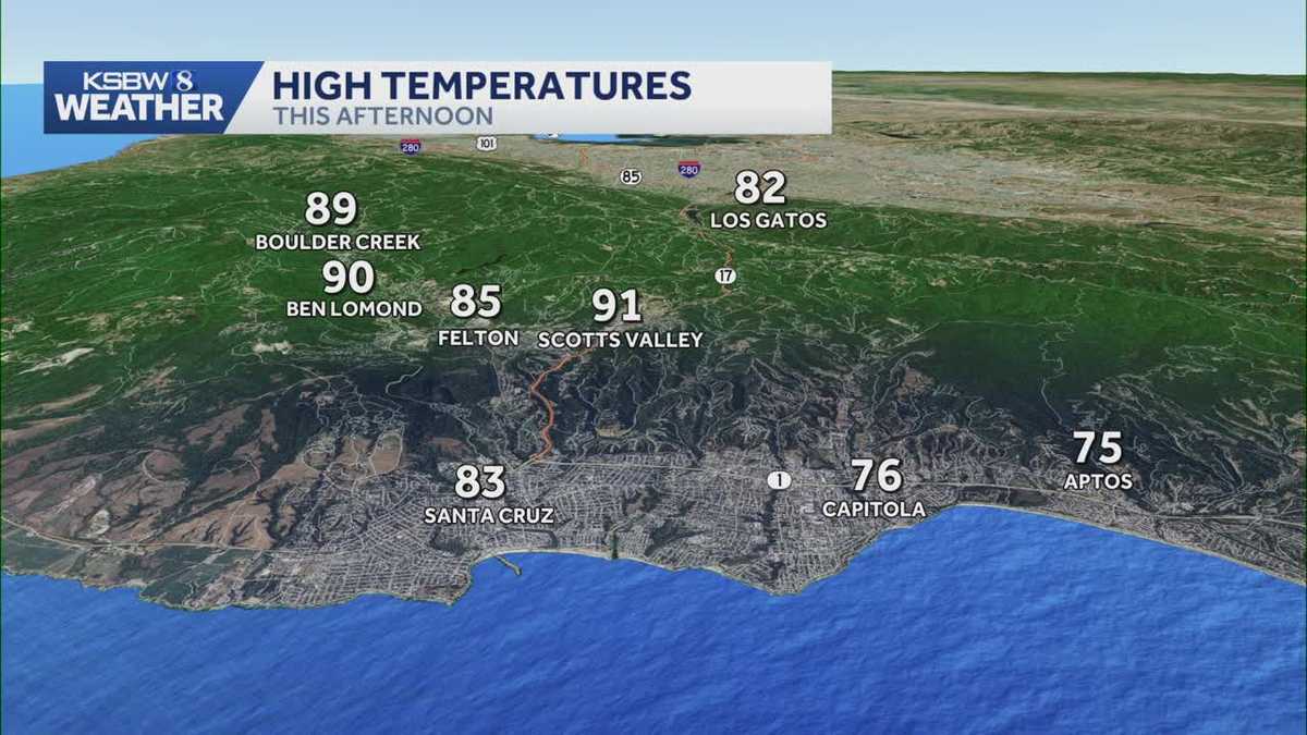
California is experiencing above-normal temperatures, with the heat wave now over but temperatures still running 10-15 degrees above normal, and some elevated interior locations may see highs 20 degrees above normal by the end of the afternoon. The ridge that brought record-breaking heat last week has shifted to the southeast over the desert southwest, but it continues to dominate the weather pattern and daily forecast. The ridge axis will build back up over California for the remainder of today and tonight, then pivot eastward on Tuesday. Tuesday will be slightly warmer than today, but barely noticeable. Overnight lows will also run 5-10 degrees above normal for most locations tonight and through the remainder of the extended forecast. The stable environment will provide pleasant weather with mostly clear skies, especially away from the coast. Weak onshore flow will result in pockets of marine stratus overnight.
SALINAS, Calif. —
California is experiencing above-normal temperatures, with the heat wave now over but temperatures still running 10-15 degrees above normal, and some elevated interior locations may see highs 20 degrees above normal by the end of the afternoon.
The ridge that brought record-breaking heat last week has shifted to the southeast over the desert southwest, but it continues to dominate the weather pattern and daily forecast.
The ridge axis will build back up over California for the remainder of today and tonight, then pivot eastward on Tuesday.
Tuesday will be slightly warmer than today, but barely noticeable. Overnight lows will also run 5-10 degrees above normal for most locations tonight and through the remainder of the extended forecast.
The stable environment will provide pleasant weather with mostly clear skies, especially away from the coast.
Weak onshore flow will result in pockets of marine stratus overnight.