
A series of earthquake alerts reported across Northern California late Monday night were the result of a technical glitch in a U.S. Geological Survey system, not a cluster of seismic events, according to preliminary information.
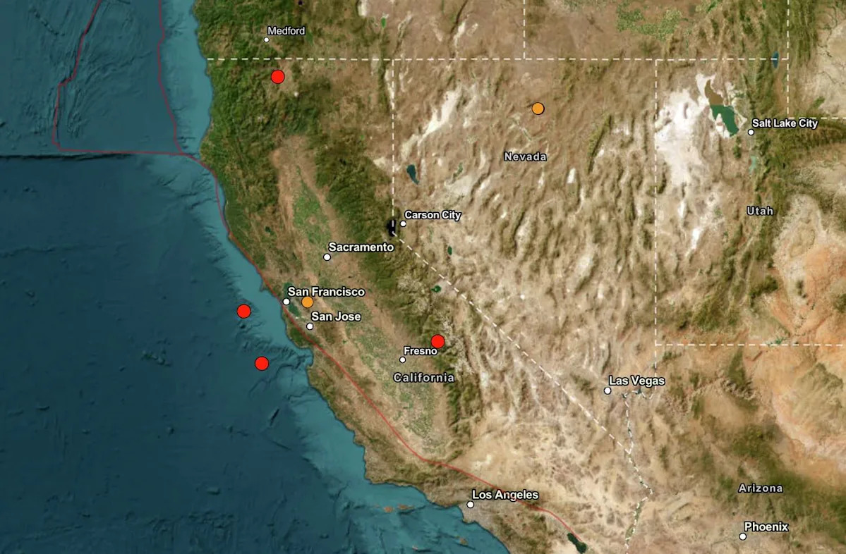
Shortly before 10 p.m., automated alerts indicated several small earthquakes had struck within about a minute in different parts of the state, including offshore areas west of the Bay Area, the Sierra Nevada foothills and near the Oregon border.
The alerts, generated by the USGS earthquake notification system, listed magnitudes ranging from 3.2 to 3.8 and locations near Point Reyes, Bonny Doon, Shaver Lake in Fresno County and Yreka. The events were initially marked as “automatic” detections by the Northern California Seismic System, part of the California Integrated Seismic Network.
However, those reports were later called into question as inconsistencies emerged, suggesting the activity did not reflect actual seismic events.
The USGS has not yet issued a full public explanation of what happened or clarified whether any of the reported quakes were valid. It is common for automatically generated detections to be reviewed and, in some cases, revised or removed.
As of late Monday night, there were no confirmed reports of shaking, damage or injuries tied to the alerts. The USGS “Did You Feel It?” system, which collects public reports of shaking, showed little to no activity associated with the listed events.
Seismologists routinely review automatically generated earthquake data, which can occasionally produce erroneous readings due to signal interference or processing errors, though such instances are relatively rare.
This article originally published at USGS glitch triggers false earthquake alerts across Northern California.