
Most of the people killed or severely injured on San Francisco streets die on the same roads — and city officials have unveiled an updated map of exactly where those are.
Mayor Daniel Lurie announced the 2024 High Injury Network (opens in new tab), or HIN, as part of a broader street safety directive launched in December aimed at reducing traffic deaths and serious injuries.
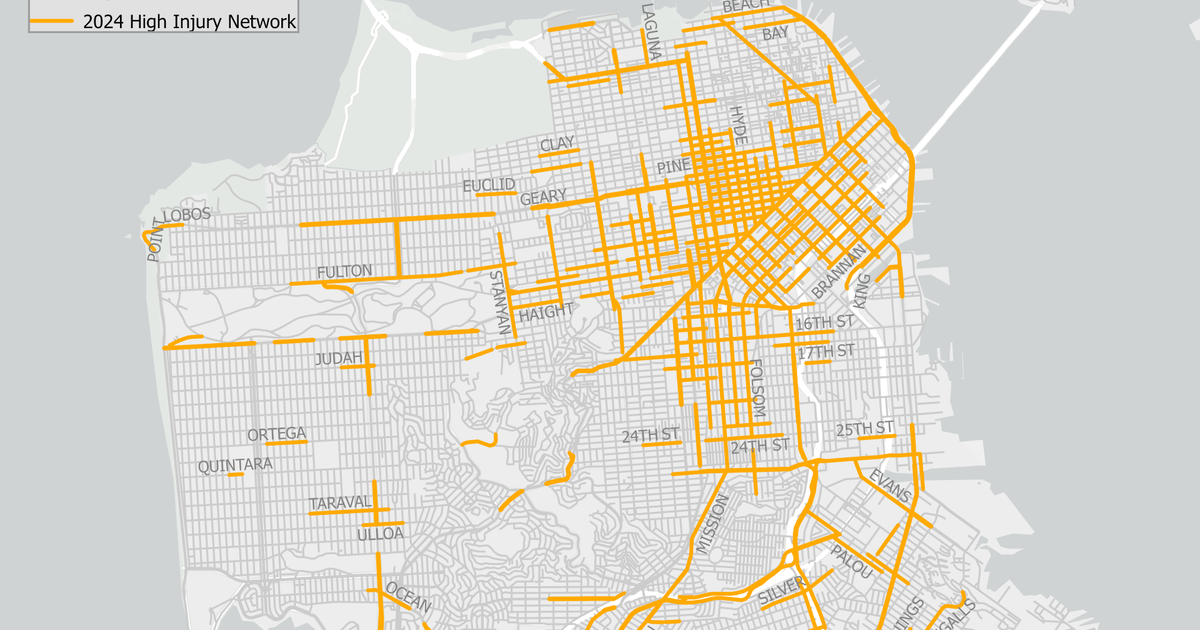
The map, which uses 2024 data, shows that about 13% of the city’s streets account for 74% of its most severe crashes.
“Too many San Franciscans are losing their lives on our roadways, and often in predictable and preventable crashes,” Lurie said in a statement. “By focusing on the streets where the most crashes occur, we will make our roadways safer for everyone.”
The High Injury Network is updated every three to five years using hospital data, police reports, and death records to track where the most serious crashes happen. The mayor’s office said the updated map will help direct street design changes and traffic enforcement, including against electric scooters, according to a press release.
The mayor’s office said targeted improvements on previously dangerous corridors have led to fewer crashes. Seventh Street between Harrison and Townsend saw injury crashes fall 69% between 2016 and 2024; California Street between 18th Avenue and Arguello Boulevard saw a 64% drop after safety upgrades; and Townsend Street between Third and Eighth streets saw total crashes decline 52%.
Although some areas have seen a major reduction in serious injuries, other segments have been newly identified as high-risk, including Fulton Street between Fourth and Seventh avenues, the Embarcadero between Howard Street and Pier 40, and Point Lobos Avenue between 46th Avenue and the Great Highway — a scenic downhill route where cyclists must merge into traffic from an unprotected bike lane.
For more than a decade, San Francisco has been trying to eliminate traffic deaths through its Vision Zero initiative. During the pandemic, officials accelerated “quick-build” projects — faster, lower-cost changes like painted curb extensions, protected bike lanes, and traffic calming — to respond to shifting travel patterns and rising speeds.
 Point Lobos Avenue, which passes along the Cliff House, has been newly identified as a hazardous road on the city’ latest high-injury network map. | Source: Courtesy SF Planning
The HIN map is created by multiple agencies, including the San Francisco Municipal Transportation Agency, the San Francisco Police Department, and the San Francisco Department of Public Health, which work together to analyze crash trends and identify underlying causes.
City leaders pointed to early signs of progress from recent safety measures. San Francisco recently became the first city in California to roll out automated speed cameras, which the mayor’s office said have reduced speeding by 78% at monitored locations. The city has also expanded its red-light camera program to 25 locations at 18 intersections, contributing to a decline in red-light violations.
Transportation officials plan to use the updated map to prioritize more “quick-build” projects along with nearly 30 additional safety and transit improvements.