
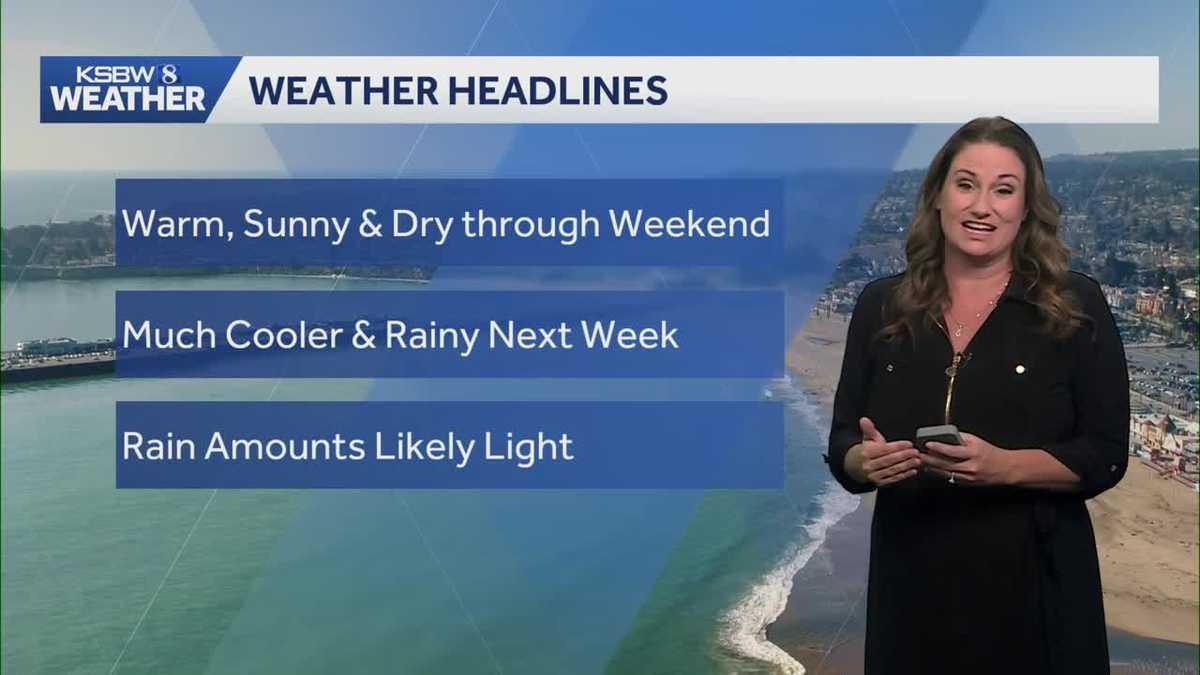
California is currently experiencing above-normal temperatures, with a gradual warm-up expected through the weekend and a potential pattern change bringing rain next week. Overnight lows are forecasted to be around 10 degrees above normal, mostly in the mid-50s, with cooler valley temperatures in the upper 40s. Friday marks the beginning of this warm-up, with highs ranging from the mid-70s to low 80s across the interior, and even warmer temperatures in southern Monterey County, though still within Minor Heat Risk.Coastal areas are expected to climb into the low 70s due to a building ridge and surface high pressure with light and variable winds.The region remains under the influence of a persistent ridging pattern, with relatively strong zonal flow acting on the apex of the ridge. Temperatures are expected to gradually increase on Saturday and Sunday, reaching 15-20 degrees above normal for most interior spots and warmer along the coast with continued light winds.A pattern change is anticipated to begin on Monday, bringing a return of more robust onshore flow, an increasing marine layer, and cooler temperatures. The signal for mostly beneficial wetting rains remains in the forecast, however, differences in deterministic guidance persist, lowering confidence in exact timing and potential rainfall amounts. For now, the official forecast favors the North Bay and coastal ranges with onset as early as late Monday night with more widespread coverage later Tuesday into Wednesday.
California is currently experiencing above-normal temperatures, with a gradual warm-up expected through the weekend and a potential pattern change bringing rain next week. Overnight lows are forecasted to be around 10 degrees above normal, mostly in the mid-50s, with cooler valley temperatures in the upper 40s.
Friday marks the beginning of this warm-up, with highs ranging from the mid-70s to low 80s across the interior, and even warmer temperatures in southern Monterey County, though still within Minor Heat Risk.
Coastal areas are expected to climb into the low 70s due to a building ridge and surface high pressure with light and variable winds.
The region remains under the influence of a persistent ridging pattern, with relatively strong zonal flow acting on the apex of the ridge.
Temperatures are expected to gradually increase on Saturday and Sunday, reaching 15-20 degrees above normal for most interior spots and warmer along the coast with continued light winds.
A pattern change is anticipated to begin on Monday, bringing a return of more robust onshore flow, an increasing marine layer, and cooler temperatures. The signal for mostly beneficial wetting rains remains in the forecast, however, differences in deterministic guidance persist, lowering confidence in exact timing and potential rainfall amounts.
For now, the official forecast favors the North Bay and coastal ranges with onset as early as late Monday night with more widespread coverage later Tuesday into Wednesday.