
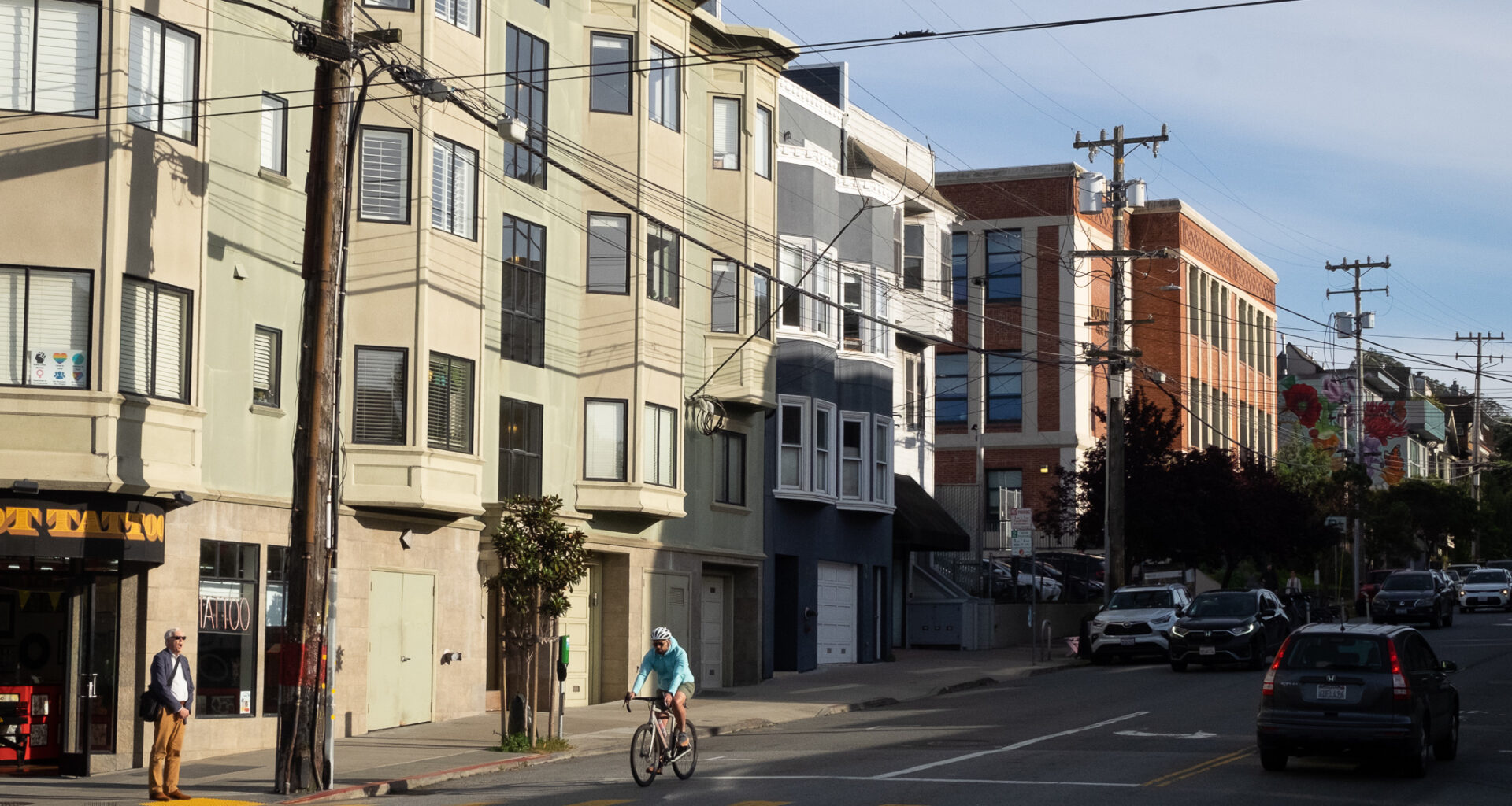
For decades, the city has known that bicycle infrastructure in the Inner Sunset is riddled with problems, but failed to make adequate and timely changes. Another wake up call came in early March when a dump truck struck a cyclist at the intersection of Seventh and Irving, and dragged her for about 20 feet, leaving the cyclist with life-threatening injuries.
Again, the crash raised the question of how an intersection neighbors describe as “like a freeway,” has not been made safer.
Mission Local found attempts to make Seventh Avenue safer for cyclists going back at least 20 years, but these attempts don’t usually come to fruition without a “fight,” said Emma Hare, a legislative aide for District 7 Supervisor Myrna Melgar.
Minutes from the city’s Bicycle Advisory Committee meeting in 2006 mention a plan to add striped bike lanes down Seventh Avenue from Lawton to Kirkham, calling it a “community consensus.” That happened.
But making changes on the blocks between Kirkham and Lincoln further north were more contentious, the minutes wrote. Implementing bike lanes there would take out parking near intersections and remove the left-turn lane for cars.
Today, the blocks north of Judah Street ended up only having “sharrows,” which are bikeways marked by two chevrons indicating that bicycles share the lane with motor traffic. That decision created a gap in the biking network on Seventh Avenue.
“Sharrows are just the weakest thing that a transportation agency could do,” said Christopher White, executive director of San Francisco Bike Coalition.
The change from a bike lane to a sharrow is also dangerous, White adds, because it forces cyclists and drivers to merge together in ways that will inevitably lead to conflict.
“They are not effective at keeping people safe,” he said. “They are hardly better than nothing at all.”
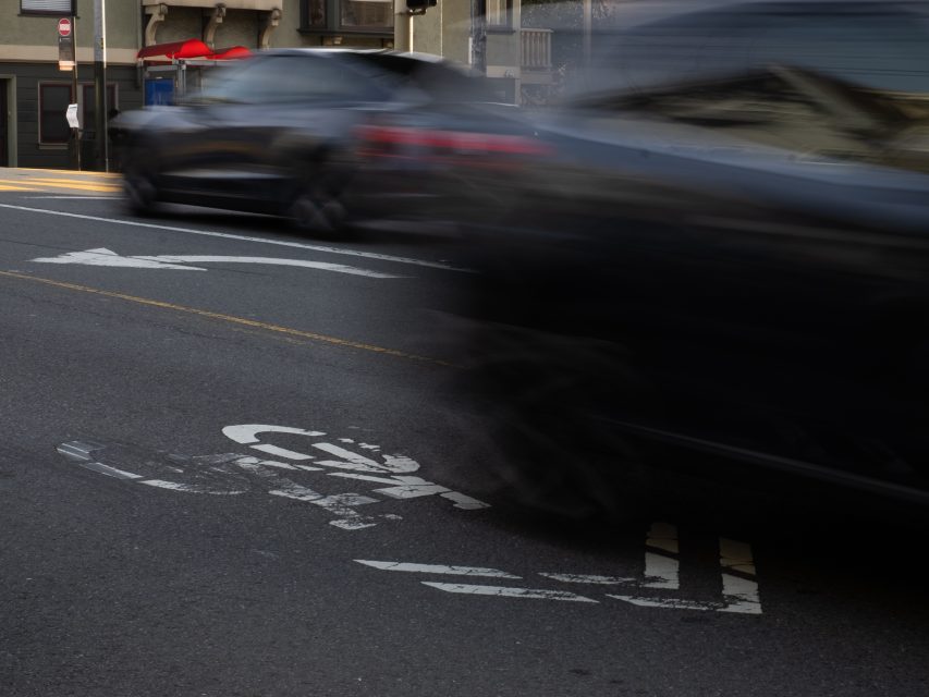 Sharrows on 7th Avenue are marked by two chevrons on the road, indicating that cyclists share the road with motor traffic. Photo by Junyao Yang on March 26, 2026.
Seventh Avenue, near where the crash happened, is described by locals as a hectic street that is dangerous for pedestrians and cyclists. Irving Street, a main commercial corridor for businesses and pedestrians, is also on the path of the N-Judah light rail. It routinely has double-parked cars and trucks.
“Many drivers racing or running the light or making aggressive turns in what is a very small intersection,” said Marta Lindsey, a spokesperson for WalkSF, who had biked through the intersection just a few hours before the crash. She had witnessed “countless close-calls” there and said the high volume of traffic with so many pedestrians and cyclists was a “deadly combination.”
The San Francisco County Transportation Authority began working on an Inner Sunset Transportation Study in the summer of 2024, at the request of Supervisor Melgar. Its final report will be published in late spring.
An initial assessment published in November 2024 found that “dedicated cycling facilities are limited and the existing routes are high-stress” in the Inner Sunset. Despite this, it added, many people walk and ride their bikes in the neighborhood, especially on weekends.
SFMTA is “moving away” from using sharrows, said White. But it is not moving fast enough. Ideally, White continued, the city should review all sharrows and bikeways on roads with over 20 mph speed limit, and upgrade those bikeways to protected bike lanes, he said. It should “audit” bike corridors with rapid lane changes, like Seventh Avenue, and standardize them.
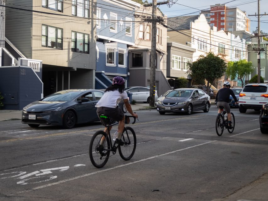 On 7th Avenue south of Judah Street, cyclists ride on a striped bike lane, separate from cars. Photo by Junyao Yang on March 26, 2026.
The Inner Sunset transportation study proposed this exact solution, recommending replacing the sharrows on Seventh Avenue with a painted bike lane, and removing the center left turn lane entirely. This change would have no or limited impact on parking spaces, said Stephen Chun, the San Francisco County Transportation Authority spokesperson. Once approved, it would take two to five years to implement, depending on funding availability.
The agency is also proposing a long-term plan to examine the best routes for cyclists through the Inner Sunset. That plan will take over five years and requires further study and funding. It will consider both routing changes and street redesign to encourage cyclists to use them.
That could mean additional improvements on Seventh Avenue, or designating an alternative route for cyclists, on Sixth Avenue, Fifth Avenue and Hugo Street. That plan would route cyclists away from the car-traffic-heavy Seventh Avenue.
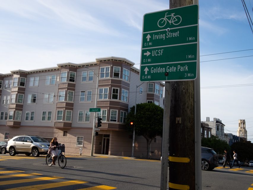 A wayfinding sign on 7th Avenue and Judah Street directs cyclists down 7th Avenue. Photo by Junyao Yang on March 26, 2026.
Hare, the legislative aide, said that she has heard from both drivers and cyclists that the city needs to “get bikes off” the Seventh and Irving intersection entirely. The intersection of cars, trains, bikes and pedestrians creates conflicts, Hare said, and “the safest thing we can do is to stop the conflict. Don’t put everything everywhere all at once.”
It’s unusual for so many different people using so many different modes of transit to agree, Hare said. “We don’t get that very often.”
This solution, however, does not help cyclists trying to get on Irving Street, Hare said. “We are still working on that.”