
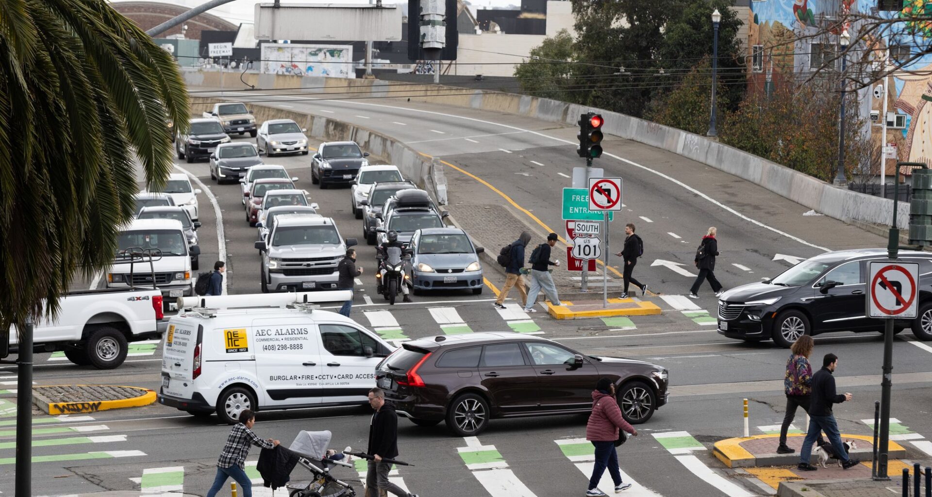
Traffic transits the intersection at Octavia Boulevard and Market Street in San Francisco on Thursday, Feb. 15, 2024. The intersection has been added to the city’s latest “high injury corridor” map, where the majority of severe and fatal crashes happen.
Benjamin Fanjoy/The Chronicle
San Francisco officials this week released an updated version of its “high injury network,” the 13% of streets where 74% of severe and fatal traffic injuries occur, adding several new streets while removing others.
The latest version of the map is based on collision and hospital data from 2020-2024, an update to the previous iteration, which included data from 2017 to 2021.
While large swaths of the map remain the same, several short segments were added, in many cases near other short segments that were removed from the map. Some larger stretches were added as well, including Alemany Boulevard from Mission Street to Oakdale Avenue and Lincoln from 37th Avenue to the Great Highway. (The data used for the map predates the closure of the Great Highway to create Sunset Dunes Park.)
Article continues below this ad
The high injury network is a critical piece of the city’s street safety plan. It serves as a baseline for where both police and transit officials will focus on enforcement and safety interventions. Already, police have increased “high-visibility enforcement” prioritizing streets on the network and have integrated traffic enforcement into regular patrols within each police district, focusing on the high injury corridors within each one.
The map also comes as concern about pedestrian safety is heightened. While the city saw a drop in pedestrian deaths last year, six pedestrians have been killed on city streets so far this year, including a 2-year-old. Four of the deaths were on streets that are on both iterations of the high injury network. One was on a segment of Mission Street that was removed from the latest version, and the most recent, on Friday, was near a stretch of Jackson in Chinatown that was added.
San Francisco Chronicle Logo
Make us a Preferred Source to get more of our news when you search.
Add Preferred Source
“Too many San Franciscans are losing their lives on our roadways, and often in predictable and preventable crashes,” Mayor Daniel Lurie said in a statement. “The updated High Injury Network gives us a clear understanding of where changes need to be made—and under our Street Safety executive directive, we’re acting on it with targeted safety improvements and stronger enforcement.”
Article continues below this ad
SFMTA spokesperson Parisa Safarzadeh noted that, post-pandemic, the traffic situation has changed notably, with “more reckless driving behavior, larger and heavier vehicles, and the rapid growth” of e-scooters and bikeshares. The data that feeds the current map was collected before several changes were made to the city’s streetscape, including speed cameras and the expansion of daylighting. The latter has seen the city painting more curbs near crosswalks red, preventing parking to improve the visibility of people crossing the street.
Still, the updated network does reflect progress, she said. For example, California Street between 18th Avenue and Arguello in the Richmond District came off the network after safety treatments including daylighting, upgraded crosswalks and a reduction in the number of travel lanes reduced injury collisions by 64% in the first year.
In SoMa, collisions on Townsend between Third and Eight streets were cut in half after the city added a separated bikeway and pedestrian pathway, transit boarding islands and left-turn traffic calming measures, enough to remove that stretch from the high injury network as well. Similar changes also resulted in the removal of Seventh Street between Harrison and Townsend.
Even for streets that remain on the network, Safarzadeh said, crashes resulting in injury have declined after safety improvements. Transit and health officials are still evaluating collision data to identify specific trends for a report later this year.
Article continues below this ad
“In places where severe crashes repeat or concentrate, multiple factors are often at play, which means no single tool or agency can solve the problem alone,” Safarzadeh said in a statement. “Preventing the most serious crashes requires multiple layers of safety working together.”