
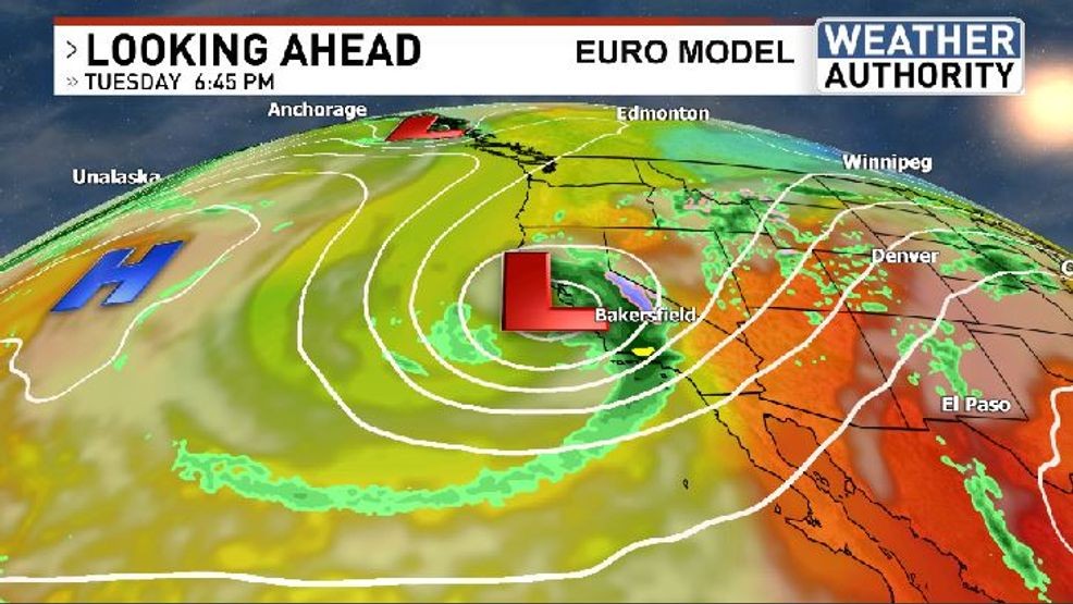
BAKERSFIELD, Calif. (KBAK/KBFX) — We’re still in the first half of October but the forecast focus will be on a weather pattern that resembles the second half of December. A winter-like trough is anticipated to be carved out across the West Coast as a weather system is expected to develop out of southwest Canada and “retrograde” or push southwestward out over the Pacific Ocean, just off the California coast where it will scoop up moisture, to then swing it back inland over the Golden State for the first appreciable chance of widespread rain much of the state has seen so far this season. While it’s still too early to pin down potential amounts, wetting rains are likely for many and snow could come into the picture across the higher elevations of the Sierra.
Before that happens though, the weather looks pleasant and pretty comfortable for Sunday with highs in the 70s for most areas, and the 60s in the mountains.
Have a great day!