
A magnitude 4.1 earthquake shook Southern California on March 27, 2026, and triggered more than a dozen aftershocks that led to light to moderate shaking across the region.
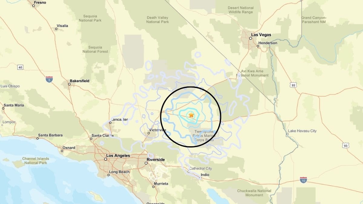
The quake was recorded at about 3:13 p.m. PT Friday, with its epicenter about 26 kilometers west-northwest of Ludlow, according to the U.S. Geological Survey (USGS). It originated at a depth of 1.4 kilometers. Shallow earthquakes generally produce more noticeable shaking despite their moderate magnitude.
According to the USGS, 57 people reported feeling the shaking through its “Did You Feel It?” system, where the quake was classified as Level III intensity. ShakeMap data indicated a maximum intensity of Level V, which is described as moderate shaking.
The USGS assigned a Green alert level, indicating a low likelihood of casualties or significant damage. Most buildings in the region are designed to withstand seismic activity, though older structures may remain vulnerable.
Aftershocks Recorded After The Earthquake
The magnitude 4.1 event was identified by the agency as the mainshock. It has been followed by at least 16 aftershocks, including one above magnitude 3.0 and several ranging from 1.2 to 2.5 near Ludlow.
The USGS released an aftershock forecast for the coming days, showing that there will be continued but low-level activity in the region.
There is a 22% chance of at least one aftershock reaching magnitude 3 or higher, with an expected range of zero to two such events. The probability of a magnitude 4 aftershock is about 3%, with zero to one such events expected.
Stronger activity is expected to decrease over time, with less than a 1% chance of a magnitude 5 or larger earthquake. The chance that this event could act as a foreshock to a larger earthquake is estimated at around 2%, according to USGS models.
No Damage Reported
Officials noted the quake may have triggered minor secondary hazards, such as small landslides or localized ground instability, though no major incidents have been reported.
Nearby areas including Yermo, Barstow, Fort Irwin, and Lucerne Valley reported Level III shaking, while Riverside recorded Level II intensity, according to USGS data.
According to ShakeAlert, an initial alert was issued about 7.8 seconds after the quake began, followed by a final update at 13.1 seconds. The estimated magnitude was later revised from 4.4 to 4.1.
The region has high seismic activity due to the interaction between the Pacific and North American tectonic plates. Major fault systems, including the San Andreas Fault and the Eastern California Shear Zone, play a key role in earthquake activity in the area.
These systems are known for producing moderate earthquakes and occasional larger events, underscoring the region’s ongoing seismic risk.