
GONDOLA AND SIGHTSEEING ACTIVITIES WILL REMAIN OPEN UNTIL APRIL THE 19TH. ALL RIGHT, THEY COULD ADD A FEW FLAKES THOUGH, HERE IN THE NEXT, WHAT, THREE FOUR DAYS? SOMETHING LIKE THAT. YES THEY CAN. HOWEVER, I THINK THOSE FLAKES ARE GOING TO BE A LITTLE BIT MORE SLUSHY. INSTEAD, THE INCOMING WEATHER SYSTEM. WE ALWAYS LOOK AT THE ORIGIN IT’S GOING TO BE SWINGING IN FROM THE PACIFIC RATHER THAN OUT OF THE NORTH, WHERE THESE WEATHER SYSTEMS ARE GOING TO BE COLDER. THIS ONE IS GOING TO BE ON THE WARMER SIDE. RIGHT NOW. HOWEVER, WE ARE GOING TO BE ON THE WARMER SIDE AS WE GET READY FOR A SUNNY DAY THIS MORNING. LITTLE BREEZY FOR SOME, ESPECIALLY IN THE NORTH VALLEY. STOCKTON WINDS. NOT TOO BAD. MAYBE ABOUT TEN MILES PER HOUR, BUT YUBA CITY SACRAMENTO FAIRFIELD THESE WINDS COMING OUT OF THE NORTH 10 TO 20MPH THIS MORNING. AND THE FUNNY THING ABOUT THESE WINDS IS THAT AS THEY FLOW DOWNSLOPE, IT ACTUALLY WARMS. SO THE BOWL THAT IS THE NORTHERN SACRAMENTO VALLEY AREAS WITHIN IT ARE ANYWHERE FROM 3 TO 13 DEGREES WARMER THAN THIS TIME YESTERDAY. SO CHECK OUT THE TEMPERATURE TREND. WE HAVE WARMER TEMPS IN YUBA CITY AND SACRAMENTO. COMPARE THAT TO STOCKTON AT 44 DEGREES PLACERVILLE 39. AUBURN 52, TRUCKEE AND SOUTH LAKE TAHOE. NO WIND TEMPERATURES IN THE 20S, SO WINDS CONTINUE TO FLOW OUT OF THE NORTH AS WE TRANSITION TO THIS AREA OF HIGH PRESSURE. THIS ONE IS GOING TO WARM US BACK INTO THE 80S SATURDAY, SUNDAY AND MONDAY IN THE VALLEY. WHILE THESE NUMBERS A COUPLE WEEKS AGO WOULD HAVE SET NEW DAILY RECORD HIGHS, THE DAILY RECORDS ARE NOW RUNNING IN THE MID TO UPPER 80S, EVEN 90 DEGREES. SO WE ARE GOING TO STAY SOUTH OF BREAKING ANY RECORDS, BUT IT WILL STILL BE UNUSUALLY WARM THANKS TO HIGH PRESSURE. NOW BEYOND THE WEEKEND. MONDAY TUESDAY IS NICE. MEANWHILE, WE’RE GOING TO BE TRACKING THIS WEATHER SYSTEM THAT’S GOING TO SWING RIGHT IN. LIKE I SAID FROM THE PACIFIC, PRE-FRONTAL SHOWERS ARRIVING AS EARLY AS WEDNESDAY. AND THEN WE HAVE WIDESPREAD SCATTERED SHOWERS THURSDAY, FRIDAY, MAYBE INTO NEXT WEEKEND. THAT IS VERY UNCERTAIN. THIS IS A PACIFIC STORM SYSTEM. STILL TRYING TO FIGURE OUT HOW LONG IT’S GOING TO BRING US THAT CHANCE OF RAIN AND HOW MUCH RAIN, ESPECIALLY IN THE VALLEY. WE DO KNOW THAT THE FOOTHILLS AND THE SIERRA MAY GET SOME SHOWERS, BUT WHAT WE DO KNOW SO FAR IS THAT IT’S GOING TO BE WET WEDNESDAY AND ON IN THE REGION. SNOW LEVELS ARE GOING TO BE HIGH THANKS TO THE ORIGIN OF THIS SYSTEM, AND THERE WILL BE A MODERATE COOLDOWN. TEMPERATURES WILL BE BACK IN THE 70S, MAYBE EVEN UPPER 60S BY THE END OF YOUR SEVEN DAY FORECAST. BUT THIS IS WHAT THAT SEVEN DAY FORECAST LOOKS LIKE. 80 SATURDAY AND SUNDAY IN TIME FOR THE WEEKEND. AND THEN THE SHOWERS AND BREEZES
Northern California forecast: Breezy morning gives way to a sunny Friday

Updated: 6:30 AM PDT Apr 3, 2026
A few lingering breezes will stick around behind this week’s weather system early Friday, but winds should ease by the afternoon, setting the stage for a beautiful end to the week for Northern California. Expect abundant sunshine and warmer temperatures, climbing into the mid-to-upper 70s in the Valley. High temperatures in the Foothills today will peak near 60 degrees, with afternoon temperatures in the Sierra climbing into the mid-50s and low-60s.The warming trend continues through Easter weekend, with sunny skies and highs reaching the low 80s both days. A few clouds may pass through Saturday night, but overall, the holiday weekend looks warm, bright, and pleasant.Mild conditions are expected to hold into Tuesday, though clouds will gradually begin to increase.By Wednesday, the weather turns more unsettled. Breezy conditions return as prefrontal showers begin to move in, followed by more widespread showers on Thursday. There is still much uncertainty around the exact timing and rainfall amounts, especially in the Valley. Showers could linger into next weekend as temperatures cool back into the upper 60s to low 70s.REAL-TIME TRAFFIC MAPClick here to see our interactive traffic map.TRACK INTERACTIVE, DOPPLER RADARClick here to see our interactive radar.DOWNLOAD OUR APP FOR THE LATESTHere is where you can download our app.Follow our KCRA weather team on social mediaMeteorologist Tamara Berg on Facebook and X.Meteorologist Dirk Verdoorn on FacebookMeteorologist/Climate Reporter Heather Waldman on Facebook and X.Meteorologist Kelly Curran on X.Meteorologist Ophelia Young on Facebook and X.Watch our forecasts on TV or onlineHere’s where to find our latest video forecast. You can also watch a livestream of our latest newscast here. The banner on our website turns red when we’re live.We’re also streaming on the Very Local app for Roku, Apple TV or Amazon Fire TV.See more coverage of top California stories here | Download our app | Subscribe to our morning newsletter | Find us on YouTube here and subscribe to our channel
SACRAMENTO, Calif. —
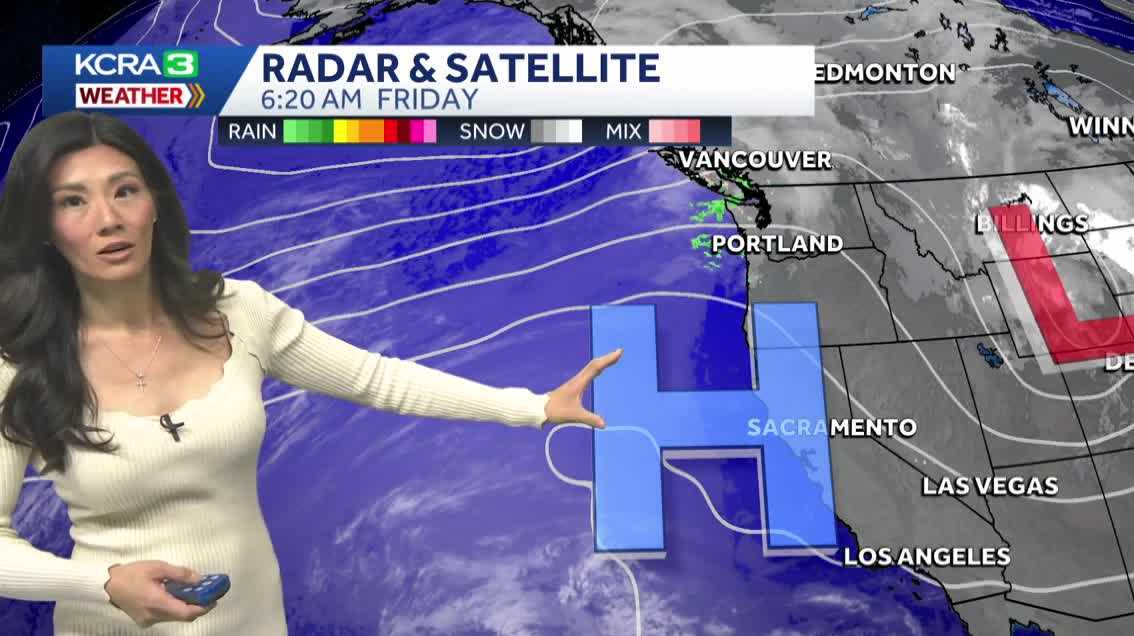
A few lingering breezes will stick around behind this week’s weather system early Friday, but winds should ease by the afternoon, setting the stage for a beautiful end to the week for Northern California.
Expect abundant sunshine and warmer temperatures, climbing into the mid-to-upper 70s in the Valley. High temperatures in the Foothills today will peak near 60 degrees, with afternoon temperatures in the Sierra climbing into the mid-50s and low-60s.
The warming trend continues through Easter weekend, with sunny skies and highs reaching the low 80s both days. A few clouds may pass through Saturday night, but overall, the holiday weekend looks warm, bright, and pleasant.
Mild conditions are expected to hold into Tuesday, though clouds will gradually begin to increase.
By Wednesday, the weather turns more unsettled. Breezy conditions return as prefrontal showers begin to move in, followed by more widespread showers on Thursday.
There is still much uncertainty around the exact timing and rainfall amounts, especially in the Valley. Showers could linger into next weekend as temperatures cool back into the upper 60s to low 70s.
REAL-TIME TRAFFIC MAP
Click here to see our interactive traffic map.
TRACK INTERACTIVE, DOPPLER RADAR
Click here to see our interactive radar.
DOWNLOAD OUR APP FOR THE LATEST
Here is where you can download our app.
Follow our KCRA weather team on social media
Meteorologist Tamara Berg on Facebook and X.Meteorologist Dirk Verdoorn on FacebookMeteorologist/Climate Reporter Heather Waldman on Facebook and X.Meteorologist Kelly Curran on X.Meteorologist Ophelia Young on Facebook and X.
Watch our forecasts on TV or online
Here’s where to find our latest video forecast. You can also watch a livestream of our latest newscast here. The banner on our website turns red when we’re live.
We’re also streaming on the Very Local app for Roku, Apple TV or Amazon Fire TV.
See more coverage of top California stories here | Download our app | Subscribe to our morning newsletter | Find us on YouTube here and subscribe to our channel