
A trek to the tri-state border monument reveals the story of a 19th-century surveyor who mapped California’s boundaries by hand.
MODOC COUNTY, Calif. — At the far northeastern edge of Modoc County, where California’s boundary first begins to take shape, the ground crunches underfoot with each step across rocky, sagebrush-covered terrain.
The Backroads team is on a quest to find the Tri-State border monument — the remote marker that separates California, Oregon and Nevada.
To help locate the historic site, ABC10 enlisted Roger Farschon, a retired ecologist with the Bureau of Land Management and a local historian.
“The monument is on this side of the fence a little bit,” Farschon said, pointing across the rugged landscape.
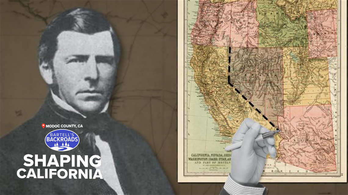
He pushes onward through the high desert, searching for a marker set more than a century ago by surveyor Alexey Von Schmidt, a man whose work quietly helped define the shape of California.
The surveyor who established the line where we’re heading was out here in 1872,” Farschon said. “And there was not much out here.”
TAKE A TRIP ON BARTELL’S BACKROADS:
► Binge the Backroads with the ABC10+ streaming app for your TV
► See an interactive map of everywhere John has visited on the backroads
► Watch all of the Backroads videos on your phone
► Follow John on Facebook
After a long hike, the monument comes into view.
What appears to be a simple pile of rocks and mortar is actually the starting point of California’s eastern boundary — and the source of numerous surveying challenges that began in 1872.
California’s northern and southern borders had already been established by then. Von Schmidt was hired to mark the eastern boundary of the state at 120 degrees longitude, running from the Oregon Territory all the way to the Mexico border.
But Von Schmidt’s task was far from easy. Farschon said that a previous surveyor, Daniel Major, had made a key mistake when plotting the starting point for the boundary.
“When (Von Schmidt) got up here, he found that it was three miles to the west of the 120,” Farschon said.
Back then, such errors were common. Determining latitude and longitude required painstaking calculations, precise timekeeping and corrections for the curvature of the Earth. Von Schmidt did his best to fix the earlier mistake and pressed south, marking each mile along the way.
“This is just the first point,” Farschon said. “Every mile on that boundary, he established another milepost.”
Von Schmidt had planned to complete the survey in one season, but his work hit a major obstacle — Lake Tahoe.
“Well, in 1872, they did the best job they could do,” Farschon said.
Plotting a boundary line through the lake proved so difficult that California now has a fifth boundary point in its middle.
The Tri-State monument itself isn’t easy to reach, but for those who do make the trek, the journey feels like a pilgrimage — a chance to explore California’s origins and honor the man who mapped them.
As Farschon opens a metal box hidden within the stones, he smiles.
“Oh look, treasures,” he says, revealing notes and small keepsakes left by past visitors. It’s a growing collection dedicated to Alexey Von Schmidt, the man who helped shape California’s borderlines.
WHERE TO FIND ANOTHER CORNER OF CALIFORNIA ON THE BACKROADS: