
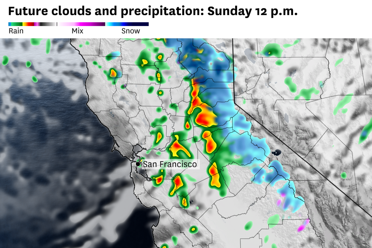
The Bay Area’s third straight day of meaningful rain brought isolated thunder and lightning Sunday as the low-pressure system’s cold core moved onshore just north of Point Arena on the Mendocino County coast.
Sunday’s rain has been more intermittent than the organized bands of heavy rain that fell Saturday.
Totals from Saturday ranged from a widespread 1 to 1.5 inches across Marin, the East Bay and the Peninsula. San Francisco picked up just under an inch, while San Jose, shielded by the hills to the west, saw less than half an inch at the airport. The heaviest rain, more than 3 inches, fell along south-facing coastal slopes.
Rainfall totals were not expected to be as high Sunday, but the threat of showers was continuing through the afternoon.
The storm was not moving very quickly, and it continued to drag a large lobe of very cold air with it, keeping the atmosphere unstable and supportive of showers and possible thunderstorm development.
At least one additional piece of atmospheric energy was expected to rotate into the main low-pressure system Sunday afternoon, triggering more widespread showers and perhaps a rumble of thunder or two across the Bay Area. Some of those storms could produce ice pellets as well.
Shower chances should start to diminish by Sunday evening as the low-pressure system moves farther inland and away from San Francisco.
Meanwhile, the Sierra Nevada remains in the throes of the storm. The system dropped measurable snow to lake level by Sunday morning. Higher up, ski areas reported 10 to 18 inches of fresh snow, pushing two-day totals to 1 to 2 feet above 7,000 feet.
Snow showers should continue into the evening before tapering off by Monday morning. A few additional inches of snow are expected around lake level in Tahoe, with up to another foot possible in the High Sierra.
Farther south, Mammoth reported 12 inches at Main Lodge and 18 inches at the summit over the past 24 hours. Snow levels had dropped to around 4,500 feet by Sunday, so several more inches of snow should fall before conditions wind down Monday morning.
This latest snowfall continues the whiplash nature of the Sierra season. April totals have climbed to 3 to 4 feet after a nearly snowless March.