
North winds and rain chances in the forecast for Northern California over the next several days
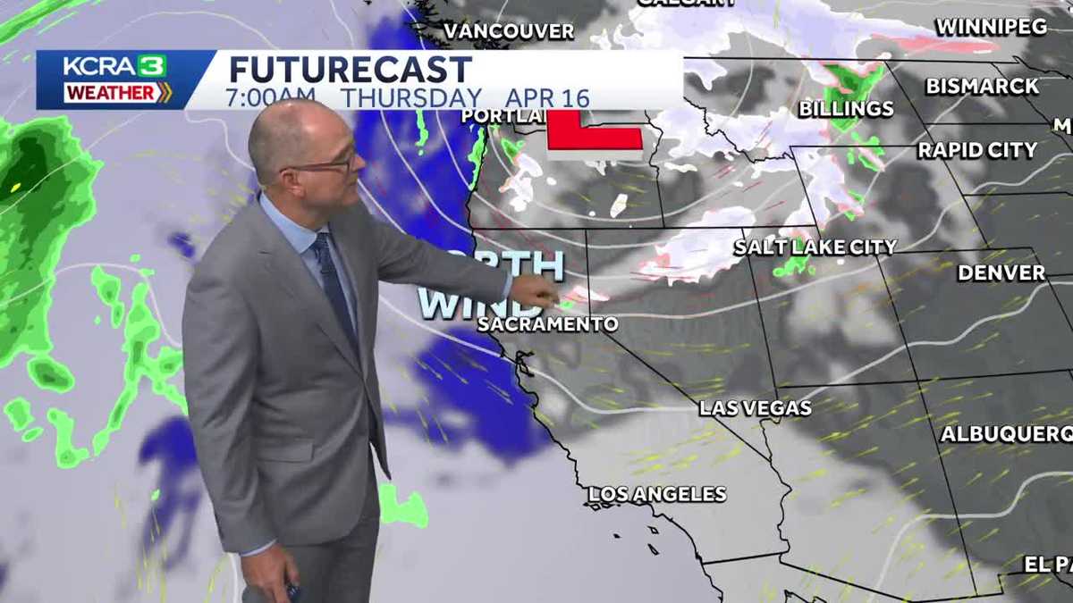
A few clouds will creep through overnight, bringing the chance for a few brief, isolated showers to the mountains. The impact will be negligible. North winds will be noticeable Thursday blowing 15-25 mph with gusts 30-40 mph. NWS has issued a wind advisory until 11 pm. Winds decrease Friday, and temps warm into the 70s. The weekend will have clouds but no rain and temps in the 70s. Rain chances look to arrive around Monday but that could change to Tuesday as computer models are having difficulty with timing.
GETTING A PICTURE? THERE WE GO. MOVING ALONG. WE’VE GOT THE LOOK AT THE DOWNTOWN AREA OF SACRAMENTO, INCLUDING THE NEW COURTHOUSE THAT’S OUT THERE. NICE SHOT. LOVE THAT TEMPERATURE 71 DEGREES IN SACRAMENTO, 72 IN STOCKTON, 72 IN MODESTO AND 50 DEGREES CURRENTLY AT LAKE. TAHOE. WINDS HAVE A NICE ONSHORE BREEZE RIGHT NOW. WINDS UP TO 18 IN FAIRFIELD 14 SACRAMENTO 15 AND STOCKTON. YOU SEE HOW IT BRANCHES ONCE IT MAKES ITS WAY TO THE VALLEY, AND THEN THE AIR GETS PUSHED UP OVER THE SIERRA. IT’S REALLY PICKING UP STEAM ON THE EAST SLOPE OF THE SIERRA. WE HAVE SUSTAINED WINDS OF 23MPH IN TRUCKEE. THERE AT THE AIRPORT, GUSTING UP TO 36MPH, 25 MILE AN HOUR WIND GUSTS AT LAKE TAHOE, 21 IN YUBA CITY AND 20 OR 33 MILE AN HOUR WIND GUSTS CURRENTLY IN SAN FRANCISCO. NOW, IT’S NOT FOR TODAY, BUT IT’S FOR TOMORROW BECAUSE WE’RE GOING TO SEE A SHIFT IN THE WINDS. WE HAVE A WIND ADVISORY THAT’S BEEN ISSUED BY THE NATIONAL WEATHER SERVICE, WITH NORTH WINDS WORKING THEIR WAY DOWN THE SACRAMENTO VALLEY, BUT ALSO INCLUDING A LITTLE BIT OF SAN JOAQUIN COUNTY. WE’RE LOOKING AT NORTH WINDS, 15 TO 25MPH. GUSTS UP TO 40MPH. SO IF YOU HAVE ANYTHING OUTSIDE THAT COULD BLOW AWAY, MAKE SURE YOU BRING IT IN OR TIE IT DOWN. LOCK IT DOWN. HERE’S THE WEATHER SYSTEM THAT’S GOING TO BRING THOSE NORTH WINDS. THE CENTER OF IT IS GOING TO SHIFT A LITTLE BIT TO THE SOUTH AND TO THE EAST. AND WE’LL GET THOSE WINDS COMING IN BEHIND THIS SYSTEM. BUT FOR TONIGHT WE’RE TALKING ABOUT A LITTLE BIT OF RAIN. IT’S NOT MUCH, BUT WE’VE GOT SOME MAKING ITS WAY ACROSS THE MOUNTAINS. COULD SEE A FEW LITTLE FLURRIES AND SHOWERS AGAIN. JUST GOING TO BE SPITTING. IT’S NOT GOING TO BRING MUCH ACCUMULATION. NOW AFTER THAT MOVES THROUGH THEN THOSE NORTH WINDS PICK UP AND WE’LL NOTICE THOSE THROUGH THURSDAY. SO WE’LL BE NOTICEABLE. AND AGAIN ALLERGY SUFFERERS BEWARE BECAUSE THE POLLENS ARE GOING TO BE IN THE AIR PUSHING AROUND WITH THOSE NORTH WINDS. CLOUDS ROLL IN SATURDAY AND SUNDAY OVER THE WEEKEND, BUT WE’RE GOING TO BE DRY NOW. LOOKS DRY THROUGH SUNDAY. IT’S NOT GOING TO BE TILL WE GET INTO MONDAY, MAYBE MONDAY AFTERNOON. TIMING OF THIS IS STILL KIND OF UP IN THE AIR, SO WE JUST HAVE TO WAIT AND SEE BECAUSE WE’VE GOT COMPUTER MODELS SAYING DIFFERENT THINGS RIGHT NOW. IT COULD BE MONDAY, COULD BE EARLY TUESDAY. SO WE’RE JUST GOING TO HAVE TO WATCH. BUT RIGHT NOW WE’RE LOOKING AT THIS ON MONDAY AND THE CHANCE WITH SOME COLDER AIR COMING IN FOR SOME SNOW ALONG WITH IT. SO THAT’LL BE NICE. BY WEDNESDAY THINGS ARE CLEARING OUT AND WE’RE LOOKING AT THAT SUN COMING BACK AND TEMPERATURES GRADUALLY WARMING BACK UP. TEMPERATURES TOMORROW THOUGH A LITTLE BIT COOLER WITH THAT COOLER AIR COMING IN MID TO UPPER 60S IN THE VALLEYS. LOW 60S FOR THE FOOTHILLS. YOUR SEVEN DAY FORECAST HAS SOME SUNSHINE, THOUGH, IN STORE FOR THE NEXT COUPLE OF DAYS. WE GO THROUGH FRIDAY AND THEN THOSE CLOUDS START MOVING IN ON SATURDAY AND SUNDAY. BUT STILL THE WEEKEND IS LOOKING PRETTY NICE. THE RAIN COMING IN, POSSIBLY THERE ON MONDAY INTO TUESDAY, TEMPERATURES DROPPING OFF IN THOSE SNOW LEVELS DROPPING ONCE AGAI
North winds and rain chances in the forecast for Northern California over the next several days
A few clouds will creep through overnight, bringing the chance for a few brief, isolated showers to the mountains. The impact will be negligible. North winds will be noticeable Thursday blowing 15-25 mph with gusts 30-40 mph. NWS has issued a wind advisory until 11 pm. Winds decrease Friday, and temps warm into the 70s. The weekend will have clouds but no rain and temps in the 70s. Rain chances look to arrive around Monday but that could change to Tuesday as computer models are having difficulty with timing.

Updated: 7:29 PM PDT Apr 15, 2026
A few clouds will creep through overnight, bringing the chance for a few brief, isolated showers to the mountains. The impact will be negligible. North winds will be noticeable Thursday blowing 15-25 mph with gusts 30-40 mph. NWS has issued a wind advisory until 11 pm. Winds decrease Friday, and temps warm into the 70s. The weekend will have clouds but no rain and temps in the 70s. Rain chances look to arrive around Monday but that could change to Tuesday as computer models are having difficulty with timing.
A few clouds will creep through overnight, bringing the chance for a few brief, isolated showers to the mountains. The impact will be negligible. North winds will be noticeable Thursday blowing 15-25 mph with gusts 30-40 mph. NWS has issued a wind advisory until 11 pm. Winds decrease Friday, and temps warm into the 70s. The weekend will have clouds but no rain and temps in the 70s. Rain chances look to arrive around Monday but that could change to Tuesday as computer models are having difficulty with timing.