
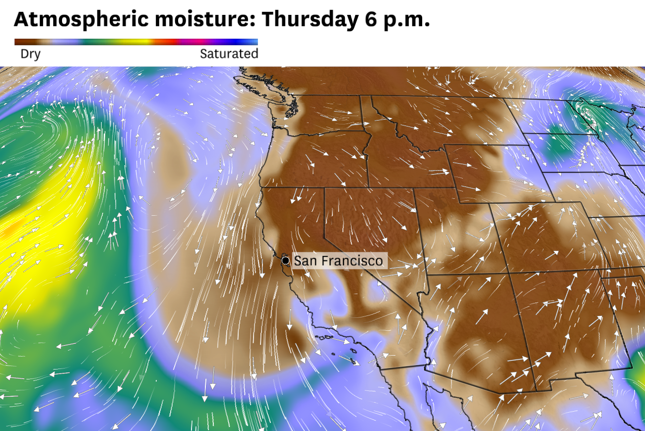
Dry northerly winds will usher in clear, warm weather to the Bay Area with low relative humidity Thursday and Friday.
Baron/Lynx
Windy weather Thursday will kick off a warming trend that will eventually push temperatures back into the 70s across the Bay Area — even in San Francisco — as soon as Friday.
A rainmaker that slammed the Pacific Northwest on Tuesday clipped far Northern California on Wednesday, but didn’t get close to bringing the Bay Area anything more than increased cloud cover. As the system moves into Nevada on Thursday, it’ll leave the Bay Area on the dry, windy side.
Northerly winds will bring gusts up to 45 mph to the region’s highest peaks Thursday and Friday morning, with occasional gusts as strong as 35 mph in the valleys. These are a version of Diablo winds that tend to cause temperatures to climb in the Bay Area. Air flowing down mountain slopes dries and warms as it approaches valley and coastal regions.
Article continues below this ad
High temperatures Friday are forecast to be in the low to mid-70s across the Bay Area, except at the Pacific Coast where temperatures will remain in the 60s.
Baron/Lynx
Offshore winds last month whipped up high levels of pollen, and a repeat is possible this week, though concentrations should remain more moderate than in March.
Highs on Thursday will be in the mid-60s to low 70s, even in San Francisco and Oakland. Temperatures are forecast to reach the mid-70s Friday and Saturday in Santa Rosa, Walnut Creek, San Jose and other inland cities in the North Bay, East Bay and South Bay. Overnight lows will be in the 40s in most places.
Wind gusts of 15 to 25 mph are expected in most of the Bay Area on Thursday afternoon but speeds in Solano County and Livermore Valley could exceed 30 mph.
Baron/Lynx
Thursday and Friday will probably be the Bay Area’s clearest days in two weeks, with hardly any clouds in the sky. By Friday, precipitable water — a measure of how much moisture is in the air — is predicted to be near record low, a sign that the atmosphere is extraordinarily dry. Relative humidity will be highest around 30,000 feet, where aircraft tend to travel, a recipe for long-lived contrails. Stargazing will be aided by the dry air and new moon phase.
Article continues below this ad
Relative humidity on Thursday is forecast to fall as low as 30% in San Francisco and as low as 10% in the inland valleys.
Baron/Lynx
Clouds may increase Saturday ahead of a rainmaker that will probably arrive late Sunday or Monday. It’s still unclear exactly when precipitation will begin, and how much will fall, but wet weather looks increasingly likely Sunday afternoon through at least Tuesday.
Thursday breakdown
San Francisco: Clear skies will result in a warmer day, albeit a windy one. Northerly gusts of 10 to 20 mph are expected all day, strongest at the Embarcadero and elsewhere along the bay shoreline. Highs will be in the mid- to upper 60s, a few degrees above mid-April norms. Overnight lows will be in the low 50s, with continued northerly breezes.
San Francisco Chronicle Logo
Make us a Preferred Source to get more of our news when you search.
Add Preferred Source
North Bay: Skies will be crystal clear with great visibility as dry north winds sweep across the region. Gusts will be in the 15 to 20 mph range in most places, but could be as high as 40 mph in Vacaville and Dixon. High temperatures will reach the upper 60s to low 70s. Overnight lows will be in the upper 30s to low 40s in wind-sheltered valleys of Wine Country and the mid-40s to low 50s elsewhere.
Article continues below this ad
East Bay: Crystal clear skies are expected, which will promote a warming trend. Highs will reach the upper 60s to low 70s, even in Oakland and Berkeley. It’ll be windy, with northerly gusts of 15 to 25 mph, except in the Livermore Valley where speeds could exceed 30 mph. Overnight lows will be in the upper 30s to low 40s in valleys where the wind dies down and the mid- to upper 40s elsewhere.
Pacific Coast and Peninsula: A few clouds may linger at sunrise but they’ll quickly clear for a sunny day with fantastic visibility. Highs will be in the mid-60s in Daly City, Pacifica and Half Moon Bay and the upper 60s in South San Francisco, San Bruno, San Mateo and Redwood City. Northerly gusts of 10 to 20 mph are expected all day, switching to the northwesterly direction on the coast in the afternoon. Starry skies at night will allow heat to escape to space, with temperatures dropping to the low to mid-40s.
South Bay and Santa Cruz: Dry northerly winds will rapidly scour out early morning clouds for abundant sunshine the rest of the day. High temperatures will be fairly uniform, ranging from the upper 60s to low 70s everywhere, even in Santa Cruz. It’ll be breezy all day, with gusts of 15 to 25 mph. It’ll remain windy overnight, with overnight lows in the 40s.