
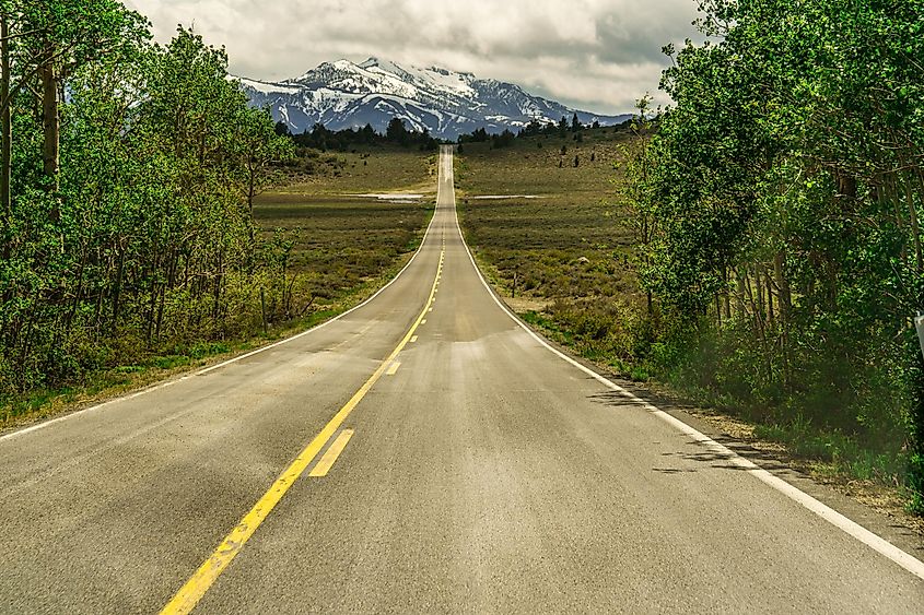
California’s Sierra Nevada covers roughly 27 million acres of mountain ranges, alpine lakes, high desert basins, and granite plateaus. Most of it is accessible only by foot, but a handful of highway routes give drivers reasonable access to some of the range’s best scenery. The June Lake Loop covers four high-alpine lakes in a 16-mile drive. Tioga Pass Road crosses Yosemite at nearly 10,000 feet. The Eastern Sierra Scenic Corridor runs along Highway 395 with views of Mount Whitney and Mono Lake. The eight drives below offer the best of the Sierra Nevada by car, with most closed half the year due to snow.
Tioga Pass Road
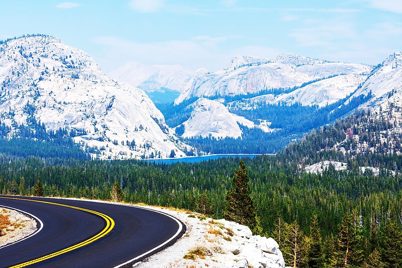
 Yosemite National Park along the Tioga Pass road, California.
Starting near the Big Oak Flat Entrance of Yosemite National Park, CA-120 crosses the park on its way to Tioga Pass at 9,945 feet, the highest automobile pass in California. Olmsted Point offers views of Half Dome and Tenaya Canyon. Tenaya Lake has easy pull-out access to its shore for swimming or picnicking. Tuolumne Meadows, a wide alpine meadow at 8,600 feet elevation, has a visitor centre and access to numerous hiking trails. The road drops out at Lee Vining on Highway 395. Plan 4 to 6 hours with stops. The road typically closes from November through May or June depending on snowfall.
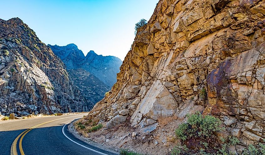
Sonora Pass
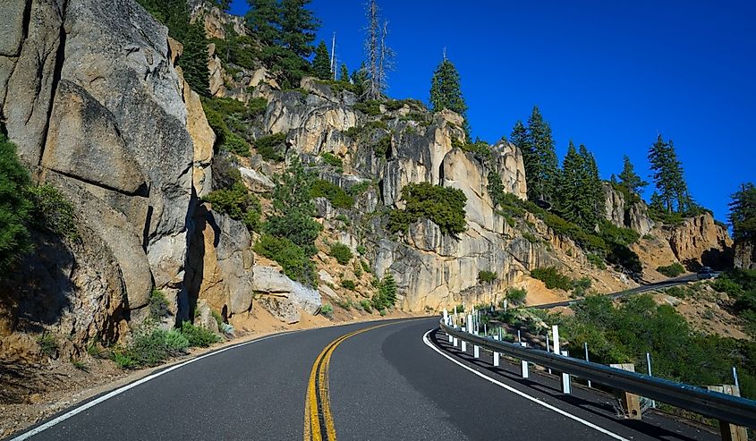 Curving Sonora Pass road with rocky edge.
California Highway 108 over Sonora Pass is steeper, narrower, and far less crowded than Tioga Pass, and it’s explicitly not recommended for large vehicles or RVs. The summit sits at 9,624 feet, making it one of the highest trans-Sierra roads open to the public. Hairpin turns and cliffside sections give the route its reputation among driving enthusiasts. Leavitt Falls Vista Point is the most-used stop for a breather, with picnic tables overlooking the falls. The road runs east to west through Stanislaus National Forest toward Bridgeport and typically closes from December through May.
June Lake Loop
 Gull Lake in the June Lake Loop, California.
For a shorter, less demanding Sierra Nevada drive, the June Lake Loop covers 16 miles past four high-alpine lakes (June, Gull, Silver, and Grant) in about an hour of driving time. The loop is one of the best fall colour drives in California, when quaking aspens turn bright yellow against the granite peaks. The town of June Lake, about 20 minutes north of Mammoth on Highway 395, offers camping, fishing, boat rentals, and a small cluster of restaurants. Pino Pies on Boulder Drive is a favourite for fueling up. Parts of the northern loop close in winter, though June Lake and June Mountain Ski Area stay open year-round.
Monitor Pass
 The road through Monitor Pass offers grand views of the scenic landscape.
Southeast of Lake Tahoe, Monitor Pass sits on California Highway 89 along a stretch known as the Robert M. Jackson Memorial Highway, connecting the West Walker and Carson River basins. The summit reaches 8,314 feet, and the surrounding terrain produces some of the best wildflower viewing in the Sierra Nevada from late spring through early summer. Traffic is consistently lighter than on the major Tahoe routes, making it a good alternative for anyone wanting a quieter experience. Monitor Pass typically closes between December and May due to snow.
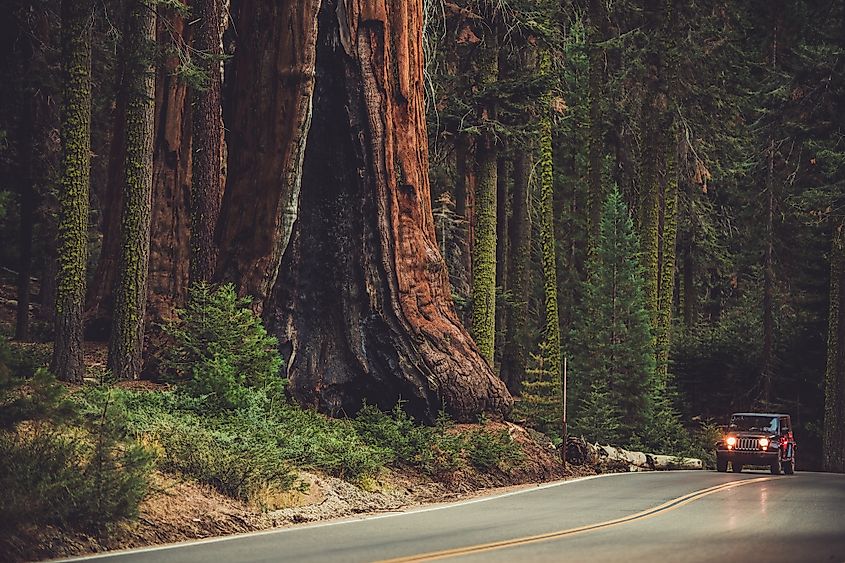
Kings Canyon Scenic Byway
 Kings Canyon Scenic Byway near Horseshoe Bend, California.
The Kings Canyon Scenic Byway starts in the foothills near Fresno and runs 50 miles along Highway 180 into Kings Canyon National Park. The route enters the park at Grant Grove, home to the General Grant Tree (the second-largest tree on Earth by volume, after Sequoia National Park’s General Sherman). The road then drops through Sequoia National Forest before reaching the Cedar Grove area and ending at Roads End, the literal terminus of Highway 180. From there, trails lead deep into the Sierra backcountry past immense glacier-carved canyon walls. The road typically closes December through May.
Generals Highway
 A car passing through Generals Highway in Sequoia National Park.
Easily paired with the Kings Canyon Scenic Byway, the Generals Highway is named for the General Sherman and General Grant trees, the two largest trees on Earth. The route connects Sequoia National Park and Kings Canyon National Park, running past the General Sherman Tree and into the heart of both parks’ giant sequoia groves.
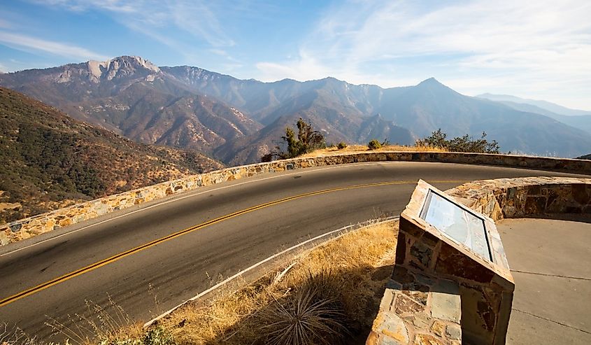 Amphitheater Point looking toward Castle Rock Peak in Sequoia National Park.
The road is notoriously steep with many switchbacks, and speed limits drop as low as 10 miles per hour on the tightest bends. Several Forest Service campgrounds provide pull-over access along the route, and Montecito Lake Resort and Stony Creek Lodge offer lodging on the highway itself. Summer is the reliable season, as parts of the route close over winter.
Eastern Sierra Scenic Corridor
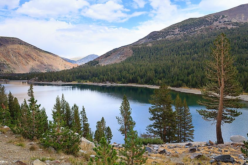
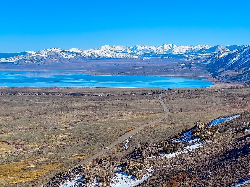 View of Mono Lake in Lee Vining, California.
The Eastern Sierra Scenic Corridor along Highway 395 runs the entire eastern flank of the Sierra Nevada, hugging jagged granite peaks the whole way. Mount Whitney, at 14,505 feet the highest peak in the contiguous United States, looms over the route near Lone Pine. Further north, Mono Lake is an ancient saline lake known for its otherworldly tufa towers, calcium carbonate formations exposed as the lake’s water level dropped over the past century. The corridor is accessible year-round, and the route can be shortened or extended by choice. Bishop and Mammoth Lakes are the main overnight stops.
Lake Tahoe West Shore Drive
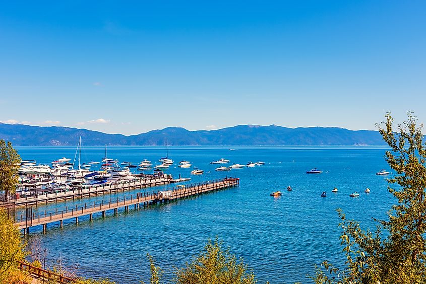 Marina in Tahoe City, California.
For a shorter, more populated drive, Lake Tahoe’s West Shore runs along Highway 89 from Tahoe City south to Emerald Bay. This is the classic Tahoe scenic drive, with turnouts for Meeks Bay, Emerald Bay, Vikingsholm Castle, and dozens of lake overlooks. In winter, the same route serves as the access corridor to ski resorts including Homewood Mountain Resort, with lake views on the approach. Rubicon Point Light, a small lighthouse on the west shore, offers panoramic lake views from a short hike. Camp Richardson Resort at the southern end rents kayaks in summer and snow machines in winter.
Sierra Nevada by Car, Season by Season
Most Sierra Nevada scenic drives are seasonal: Tioga Pass, Sonora Pass, Monitor Pass, Kings Canyon Scenic Byway, and Generals Highway all close for five to seven months a year due to snow. Highway 395 (the Eastern Sierra Scenic Corridor) and Lake Tahoe’s West Shore stay open year-round. Plan around snow closures, check road conditions before leaving, and expect limited cell service at higher elevations. Olmsted Point, Emerald Bay, and the Mono Lake South Tufa turnout on Highway 395 are the most reliably rewarding photo stops for anyone trying to cover as much as possible in a single trip.