

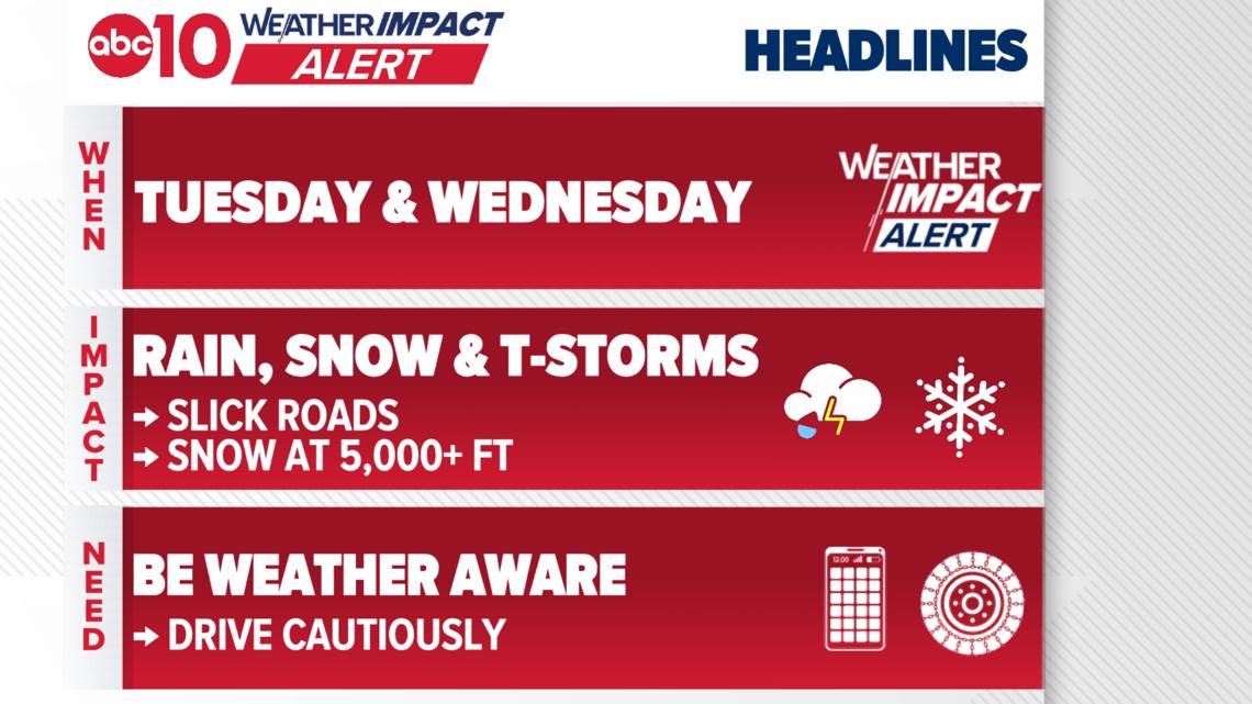
The bulk of the impacts will be felt on Tuesday, where the best environment for strong storms exists and snow levels drop to around 5,000 ft.
SACRAMENTO, Calif. — A Weather Impact Alert takes effect on Tuesday as another storm system will move into the region bringing threats of strong thunderstorms, heavy rain and heavy snow in the Sierra.
The storms will be driven by a strong area of low pressure set up over the Pacific that is cut off from the jet stream, meaning it will be a slow-moving system that will bring rounds of rain, storms and snow.
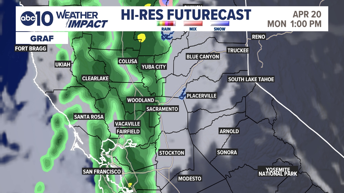
On Monday, western portions of the valley and the delta have the best chances to see some showers and moderate rainfall. The Sacramento metro has a chance for some light showers around lunchtime, but they will be light if they do materialize.
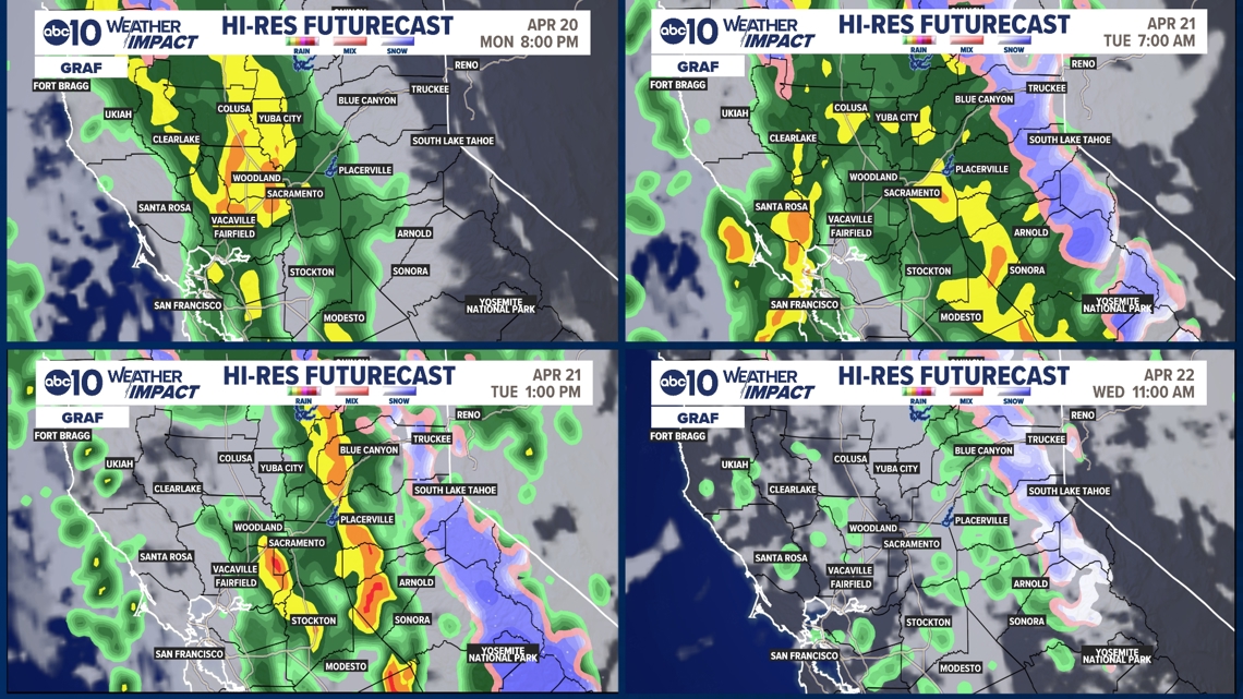
The widespread rainfall activity will begin late on Monday, after sunset, and continue into the Tuesday morning commute.
There will be pockets of moderate to heavy rainfall with this first widespread round of activity, but thunderstorms are not expected. We will also start to see snowfall overnight Monday into Tuesday as low as pass level. Travel impacts are expected on the roads Tuesday morning, be prepared for areas of ponding, slowdowns on the roads and chains in the Sierra.
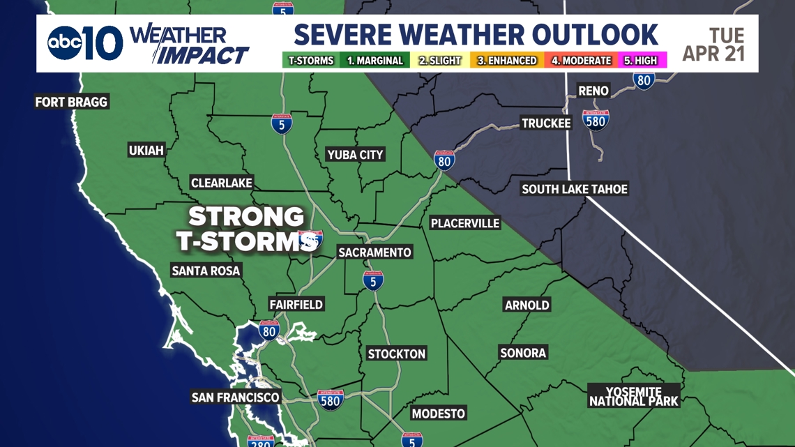
During the day on Tuesday, the ingredients are there for thunderstorms to develop. Multiple threats will be possible, with heavy downpours within the thunderstorms, lightning, hail, gusty winds and even funnel clouds. The timeframe where ingredients will line up the best is between 12-7 p.m. on Tuesday.
Snowfall during the day on Tuesday will drop to around 5,000 ft. in elevation, with delays expected along both Highway 50 and Interstate 80. A Winter Storm Watch is in effect late Monday through Wednesday afternoon and will likely be upgraded to a Winter Storm Warning by Monday evening.
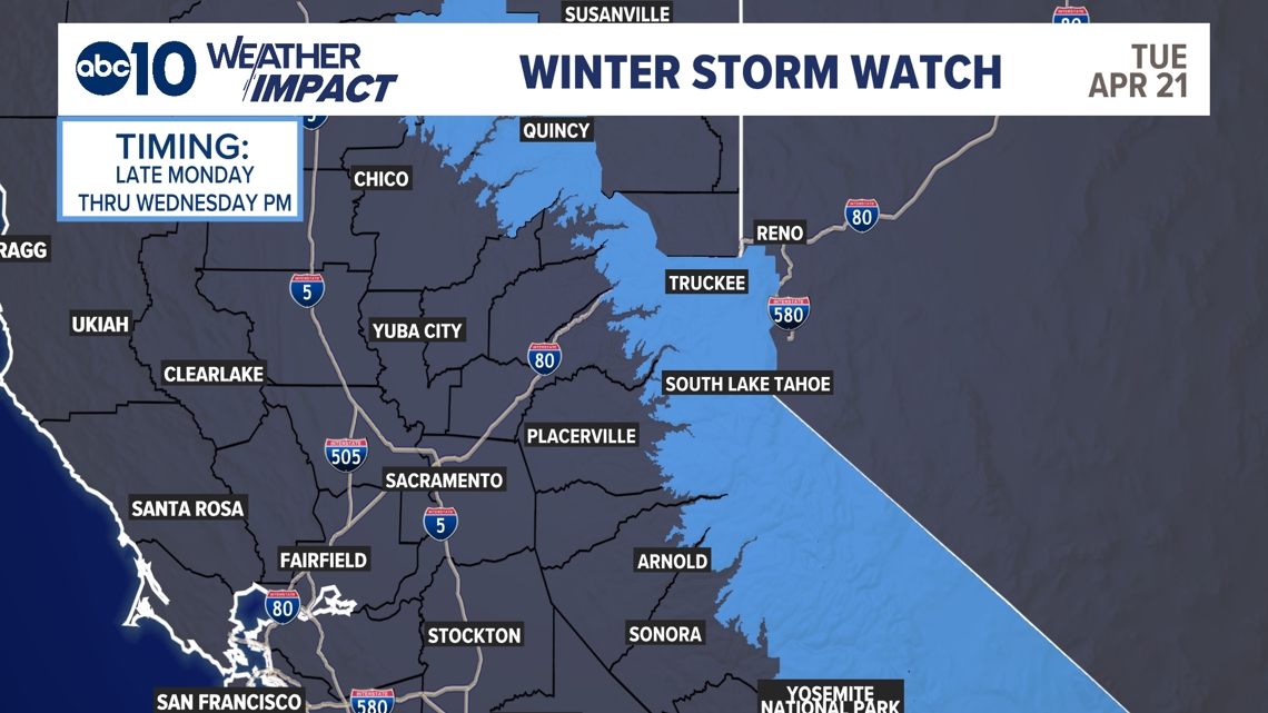
On Wednesday, coverage will slowly become scattered then isolated for rainfall in the valley and the foothills. Thunderstorm chances decrease as well. There will still be travel impacts for the morning commute, but by the afternoon most activity should be cleared up. In the Sierra, we will see snowfall through the early afternoon before the snow showers begin to climb in elevation and eventually dissipate as this area of low pressure clears from the area.
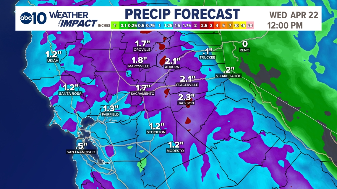
When it comes to rainfall totals, we could see .5-1.5″+ in the valley, with the highest totals where thunderstorm activity occurs. In the foothills, expect rainfall totals around 1-2″+, once again with the highest totals where thunderstorms occur.
Snowfall totals in the Sierra will be around 8-12″+ at pass level and above, with totals around 4-8″ at 6,000 ft. We will also see a decrease in temperatures, with highs Tuesday around 60º in the valley and near 40º in Tahoe. On Wednesday, highs will be into the mid 60s in the valley and low 40s in Tahoe.
Weather Impact Alert: Storm system brings valley rain and Sierra snow midweek
ABC10: Watch, Download, Read












1
/
12