
A slow-moving low-pressure system will bring unsettled weather to the Bay Area this weekend.
Baron/Lynx Cloudy skies, cool temperatures and pockets of drizzle are expected across the Bay Area Friday, with highs in the 50s near the water and mid-60s inland.Light rain and persistent cloud cover will continue Saturday and Sunday, with temperatures dropping to the low 60s and upper 50s in most areas.Rainfall totals will remain light, with San Francisco and Oakland likely to receive up to a quarter inch through the weekend.
Thursday’s sunshine is yesterday’s news. A low-pressure system approaching the California coast will turn the Bay Area cool and gray on Friday, with drizzle and light rain spreading across the region Saturday and Sunday.
It won’t be a washout and rainfall totals should remain light. But in addition to the drizzle and light rain, persistent winds from the Pacific Ocean will keep things abnormally cool and cloudy. All in all, it may end up being a rather dreary weekend.
Article continues below this ad
Greying skies and drizzle for Friday
The forecast for Friday has changed to become increasingly cloudy, cool and slightly wet. Winds from the Pacific will keep much of the Bay Area socked in cloud cover on Friday morning.
Pockets of drizzle will develop in the predawn hours in San Francisco and down the spine of the Peninsula, especially west of I-280. Depending on how strong the onshore flow becomes, some of the drizzle and light rain may spread down through the Santa Clara Valley and across the bay towards Oakland.
Pockets of drizzle and light rain on Friday morning will signal the pattern shift.
Baron/Lynx
By Friday afternoon, the drizzle and light rain should become more sparse, but the clouds are likely to hang around in San Francisco and the Pacific coast side of the Peninsula. Partly sunny skies should develop everywhere else, especially in the inland valleys of the East Bay.
Article continues below this ad
San Francisco Chronicle Logo
Make us a Preferred Source to get more of our news when you search.
Add Preferred Source
It will be a cool day across the board, with temperatures in the 50s close to the water, in the mid-60s in San Francisco and Oakland and slightly warmer — in the upper 60s — in the North Bay and South Bay.
A dreary Saturday and Sunday
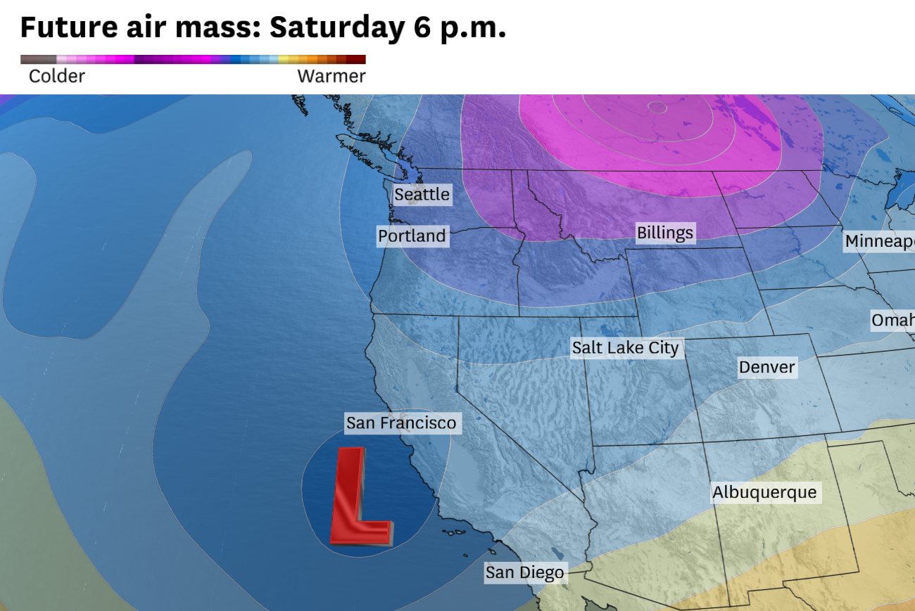
The increased onshore flow and cooler, cloudier conditions on Friday are a prelude to what comes next. A cut-off low pressure system, so-called because it escapes the jet stream’s west-to-east flow, will inch its way toward California on Saturday, eventually crossing into the state somewhere along the Central Coast in the afternoon or evening.
It will further lock in the cool and cloudy conditions on Saturday, not just for the city and the coastline but across much of the region. Interior highs should fall back into the mid-60s, about five degrees cooler than Friday. Everywhere else, including San Francisco and Oakland, should be stuck in the low-60s with persistent cloud cover lasting throughout the day.
Article continues below this ad
Saturday’s temperatures will run about 5 to 10 degrees below average for late April.
Baron/Lynx
Winds from the southwest will pump help to drag Pacific moisture onshore, increasing the likelihood of drizzle and light rain developing in most locations, especially on Saturday evening and overnight into Sunday morning.
Sunday looks like the dampest day of the weekend. The slow moving low pressure system won’t make much progress inland on Sunday. That will keep San Francisco and much of the Bay Area covered with clouds and cool temperatures in the upper 50s to mid-60s, with an ongoing chance of drizzle and light rain.
Given the sporadic nature of the weekend precipitation, totals will be low and rather randomly distributed. San Francisco and Oakland appear most likely to pick up the bulk of the quarter-inch forecast totals, with some higher amounts in the coastal mountains and along the immediate shoreline.
Article continues below this ad
The bigger picture is that the East Pacific remains fluid and active. A series of cut-off lows will steer California’s weather into next week.
These systems spin like dreidels and are notoriously hard to pin down, which makes the weekend forecast uncertain. The one this weekend is weak. Expect no sweeping cold fronts, just Pacific moisture drifting in Friday through Sunday with random pockets of drizzle and light rain. A stronger cut-off low follows next week, keeping rain chances alive as April closes out.