
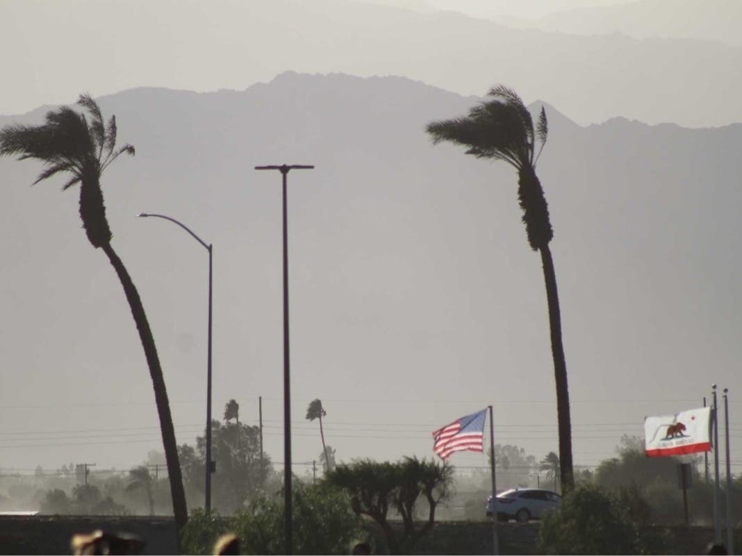
Southern California’s record-setting heat broke Thursday as the Santa Ana winds died down — yet forecasters say it will remain warmer than normal over the next few days.
The Santa Ana wind event brought dry heat as high as 100 degrees in some areas earlier this week thanks to the offshore nature of those winds.
“You’re taking that warm, dry desert air and pushing it to places that otherwise get the cool Pacific air whenever we have onshore flow,” National Weather Service meteorologist Dave Munyan told Patch.
Wednesday brought record-breaking temperatures for October 29 across the region:
Anaheim — 94 degrees (tied with 2008)Chula Vista — 94 degrees (old record: 87 degrees in 1921)Burbank — 94 degrees (tied with 1965)Lake Elsinore — 96 degrees (tied with 1955)Long Beach Airport — 94 degrees (old record: 89 degrees in 1958)Downtown Los Angeles — 97 degrees (old record: 90 degrees in 1958)Escondido — 98 degrees (old record: 96 in 1939) Preliminary new high temperature records set today. Downtown LA had a high of 97 degrees, breaking the old record of 94 set in 1931. NWS Oxnard had a high of 95 degrees, which ties the record previously set in 1931. #CAwx pic.twitter.com/nm3lmPI4ru
— NWS Los Angeles (@NWSLosAngeles) October 29, 2025
Highs across much of Southern California dropped 5 to 10 degrees on Thursday.
“Today, we’re returning to our more typical onshore flow that we see. That largely explains the pretty notable drop in temperatures,” Munyan said.
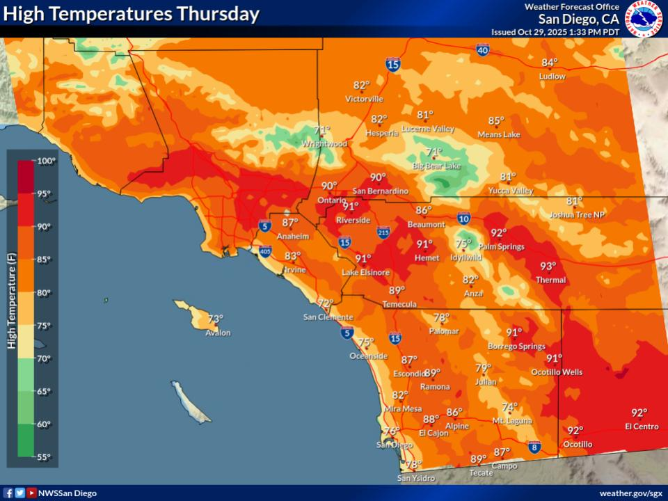 On Thursday, highs are expected to be 72 to 82 on the coast, 82 to 87 in the valleys and inland Orange County, 85 to 91 in inland valleys, 70 to 79 in the mountains, 80 to 83 in the high desert and 88 to 92 in the low desert. (NWS)
The switch to onshore flow — winds coming from the ocean — is expected to bring two days of noticeable cooling. But even with that, temperatures are expected to be above normal for many areas, according to the NWS.
Here’s a look at forecasted high temperatures across Southern California:
CityThursdayFridaySaturdaySundayCabazon88848586Carlsbad75717173Downtown LA89808081Foothill Ranch86808182Fullerton86798082Laguna Hills75707072Lake Elsinore93878989Long Beach82737476Monrovia91938385Northridge93868888Palm Desert93929292San Diego Airport80747477Santa Monica78717173
Temperatures will continue to cool through the end of the weekend in most areas, though will remain above average for the time of year into early next week, according to the National Weather Service.
“For Monday through Wednesday, high pressure aloft is expected to weaken and onshore lower level flow will gradually strengthen. Cooler high temperatures will spread inland for Monday through Wednesday. The cooling is expected to be slower and more gradual for Monday and Tuesday with greater spread in the amount of additional cooling for Wednesday,” the NWS said.