
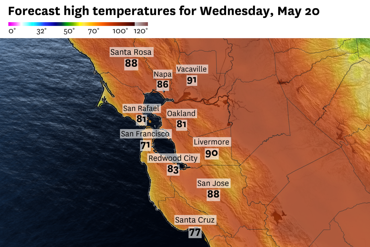
The Bay Area’s brief warm spell will start looking more like a typical May pattern Wednesday: cool near the ocean, mild around the bay and still warm inland.
Highs are expected to reach the 80s across many inland valleys, with a few hotter spots near 90. But closer to the coast and bay, marine air will be more noticeable. San Francisco, the Peninsula coast and bayside communities should mostly stay in the 60s and 70s as afternoon onshore winds return.
The humidity recovery will also be uneven. Coastal and bayside areas should moisten first, while parts of the inland East Bay, South Bay and far North Bay remain dry through the afternoon. That could keep fire-weather concerns elevated in the hills and interior valleys, especially where dry grasses overlap with breezy afternoon winds. A broader cooldown and more widespread humidity recovery should arrive late this week as the marine layer rebuilds.
San Francisco: San Francisco’s brief warm stretch will fade Wednesday, though not evenly. Eastern neighborhoods, including the Mission, SoMa and downtown, should still climb into the upper 60s and low 70s during the afternoon. But west of Twin Peaks, the marine influence will be much more noticeable, with the Sunset, Richmond and Ocean Beach mostly in the upper 50s to low 60s. Morning clouds may be patchy, especially closer to the ocean, before partial clearing. West to southwest winds will increase during the afternoon, making the city feel cooler by evening. Clouds may increase again overnight, with lows mainly in the low to mid-50s.
North Bay: The North Bay will stay warm and sunny Wednesday. Santa Rosa, Petaluma, Napa and Novato should climb into the mid-80s during the afternoon, while Fairfield and Vacaville should approach 90 degrees. San Rafael and Vallejo should be a bit cooler, generally in the upper 70s to mid-80s, with a light bay breeze arriving later in the day. Conditions will stay mostly clear overnight with lows mostly in the 50s, with patchy clouds possible near the bay and along the coast.
East Bay: The East Bay will have a more traditional temperature split Wednesday between the shoreline and the inland valleys. Oakland, Berkeley, Alameda and Richmond should stay relatively mild, with highs mostly in the low to mid-70s and a west to southwest breeze increasing during the afternoon. Fremont and nearby southern East Bay communities should run warmer, generally in the upper 70s to low 80s. Farther inland, Concord, San Ramon and Livermore should climb into the upper 80s to around 90. Winds will be light in the morning, then turn onshore through the afternoon, with gusts generally around 15 to 20 mph in the inland valleys. Overnight lows will fall into the upper 50s to low 60s near the bay and mostly low to mid-60s inland.
Pacific Coast and Peninsula: The immediate coast will stay cool Wednesday as the marine layer returns. Half Moon Bay and Pacifica should mostly stay in the upper 50s to mid-60s, with patchy morning clouds, partial afternoon clearing and west to southwest winds increasing through the day. Daly City should be a little warmer but still marine-influenced, with highs in the upper 60s. The bayside Peninsula will be warmer, with SFO and San Mateo reaching the low to mid-70s, while Redwood City climbs into the low 80s. Clouds will return along the coast overnight with lows in the upper 40s to mid-50s.
South Bay and Santa Cruz: The South Bay will stay warm and sunny Wednesday. San Jose should climb into the mid- to upper 80s during the afternoon, while Mountain View and Milpitas reach the low to mid-80s. Morgan Hill will be one of the warmer spots, likely hitting 90 degrees.Santa Cruz will be cooler than the inland South Bay but still mild for the coast. Highs should reach the low to mid-70s near the water, with warmer readings likely in the mountains. Overnight lows will fall mostly into the low to mid-50s around the South Bay and Santa Cruz, with patchy clouds possible near the coast.