
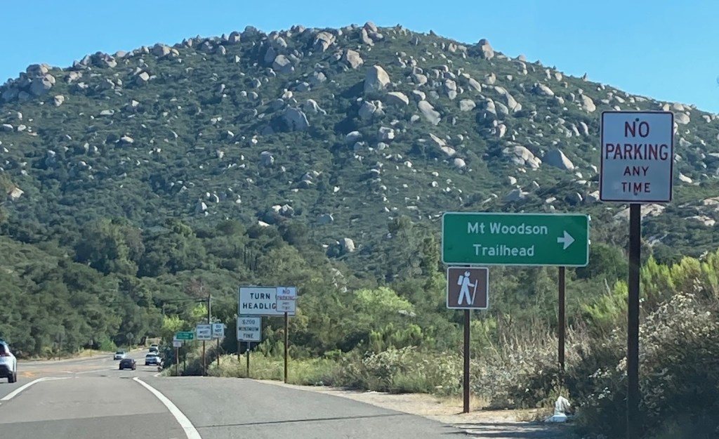
The Ramona Community Planning Group voted unanimously June 11 to ask county and Caltrans officials to address a number of issues at the new parking lot at Mt. Woodson Gateway County Preserve, including a lack of No Parking and directional signs and the fact that a number of visitors are still parking along state Route 67.
Planning Group member Maureen Dant said the current signs are inadequate to show the location of the parking lot for hikers using the Fry-Koegel Trail, which is just south of Archie Moore Road.
“I don’t know where the parking is,” Dant told her fellow Planning Group members. “Signage for the trailhead needs to be large and visible.”
Another concern is that Mt. Woodson visitors are still parking on the west side of the mountain between north and south Mt. Woodson Road off SR-67. The parking lot was intended to provide a safe alternative to parking alongside the highway with fast-moving traffic.
Some of the No Parking signs along the highway have been painted over, said Kristi Mansolf, chairperson of the Planning Group’s Mt. Woodson Gateway County Preserve Ad Hoc Subcommittee.
A related issue is that cars are being parked along narrow stretches of Archie Moore Road so hikers can visit the trail, Mansolf said. This creates a hazard for emergency vehicles accessing the area, she said.
The Planning Group agreed to send letters to county and Caltrans officials.
One letter will recommend a new traffic investigation report be conducted to study whether bigger and better directional signs can be added at the parking lot entrance.
Another will recommend that No Parking signs be extended between the Mt. Woodson Road south and Mt. Woodson Road north areas.
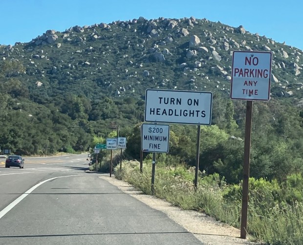
A third request is to relocate a Turn on Headlights sign on SR-67 near where the parking lot is accessed, Mansolf said. There are too many signs in one area and by moving the sign – possibly to an area near North Mt. Woodson Road – it would be less distracting to drivers, she said.
Kristi Mansolf
“No Parking” and “Turn on Headlights” signs alert drivers to parking rules at state Route 67 near Mt. Woodson Gateway County Preserve. (Kristi Mansolf)
Ramona Sheriff’s Lt. Scott Roller, who attended the meeting, said SR-67 is mostly the domain of the California Highway Patrol. Sheriff’s deputies would not ordinarily be enforcing the parking rules unless there was a traffic hazard or collision, he said.
“I don’t know who controls parking on the dirt,” Roller said. “I would not issue a citation for parking on the dirt because there’s no delineation over who controls it.”
Kristi Mansolf
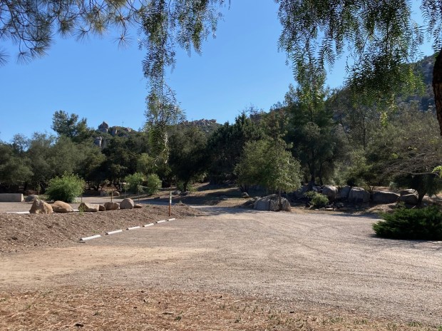
The 200-space parking lots at the Mt. Woodson Gateway County Preserve are often left with empty spaces. (Kristi Mansolf)
Some have asked that the county allow hiking at Mt. Woodson beyond the current hours of sunrise to sunset.
At the meeting, speaker Erin Brown asked for longer hours, such as no parking between the hours of 9 p.m. and 5 a.m., so people can go on hikes during sunrises and sunsets.
Planning Group member Basil Aruin suggested the Planning Group request that the county and Caltrans work together on adjusting the hours of the parking lot.
Members of the group agreed that it’s important for Mt. Woodson visitors to have the extended access. They voted unanimously to ask the county and Caltrans to investigate ways to allow recreation at Mt. Woodson outside of current parking lot hours and to accommodate legal parking.
However, county Parks and Recreation Department staff have expressed concerns about the safety of having sunrise-to-sunset hours. They have mentioned the lack of lighting and poor visibility from the roadway.
Myles Vandegrift, a Ramona resident of 31 years who has been hiking and rock climbing Mt. Woodson for 34 years, said the new parking lot is “beautiful and well-maintained” but it’s not getting used. He said he would like to see hikers use the parking lot for free for one to three months and more No Parking signs along SR-67.
“I want to see people use it and be safe,” said Vandegrift, who did not attend the meeting. “If it will help people be safe, I’m all for it.”
In other items, Planning Group members discussed the proposed roundabout that Caltrans is considering installing at SR-67 and Mussey Grade Road.
Recent collisions at that intersection, including several fatalities, prompted a community call for action.
File photo
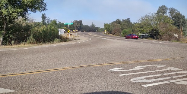
A proposed roundabout at the Mussey Grade Road and state Route 67 intersection is getting mixed reviews from the Ramona Community Planning Group. (File photo)
Several Planning Group members said they have seen roundabouts work well in high-volume traffic areas in other locations outside Ramona. Robin Joy Maxson said she has seen them slow traffic in Oregon towns, Chairperson Lauren Elyse Welty said she saw many of them “work seamlessly” in Denver, Colo., and member Holly Hamilton-Bleakley said she saw them work “efficiently” in the United Kingdom.
Dant, however, said a roundabout may not be an “appropriate application” at the Mussey Grade location.
“That road is a challenge,” Dant said. “It doesn’t make sense to have all that traffic diverted to a roundabout.”
She suggested further studies of routing traffic from Mussey Grade to Dye Road via a Dye Street extension.
Welty said that option could face eminent domain issues in trying to secure property for a Dye Street extension, and once built, it would have to be maintained by the county.
“They (Caltrans) did a certain amount of traffic studies to figure out the best option,” Welty said. “When repaving San Vicente Road was suggested everyone was in an uproar, but now the traffic flows so much more smoothly.”
Maxson said Caltrans engineers expressed a need for safety and a desire to eliminate traffic-related deaths and serious injuries during a recent community presentation.
“At northbound SR-67 there’s a short line-of-sight and traffic is really moving,” Maxson said. “The chances of a T-bone and serious injury are great.”
Maxson said she was in favor of a roundabout because it promises two lanes of traffic in each direction, which would improve evacuation safety.
Aruin agreed, saying a signal light at that intersection would back up traffic on SR-67.
“Anything would be better than what we have now,” he said. “The roundabout has a cool design.”
The concept of a roundabout is expected to be discussed at a future Planning Group’s Trails and Transportation Subcommittee meeting, which would lead to a recommendation to the full Planning Group for consideration.