
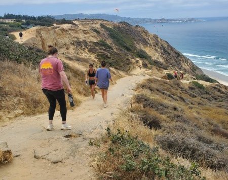
San Diego lifeguards have been responding to frequent calls for rescues on the trails above Black’s Beach in La Jolla for the past five years. And with the busy summer tourist season upon us, lifeguards are issuing additional warnings about hiking in that area.
Historically, the trails around the Torrey Pines Gliderport were used by surfers making their way to Black’s Beach 300 feet below. But in recent years, the area has gained popularity among hikers who use the trails for recreation. In the process, a network of “social trails,” or “false trails,” has been created.
Benny Cartwright, a spokesman for the San Diego Parks & Recreation Department, said the paths have formed from repeated use over the years and warned that they “can sometimes look like legitimate trails, but they are not maintained and may lead to steep, unstable or unsafe areas. The coastal bluffs are constantly changing due to erosion and weather, so conditions can be very different from one visit to the next.”
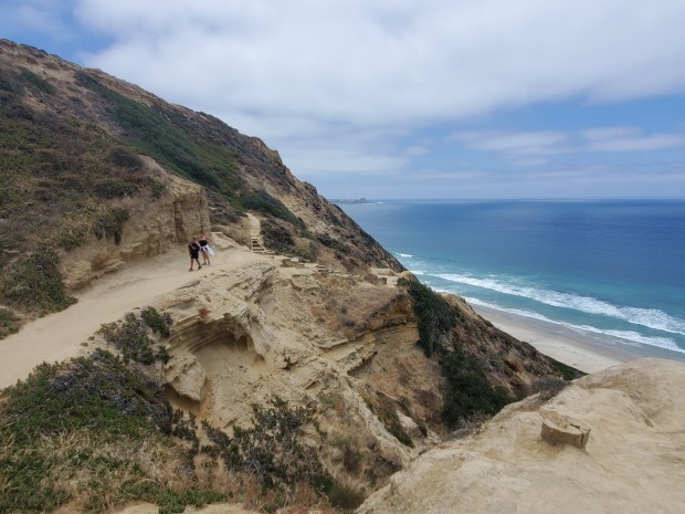 A network of trails connects the Torrey Pines Gliderport to Black’s Beach in La Jolla, 300 feet below. (Ashley Mackin-Solomon)
Hikers can get stuck or injured on the false trails and need to be extricated by lifeguards. In 2025, there were 47 cliff rescues, with the majority above Black’s Beach. Lifeguards told the La Jolla Light that in some recent years there were more than 50 cliff rescues.
“Many of the rescues in the area involve people who leave the main trail and end up on terrain that is much more difficult to navigate than they expected,” Cartwright said.
The most commonly used trail, known as the Citizens Trail, is located roughly at 2800 Torrey Pines Scenic Drive next to the gliderport.
“It is a steep, rugged and unmaintained trail that descends the sandstone cliffs to Black’s Beach and requires proper footwear and caution,” Cartwright said. A caution and regulations sign is posted at the top of the trail, but it often is covered with stickers.
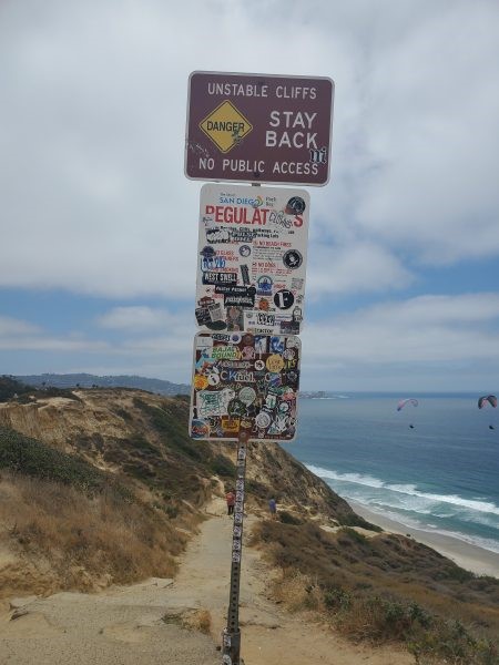 A sign posted near the entrance of the Citizens Trail above Black’s Beach is often covered in stickers. (Ashley Mackin-Solomon)
Lifeguard Lt. John Maher said he recommends that instead of using unmaintained trails, people use the trail at Black Gold Road, just south of the Citizens Trail.
“[That] is the best way down there because it is paved and maintained by UC San Diego,” Maher said. “It brings people to the south side of Black’s Beach.”
Otherwise, he said, hikers may find themselves in unsafe conditions.
“These trails can change day by day based on moisture in the atmosphere that creates a sticky or slippery surface,” Maher said. “Some parts of some trails are angled and really narrow, with no fall protection. They can have sandstone and can crumble beneath your feet and it can be hard to see what’s ahead on a few of them. Some of those false trails just end in the middle of a cliff or there will be a drop that hikers can’t get back up when they get down.
“The false trails are inherently dangerous … and we do not recommend people go near them.”
Still, Maher said, the network of false trails has grown in recent years.
“In my experience … especially the last five years, people stopped taking trails just to get to the beach. We’re seeing people go to Black’s specifically to hike, so we have noticed a spike in hiking activity in the area,” he said. “There are a couple of trails that have become popular hiking trails, but they are really dangerous. … We have always had cliff rescues, but that false trails network didn’t build up until about five years ago.”
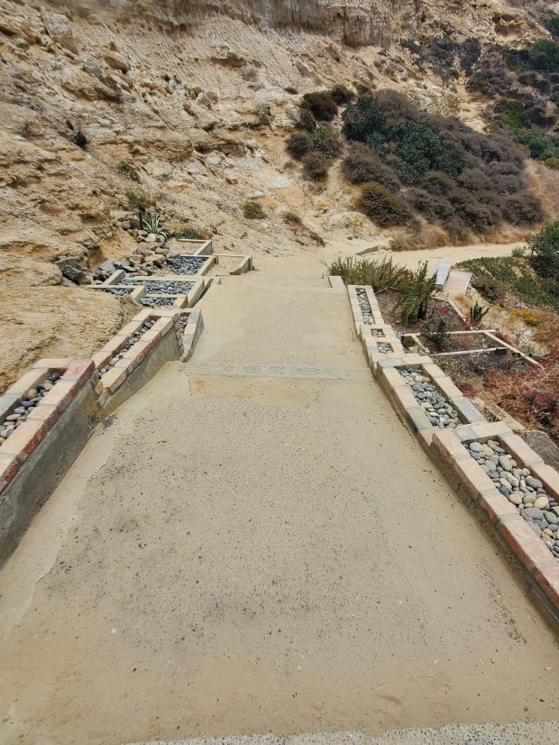 Some sections of the Citizens Trail leading to Black’s Beach are decorative, giving the impression that it is a maintained trail. (Ashley Mackin-Solomon)
“I’ve spoken with people who said they were told it was a great trail, but then they get part of the way down and realize how strenuous it is, or they get lost or they don’t have water and then they need help,” Maher added. “Also, people don’t always consider that it is 300 feet straight down, so those that go down that way have to think about coming back up. … We get a lot of people that end up needing our help and we have to carry them back up.”
He suggested looking for signs to indicate whether an area is safely accessible. For example, some signs read “unstable cliff” or “stay back,” and others contain city of San Diego regulations. But Maher acknowledged that the signs can get damaged or covered with stickers or graffiti.
He said people who are unfamiliar with the area should consider hiking elsewhere.
Cartwright agreed, saying “The views are incredible, but it’s always best to use a known and maintained route to enjoy them safely. Our message is pretty simple: Stick to established trails, watch your footing, stay well back from cliff edges and don’t be afraid to turn around if something doesn’t feel safe.” ♦