
Early Season Storm Dumps On California
California is experiencing its first widespread soaking of the season, which will also include the heaviest Sierra snowfall so far this fall.
Happening Now
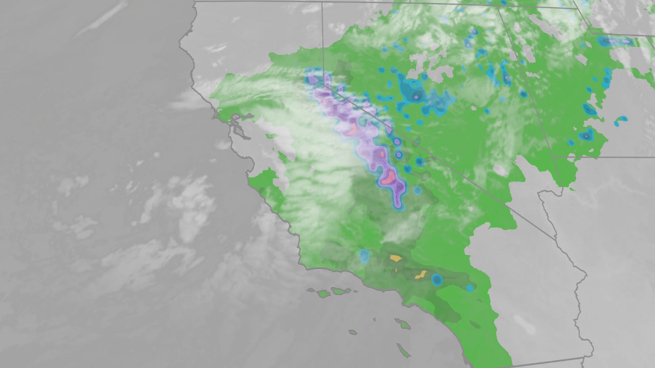
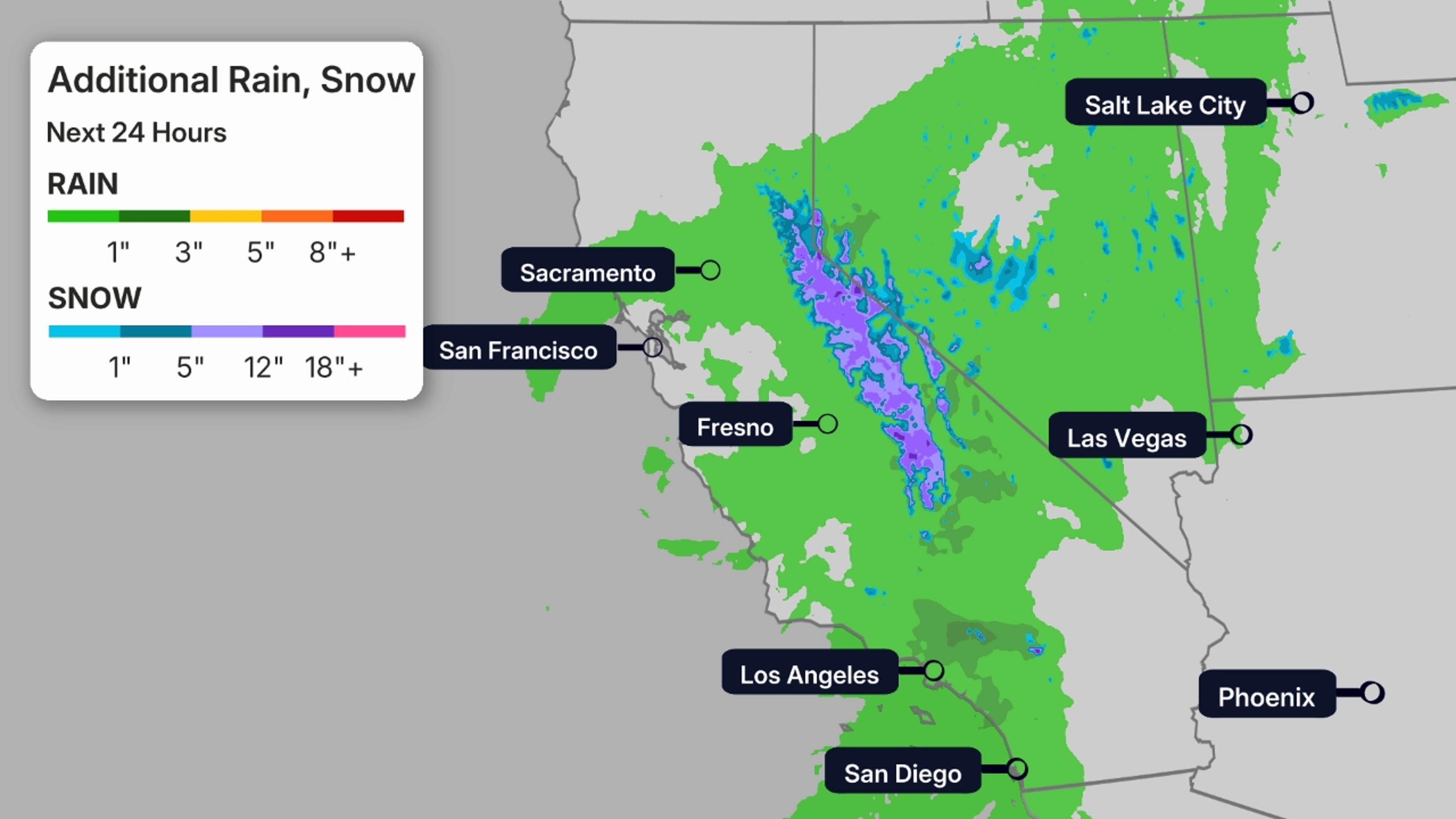
This storm system is currently diving southward along the California coast, with rain from the Central Valley into parts of Southern California, and snow falling in the Sierra.
There’s even a severe thunderstorm watch until 6 a.m. PDT for parts of Southern California, including L.A., Ventura and Santa Barbara Counties. According to the National Weather Service, this is the first severe thunderstorm watch issued for the L.A. Basin in over 17 years, since Jan. 27, 2008.
![]()
Weather in your inbox
By signing up you agree to the Terms & Privacy Policy. Unsubscribe at any time.
The heaviest rain has prompted some flash flood warnings early this morning in parts of San Luis Obispo and Santa Barbara Counties.
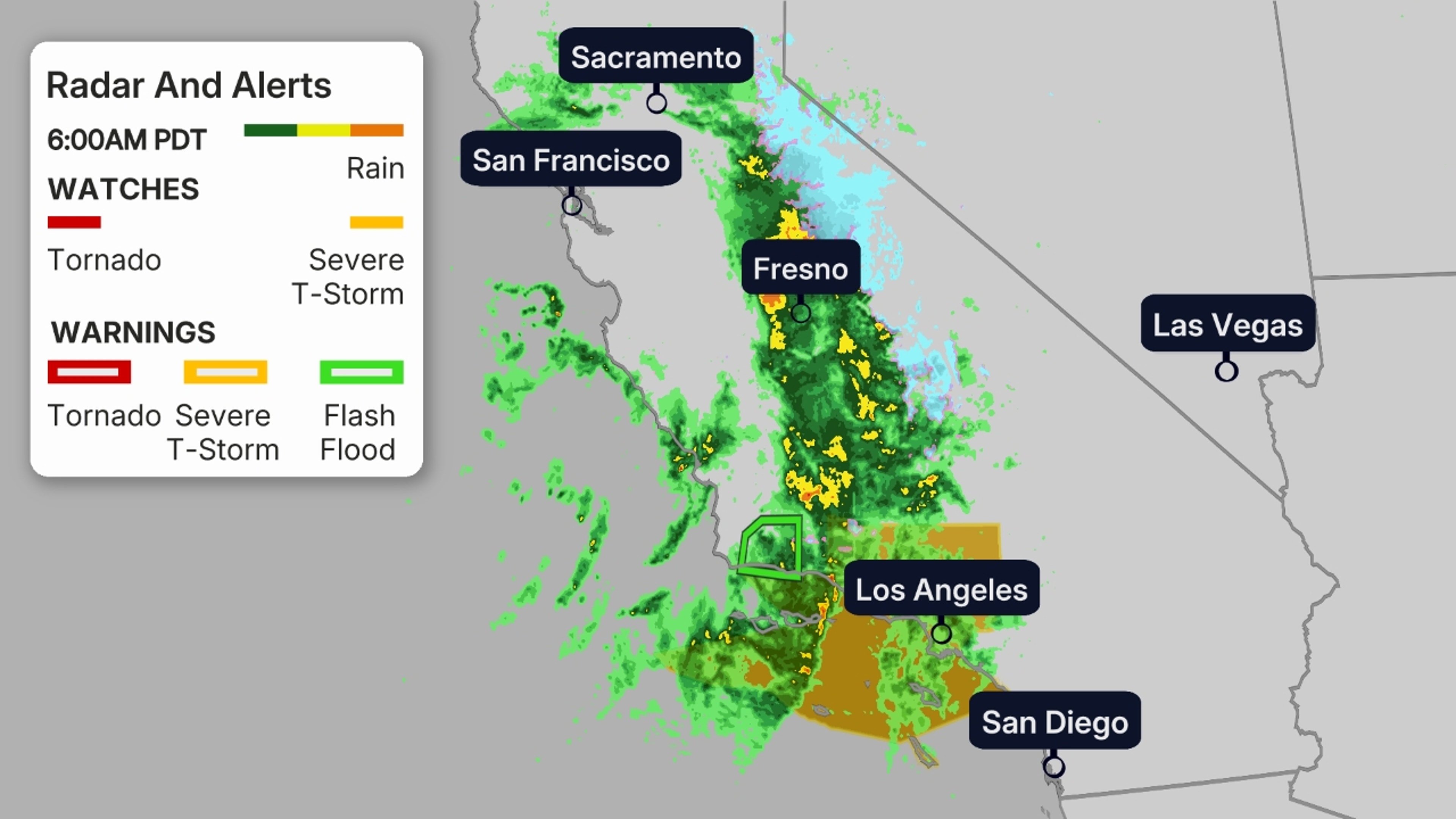
There have been over 50 reports of flooding in the state since Monday, particularly in the Bay Area Monday afternoon and evening. There were a few reports of minor rockslides, but in the East Bay near Fairview, a “large amount of mud” was reported along a stretch of Palomares Road, according to the National Weather Service.
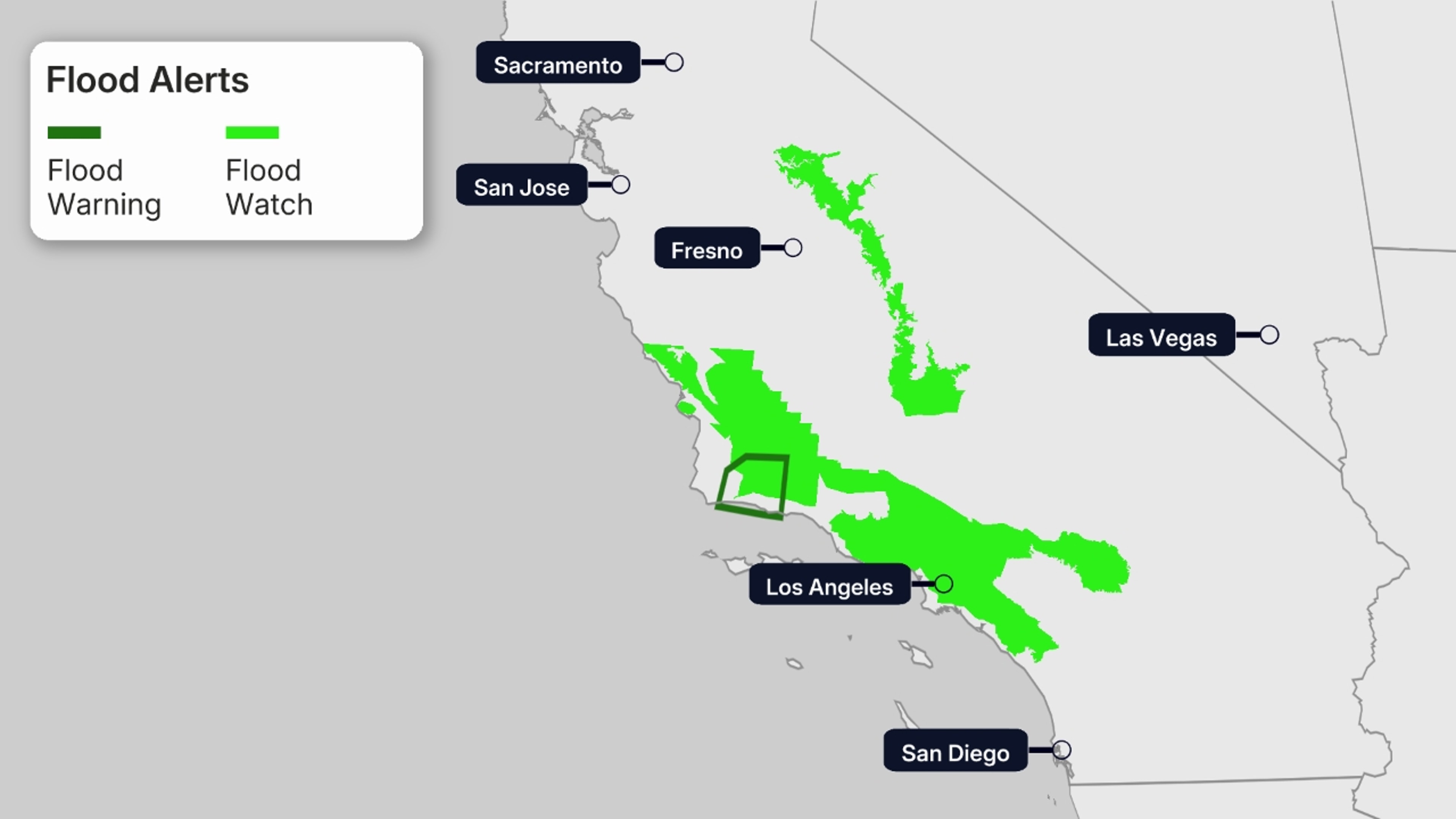
Weather Alerts
Flood watches have been issued by the National Weather Service in parts of Central and Southern California. That includes parts of the L.A. Basin and southern Sierra foothills.
Winter storm warnings are also in effect in the Sierra, generally above 6,000 feet elevation.
 Storm Timing
This system will be a quick-mover.
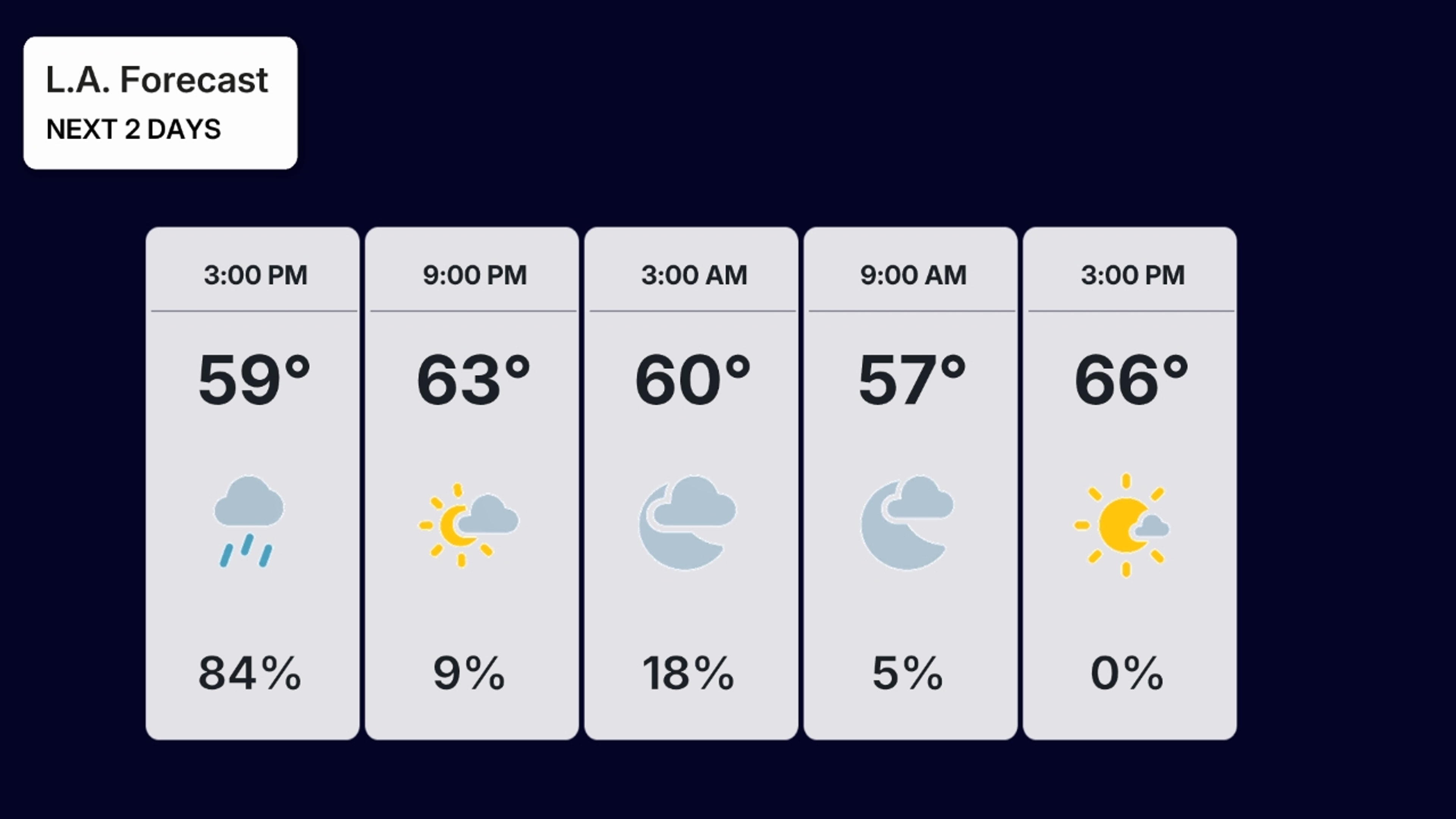
Rain will spread through Southern California Tuesday, then taper to showers by late afternoon. This could lead to challenging Tuesday commutes with wet roads in the L.A. Basin, especially in the morning.
Light rain and Sierra snow will continue through Tuesday night before ending.
 Potential Impacts
Rain
Some locally heavy rain, in excess of 1 inch, is possible in parts of Central and Southern California Tuesday. That’s particularly the case in the foothills of the Sierra below snow level (below 5,000 feet) and in the foothills and high country of Southern California.
In these places, flash flooding could occur, and some minor rockslides and debris flows are possible near areas recently burned by wildfires.
Typical flooding of streets and freeway off-ramps is also possible.
Snow
In the Sierra, snow will generally fall at elevations above 5,500 feet, where 1 to 3 feet of total snow may occur through late Tuesday night or early Wednesday morning. A few inches of snow may also accumulate down to lake level at Lake Tahoe.
This heavy snow plus strong winds over the ridgetops could lead to sudden reduced visibility and difficult travel over Donner Summit, among other Sierra passes. Power outages and tree damage is also possible due to the weight of this early-season wet snow and the force of strong wind gusts.
Consider avoiding travel in the Sierra during the storm.
 Rainy Season Ahead
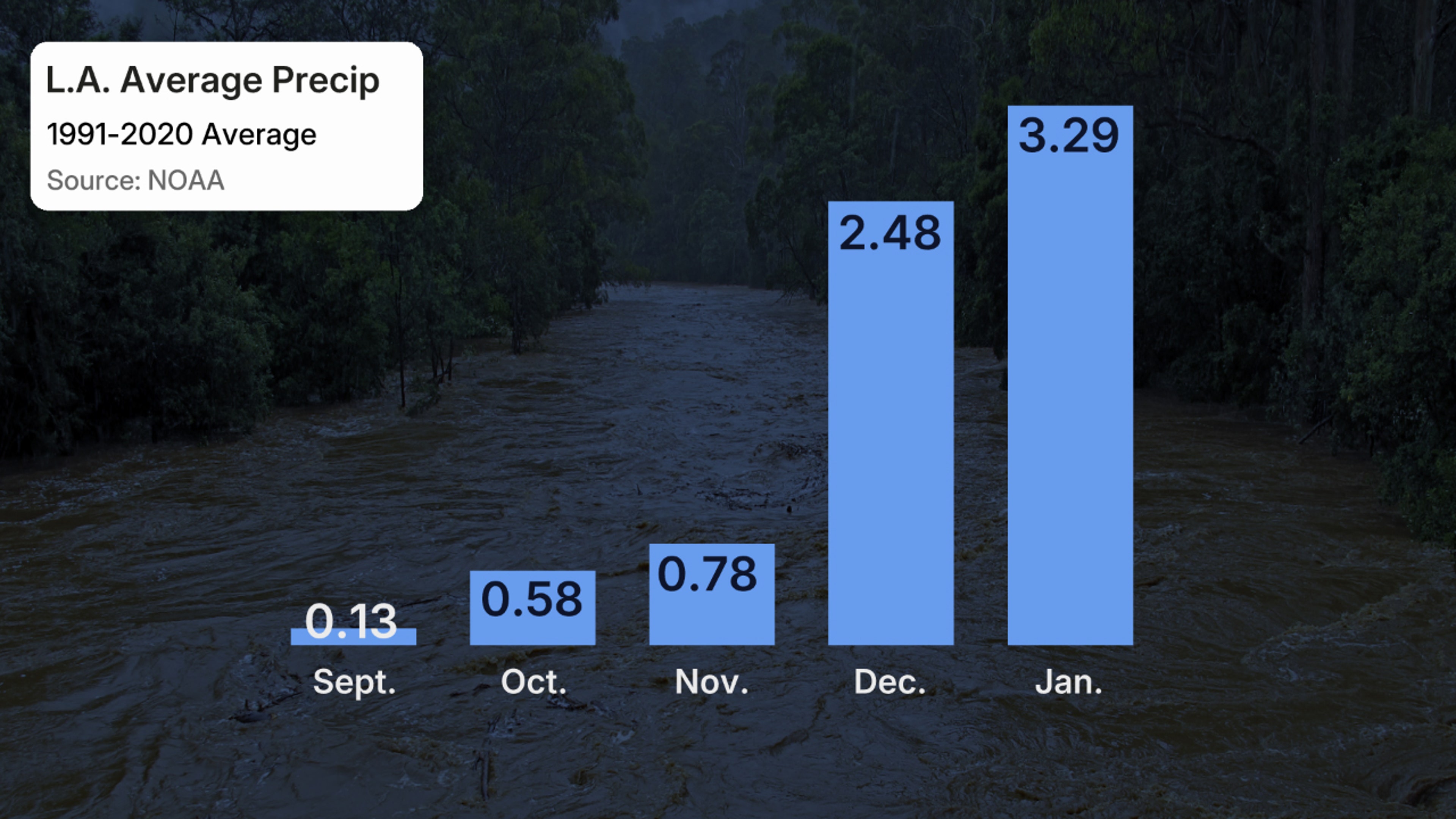
California has distinct wet and dry seasons.
That’s because the jet stream that typically delivers strong Pacific storms to the West Coast and California weakens and shifts well north in summer.
Fall is the transition period in California. Sometimes, strong Santa Ana winds fan large wildfires in October.
But occasionally, Pacific storm systems can sag far enough south to spread rain into at least Northern California, if not as far south as L.A. and San Diego.
About 82% of the average precipitation in Los Angeles falls from December through March. This often happens as strong Pacific storms tap deep plumes of moisture known as atmospheric rivers.
Jonathan Erdman is a senior meteorologist at weather.com and has been covering national and international weather since 1996. Extreme and bizarre weather are his favorite topics. Reach out to him on Bluesky, X (formerly Twitter) and Facebook.