
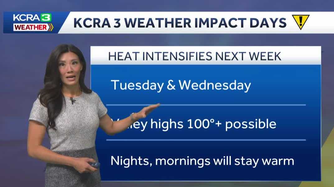
NEVER TURN YOUR BACK ON THE OCEAN. THAT’S IF YOU’RE HEADED OUT TO THE COAST. IF YOU’RE STAYING IN THE VALLEY. HOWEVER, NOTHING OF THAT SORT THIS MORNING IS PRETTY COMFORTABLE WITH TEMPERATURES IN THE UPPER 50S. WE HAVE 60 IN THE FOOTHILLS. THE SIERRA DID GET DOWN TO 30, WHICH THEY’RE CURRENTLY RUNNING AT THIS MORNING. BUT DON’T WORRY, THE HEAT WILL ARRIVE LATER THIS AFTERNOON IN THE VALLEY, 80 DEGREES BY LUNCHTIME, AND THEN TEMPERATURES CONTINUE TO WARM INTO THE 90S. IT DOESN’T STOP THERE. FORECAST HIGHS NEAR 96 DEGREES TODAY. A LITTLE WARMER IN YUBA CITY. TEMPERATURES JUST A COUPLE DEGREES SHY OF THAT TRIPLE DIGIT MARK. WE HAVE LOW 90S IN AUBURN AND PLACERVILLE TRUCKEE AND SOUTH LAKE TAHOE. YOU HAVE TEMPERATURES THAT WILL GO FROM THE 30S NOW TO THE 80S IN JUST A MATTER OF HOURS. SO WE DO HAVE HEAT THAT’S BUILDING IN FROM THE SOUTH. THANKS TO THIS AREA OF HIGH PRESSURE THAT IS CENTERED OVER THE DESERT SOUTHWEST CURRENTLY. BUT WHERE IT MOVES IS GOING TO DICTATE THE TYPE OF WEATHER THAT WE GET. FOR NOW, IT’S JUST THE HEAT AND THE DRY WEATHER FOR THE REST OF THIS WEEK. HOWEVER, AS THIS HIGH MOVES INLAND AND WE SIT ON THE WESTERN PERIPHERY OF ITS CLOCKWISE CIRCULATION, IT’S GOING TO DRIVE MOISTURE UP THROUGH BAJA. AND WE HAVE INCREASING CLOUDS THIS WEEKEND, TURNING INTO A FEW THUNDERSTORMS IN THE SIERRA, WITH THE HIGHEST CHANCES IN THE SOUTHERN SIERRA EARLY NEXT WEEK. NOW THIS HIGH DOES SHIFT BACK WEST. AND NOT ONLY DO WE HAVE THAT MOISTURE LINGERING, WE ALSO HAVE THE INTENSIFYING HEAT. THAT’S WHY WE HAVE KCRA 3 WEATHER IMPACT DAYS. TUESDAY AND WEDNESDAY. IT’S THE POTENTIAL TRIPLE DIGIT TEMPERATURES RETURNING AND ALSO THE HUMIDITY THAT WILL MAKE THAT TRIPLE DIGIT TEMPERATURE FEEL STIFLING. AND THE SIERRA, WE HAVE THUNDERSTORMS STARTING ON MONDAY AND IN THE VALLEY, TEMPERATURES ARE GOING TO RISE AGAIN. IT’S NO
Northern California forecast: Thursday temperatures climb as Delta breeze weakens

Updated: 8:38 AM PDT Jul 9, 2026
Temperatures continue to climb Thursday for Northern California, with Valley highs in the mid 90s under sunny skies and lighter winds. The warming trend comes as the Delta Breeze continues to weaken, allowing a warmer weather pattern to gradually take hold.The warm weather may become uncomfortable into the weekend as a monsoonal high-pressure system builds north from the southwest. As that happens, moisture will begin spreading into Northern California, leading to more clouds, rising humidity, and increasingly muggy afternoons, especially by Sunday.While the Valley turns warmer and more humid, the Sierra will see a growing chance of unsettled weather. As moisture continues to stream into the mountains, the risk of afternoon thunderstorms will increase early next week. There is a chance that thunderstorm chances could linger through the next week.At the same time, temperatures are expected to keep rising. Forecast models show the potential for triple-digit heat returning by next Tuesday and Wednesday, which could make those days KCRA 3 Weather Impact Days for the Valley and foothills.See more coverage of top California stories here | Download our app | Subscribe to our morning newsletter | Find us on YouTube here and subscribe to our channel | Make KCRA a preferred news source in Google
Temperatures continue to climb Thursday for Northern California, with Valley highs in the mid 90s under sunny skies and lighter winds.
The warming trend comes as the Delta Breeze continues to weaken, allowing a warmer weather pattern to gradually take hold.
The warm weather may become uncomfortable into the weekend as a monsoonal high-pressure system builds north from the southwest. As that happens, moisture will begin spreading into Northern California, leading to more clouds, rising humidity, and increasingly muggy afternoons, especially by Sunday.
While the Valley turns warmer and more humid, the Sierra will see a growing chance of unsettled weather. As moisture continues to stream into the mountains, the risk of afternoon thunderstorms will increase early next week. There is a chance that thunderstorm chances could linger through the next week.
At the same time, temperatures are expected to keep rising. Forecast models show the potential for triple-digit heat returning by next Tuesday and Wednesday, which could make those days KCRA 3 Weather Impact Days for the Valley and foothills.
See more coverage of top California stories here | Download our app | Subscribe to our morning newsletter | Find us on YouTube here and subscribe to our channel | Make KCRA a preferred news source in Google