
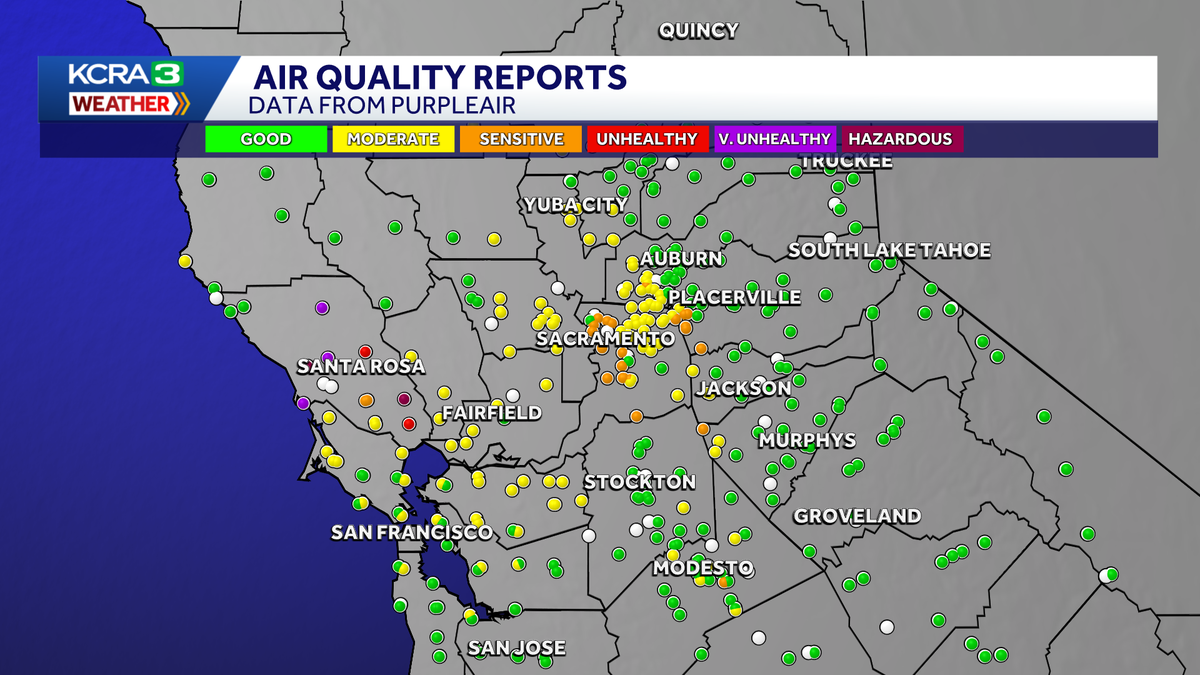
MAP: See air quality impacts across the Sacramento Valley from coastal Woodside Fire smoke
 SACRAMENTO, Calif. —
A fire burning along California’s coast is impacting air quality across parts of Northern California, with some waking up on Friday and smelling or seeing the smoke.
The smoke is being transported into Sacramento, Yuba, Solano and Yolo counties by the southwest onshore flow, as the Woodside Fire continues to burn in Sonoma County.
As of 7 a.m., the fire has burned 143 acres and is 30% contained, Cal Fire said.
Smoke may drift around the Sacramento Valley through the afternoon impacting air quality for some.
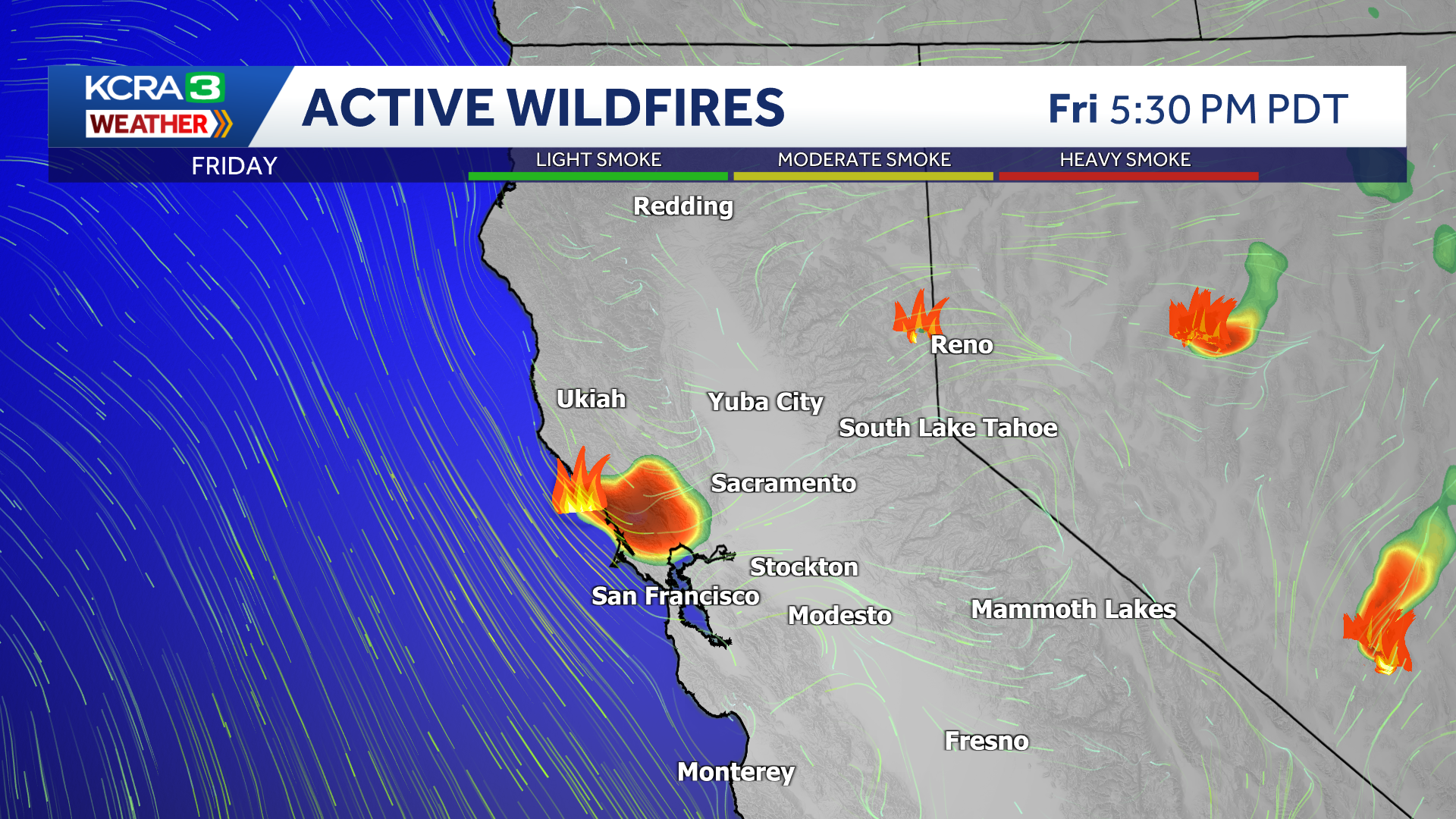
Woodside Fire Smoke Forecast Friday Afternoon
As onshore flow increases after sunset, smoke may thicken up overnight around Sacramento, Vacaville and Woodland.
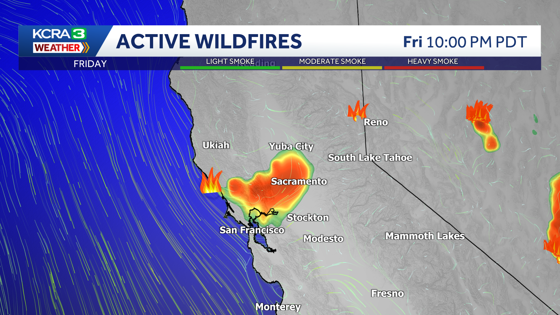
Smoke forecast for 10pm Friday July 31st
For the latest up-to-the-minute updates on air quality where you live, you can visit AirNow. See a map that shows air quality levels below.
This content is imported from infogram. You may be able to find the same content in another format, or you may be able to find more information, at their web site.