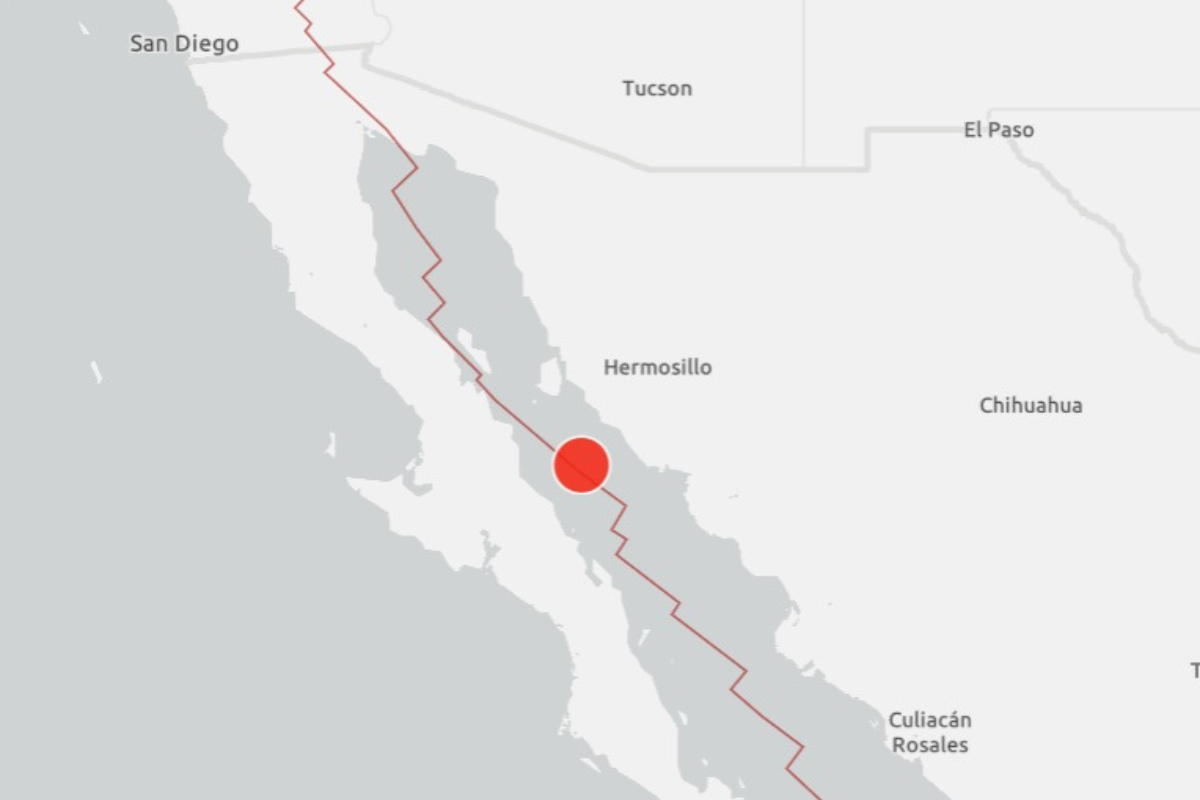
A 5.7 magnitude earthquake struck in Mexico’s Gulf of California early on Friday morning, the U.S. Geological Survey (USGS) said.
The earthquake had a depth of 6.2 miles, and its epicenter was 46.6 miles northeast of Santa Rosalía, Mexico.
The USGS said there is a green alert for shaking-related fatalities and economic losses, meaning there is “a low likelihood of casualties and damage.”
Mexico is “one of the world’s most seismically active regions,” the USGS says, because it sits atop three large tectonic plates.
“The area west of the Gulf of California, including Mexico’s Baja California Peninsula, is moving northwestward with the Pacific plate at about 50 mm per year,” the USGS says.
“Here, the Pacific and North American plates grind past each other creating strike-slip faulting, the southern extension of California’s San Andreas fault.
“In the past, this relative plate motion pulled Baja California away from the coast forming the Gulf of California and is the cause of earthquakes in the Gulf of California region today.”
This is a breaking news story. Updates to follow.