
Not too long ago, cranes seemed to line Broadway and bulldozers moved earth in the East Oakland hills, representing a boom in the construction of new apartment towers, single family homes, and other high-end housing. But the city has long struggled to build homes affordable to working people and those experiencing homelessness.
Recently, the trend flipped. Market-rate construction has screeched to a halt, but affordable housing has picked up the pace.
A bond measure passed by voters, Measure U, and a COVID-era state program called Homekey have helped the city open a lot more low-income housing units — 1,630 homes across 28 properties over the past five years — and get the ball rolling on nearly 2,000 more.
Now Oakland has a new interactive online dashboard showing where that housing is located, who it’s serving, and other details.
The affordable housing built or preserved between the summers of 2020 and 2025 is mainly spread around the Oakland flatlands, a map shows. The offerings include about 500 units for formerly homeless residents and almost 800 for families, according to the data.
If you click through to the second and third slides (don’t miss that option at the bottom of the first map), you can see what housing is in the “pipeline” — projects gearing up for development or currently under construction.
According to these maps, 1,872 brand new affordable homes are coming in the future, and 406 existing properties are going to be “preserved” — converted into affordable housing. The largest is the affordable portion of Mandela Station, a big housing development planned for West Oakland BART that’s faced some setbacks. That project includes 238 low-income units.
The preservation units are the most geographically diverse, because many of them are small properties like single-family homes that a nonprofit has converted to permanent supportive housing with financial support from the city and state.
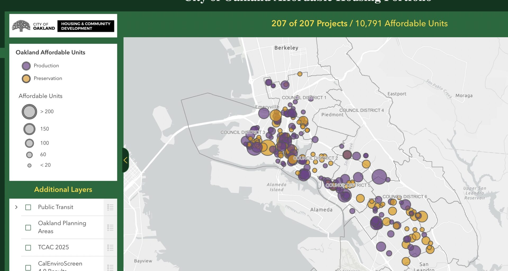
Finally, an additional map displays the city’s entire affordable housing portfolio — 10,791 units sread among 207 properties, both currently in operation and in the pipeline. What’s shown is a wide range of projects in terms of size, age, population, and location. Most parts of the city host a decent number of affordable properties, but they’re notably scarcest in City Council District 4 (Dimond, Laurel, Montclair, Redwood Heights, and much of the hills) and above I-580 and Highway 13 in general.
Oakland, like many California cities, is still lagging far behind state targets for housing construction overall.
Check out The Oaklandside’s guide to applying for affordable housing.
“*” indicates required fields