
San Francisco will open a new recreational trail through its watershed lands in San Mateo County on Monday, offering the public a rare opportunity to visit the highly restricted wilderness where millions get their water.
The six-mile Skyline Watershed Ridge Trail, in the coastal hills off Skyline Boulevard, traverses a variety of terrains, from grasslands to Douglas fir forest to redwood groves, each home to creeks and drainages that contribute to the city’s water supply. Hikers, cyclists and equestrians are welcome.
“These different landscapes filter the water as it runs toward our reservoirs,” said Tim Ramirez, manager of the Natural Resources and Lands Management Division for the San Francisco Public Utilities Commission, during a recent private tour of the new trail. “A place like this allows us to minimize our treatment costs and retain our (high) water quality.”
The SFPUC is generally not in the business of recreation. Yet Ramirez says the agency’s limited trail network is as much about educating people on the origins of their water, and the need to protect it, as it is about providing a source of fun and exercise.
“This is our platform where we can tell our story,” he said.
For most of San Francisco’s history, the 23,000-acre Peninsula Watershed has been off-limits to the public. City officials didn’t want to risk sullying the heavily wooded lands and waterways that send cold, clean runoff to the area’s three reservoirs, Crystal Springs, San Andreas and Pilarcitos. These supplies supplement the city’s water exports from in and around Yosemite National Park.
In 2003, however, the city debuted the 10-mile Fifield-Cahill Ridge Trail. Unlike other trails built on the periphery of the Peninsula Watershed, this trail runs through the heart of the property. The move was largely a response to public demand for greater access. To this day, however, the Fifield-Cahill Ridge Trail is open only for guided outings.
The Skyline Watershed Ridge Trail, which continues the city’s efforts to expand public access, will be different from its predecessor. Visitors will be allowed to come and go as they please, between the hours of 6 a.m. and 6 p.m., starting Monday. Registration is required, though it’s free and can be done online, including at the trailhead where there’s cell service.
The trail’s launching point is a new roughly 25-vehicle parking lot, which is essentially where the Fifield-Cahill Ridge Trail, to the north, leaves off at Highway 92. However, the new trail and parking lot are on the opposite side of the highway as the Fifield-Cahill Ridge Trail, so safely going between the two trails across the highway is not possible. This has left the SFPUC and the California Department of Transportation mulling the possibility of a future overpass for pedestrians and bicyclists.

Highly anticipated trail through scenic, restricted Bay Area wilderness about to open
The beginning of the trail offers the best views of San Francisco Bay, before the path continues through stands of tanoaks, Dougals firs and redwoods.
Along the way, an occasional interpretive panel provides visitors information about the watershed, from wildlife to plant pathogens to the history of Interstate 280 below. There are two primitive restrooms, at mile markers 2 and 5.
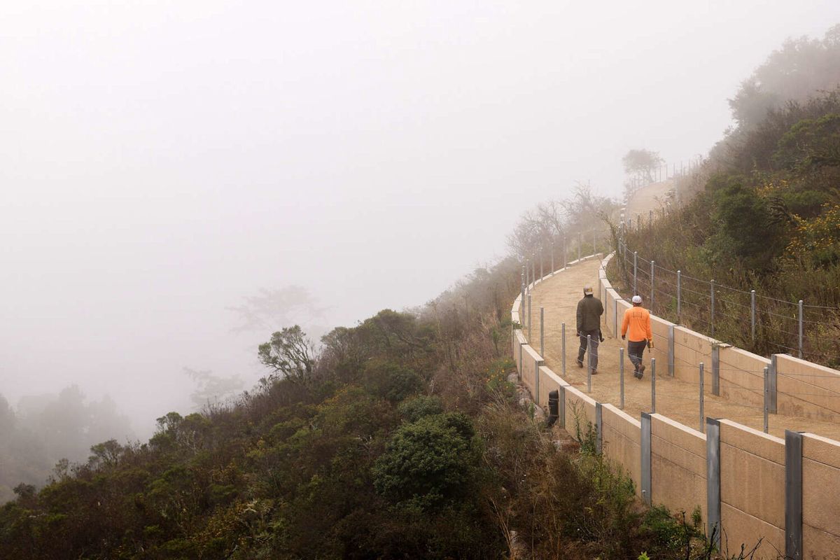
One of the most impressive stretches of trail, at least from a construction standpoint, is an elevated corridor perched on a steep, open hillside with far-reaching vistas. Crystal Springs Reservoir can be seen sprawling dramatically in the distance.
Lisa Wayne, the SFPUC’s watershed resources manager who led the $25.5 million of trail work, said the biggest surprise during construction was just how wet the watershed is. While this obviously benefits water supplies, it can complicate trail development.
“I figured we’re on a ridge, right? How wet can it be?” she said. But “there were lots of seeps and springs.”
In keeping with the SFPUC’s interest in protecting the area, the trail is flanked by a discreet wire fence, to make sure visitors don’t venture deeper into the largely undisturbed watershed. The trail also stays within a half mile or so of Skyline Boulevard.
The route concludes as it approaches the Golden Gate National Recreation Area’s Phleger Estate. There’s no access into the federal lands so visitors will have to retrace their steps back, making for a 12-mile round trip.
The SFPUC is currently working with Midpeninsula Regional Open Space District on developing a spur trail that will link the new trail, near its terminus, with a parking area at Purisima Creek Redwoods Open Space Preserve on Skyline Boulevard. This would provide another way for people to get on and off the new trail.
Janet McBride, executive director for the Bay Area Ridge Trail, praised the Skyline Watershed Ridge Trail as a “key section” of the pending 550-mile regional trail around San Francisco Bay that she’s working to develop.
The new watershed trail and the planned spur, which McBride expects will be completed in two years, help push the Bay Area Ridge Trail to about 75% completion.
The effort to build the Skyline Watershed Ridge Trail was initially called the Southern Skyline Boulevard Ridge Trail Extension Project.
Subscribe
There’s more to San Francisco with the Chronicle. Subscribe today for just 25¢.
This article originally published at Highly anticipated trail through scenic, restricted Bay Area wilderness about to open.