
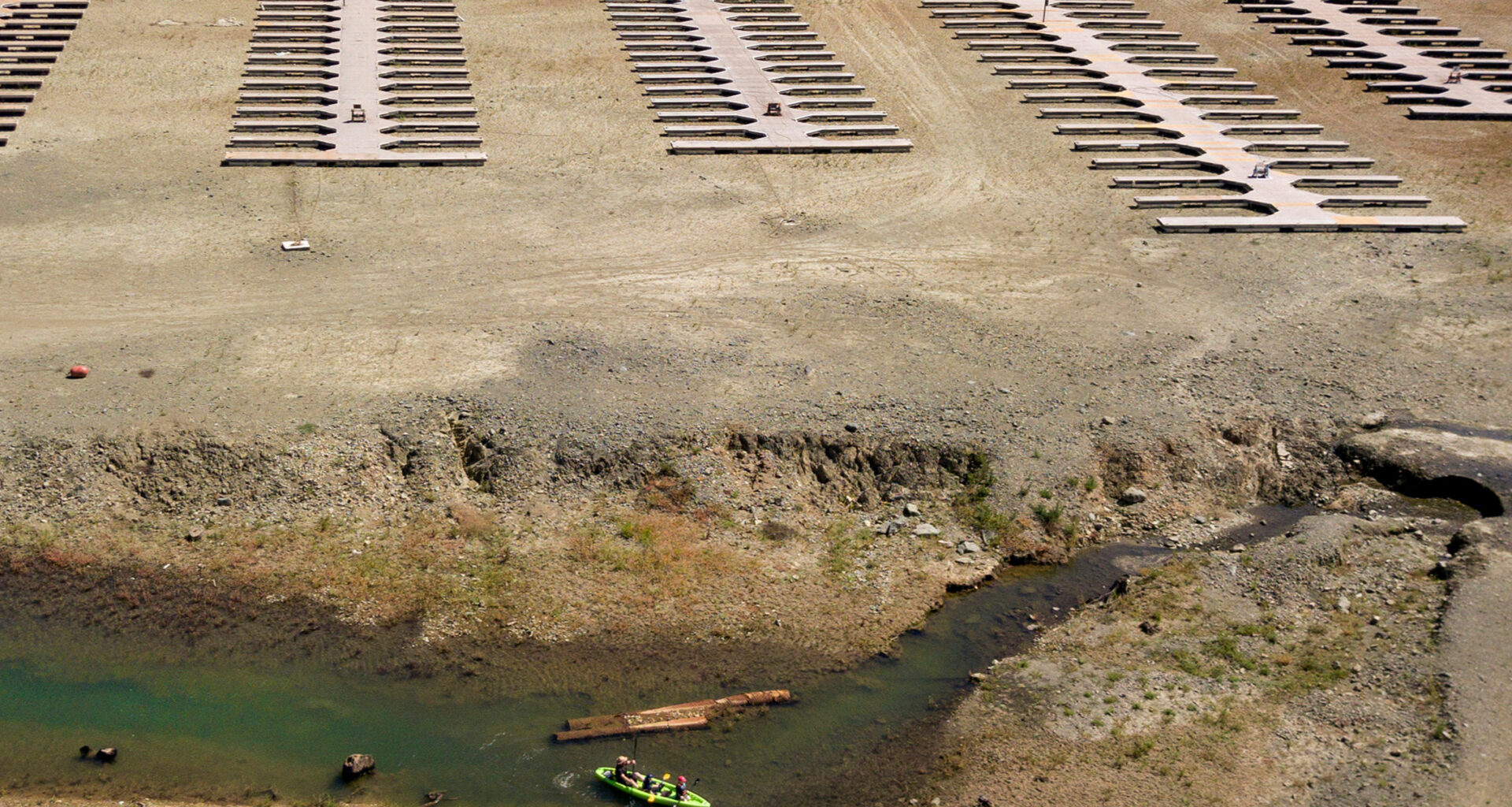
California’s water system is a complicated mix of reservoirs, snowpacks, and groundwater aquifers that supplies the Golden State throughout the year.
Groundwater is especially critical for the state’s agricultural communities to tap into when conditions get dry, but overpumping those aquifers comes with significant consequences.
For years, the San Joaquin Valley has experienced subsidence as those water reserves are drained.
But a new study published last month shows this is not the only region watching the ground sink beneath their feet.
Part of the Northern Sacramento Valley, from Woodland up to Redding, also sank between 2020-2022 as the state experienced widespread droughts — and that damage is irreversible.
J.T. Reager is an earth scientist leading the Water and Ecosystems Group at NASA’s Jet Propulsion Laboratory in Pasadena. He spoke with Insight Host Vicki Gonzalez about the study’s findings, and what can be done to limit future damage.
This interview has been edited for length and clarity.
Interview highlights
Of all the different water sources California has, why is groundwater so important?
Groundwater is a key part of our water resources portfolio. The reason we can grow so many crops and vegetables here in California year-round is because we have such great weather. But the thing we need in order to do that is water. Our natural surface water supply, which is rain and snowmelt, tends to not be enough to meet all of our demand needs for agriculture. We have this huge economy here, it’s a big part of our identity in California. We grow about a quarter of the produce for the entire nation… but the thing that really enables us to do that, especially in our drier years, is groundwater.
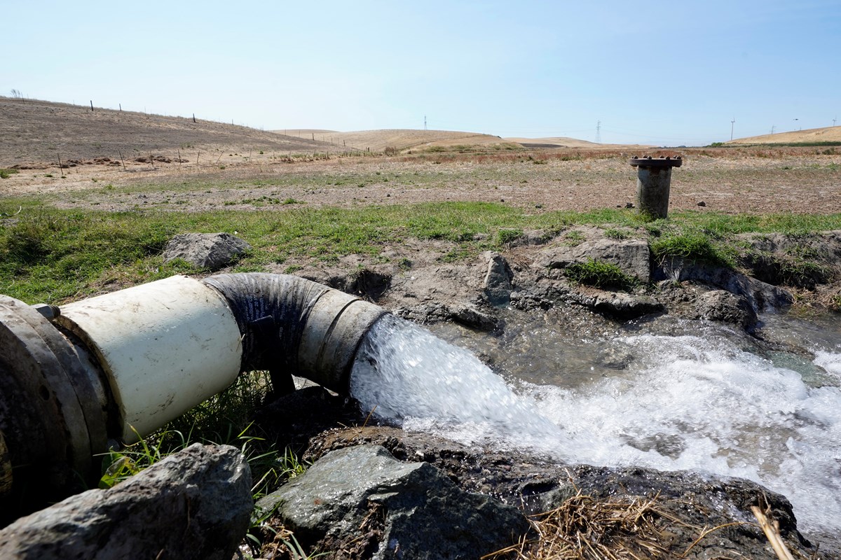 Well water flows from pumps into a canal that will be used to irrigate a vineyard, Monday, July 25, 2022, in Rio Vista, Calif.AP Photo/Rich Pedroncelli, File
So, it’s like an underground sponge?
Yeah! We try to think of groundwater as the savings account in our water budget. You get your monthly income, you get your paycheck coming in, and if you spend a little more than that you might have to dip into your savings. We’ve practically been dipping into our savings for years in order to keep our spending up, in terms of water used for agriculture.
How do you measure groundwater?
Traditionally, groundwater is measured with groundwater wells. Those wells exist on farmland; the water is brought up from deep in the ground to use for irrigation, sprayed on crops and used in flood irrigation and other techniques.
The exciting thing for us is that there’s now the potential to monitor groundwater use — which is basically invisible to the naked eye if you’re standing at the surface — from space. We have this new field, space hydrology. It’s the idea that we can use these satellites in orbit around the Earth to actually measure the changes in groundwater beneath the ground.
It’s like a medical scan for the planet. We’ve got these different techniques. One measures gravity at the surface, and changes in the Earth’s gravity field in time. We’ve got another one that measures the actual movement up and down of the surface locally. And then we’ve got a GPS which actually measures the loading and unloading of the crust that the soil sits on.
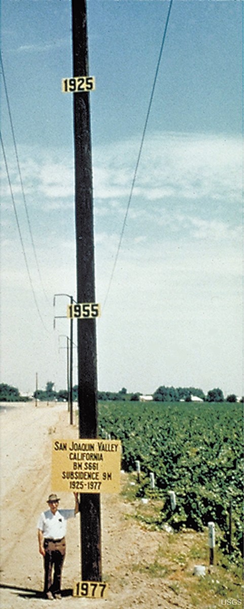 Approximate point of maximum subsidence in the San Joaquin Valley, California in 1977. Signs on the telephone pole indicate the former elevations of the land surface in 1925 and 1955.Richard Ireland, U.S. Geological Survey
At some point we pump out more water than we should and the ground subsides, or sinks. How long has this been a problem?
We’ve been pumping groundwater in California for years, 50 to 100 years, there’s been agriculture and groundwater use in California. In terms of historical damage, the southern portions of the Central Valley is really still in a league of its own. Portions of the San Joaquin Valley have dropped nearly 30 feet over the last century.
But during this recent 2021 drought we really saw the northern portion of the Central Valley, the Sacramento portion, sprinting to catch up — sinking at nearly a foot-and-a-half per year over this period. [It was] the first noticeable major sinkage happening in the northern portion.
Why is that so significant?
The Sacramento Valley has always been seen as this very water rich, resilient northern region. So seeing the ground in the north suddenly collapsing in 2021 was a major red flag. It showed that the drought, and our use of water to compensate for drought, has really pushed us past a tipping point in that region that we thought was safe and is no longer.
Have you noticed any other unusual behavior from these studies?
Interestingly, there are areas that exhibit what’s called “elastic behavior” with groundwater. That means that every time it rains the ground swells up a little bit, and every time it doesn’t rain — and we pump groundwater — the ground sinks a little bit at the surface. Traditionally in the Sacramento Valley that’s what’s happened, this elastic behavior up and down.
But in this one year, 2021 to 2022, we really saw inelastic behavior — this relatively sudden collapse that is not going to come back. That means we’ve entered a new geological regime in groundwater pumping, where now we’re actually pumping the water out of clay minerals. That storage space that used to hold water is now collapsed, and cannot be recovered.
Why is it irreversible?
This actually depends entirely on soil composition. Soil is basically made of three things. You’ve got brown dirt which is carbon-based soil; you’ve got sand; and then you’ve got clay minerals. If soil has a lot of clay in it and it’s wet, those clay minerals are like little coins. They tend to be randomly arranged in the water; they make this kind of matrix that’s like a sponge and is porous.
When we pump the water out, all those clay minerals tend to lay flat and get compressed under the weight of the ground above them. That compression then pushes the clay down into one compact layer, which makes the surface sink. But the consequence is we also lose that storage capacity underground — we can no longer fit water into that porous space that used to be there.
If we use the analogy that groundwater is our savings account, the bank vault itself is getting smaller. We can no longer hold as much money in there as we used to.
How does this subsidence fundamentally change California, and the livelihoods of its residents?
Farmers are on the front lines of climate variability, and groundwater is their primary insurance policy when we don’t have that surface water [like] snowmelt and rain. There’s also jobs and local economies that get affected. When the ground sinks unevenly, it puts a lot of stress on critical infrastructure. We’ve got irrigation canals, flood protection levies, highways, bridges and deep well pipes — those things get threatened.
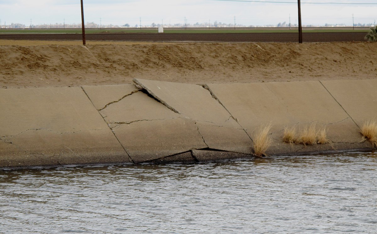 This Dec. 22, 2015, file photo shows a buckle in the lining of the Delta Mendota Canal caused by sinking land near Dos Palos, Calif.AP Photo/Scott Smith, File
And then there’s also the political side of it, which is the Sustainable Groundwater Management Act [SGMA] passed in 2014. With that, local communities are tasked with avoiding irreversible groundwater use and irreversible land subsidence. The fact that we’re seeing the subsidence, there’s implications for regulation and policy there.
Is this just happening in California? Are there other places across the country or across the world experiencing similar subsidence?
There are definitely other places. In order to get this specific style of subsidence you really need two things. You need these clay minerals to exist in the soil, and then you need that [extensive] groundwater pumping. California is a key example. There’s places in India and China and Australia where there is also subsidence, and it just depends on the right combination of human activity and natural geology.
For instance in Mexico City, the city itself has major structural degradation and cracks in buildings, streets and roads due to water use and groundwater pumping. It is an international issue, and groundwater use globally is something that is really often underappreciated. It’s not well monitored to say the least.
When we talk about water storage in the state, we usually think of snow surveys and reservoirs, but groundwater probably doesn’t get as much attention because it’s hard to visualize, right?
Water drives our ecosystems. There’s people that want to go skiing in the winter and they’re thinking about snow. And there’s people that love Yosemite, the waterfalls and the forests there, and they’re thinking about surface water. Stream flow [and] even reservoirs can be beautiful in recreational locations. But groundwater doesn’t have the same popular reflection that some of the other water sources do.
I want to give a shout out, however, to California’s Department of Water Resources, the Sustainable Groundwater Management Act [and] the SGMA Sustainability Office… [they] are doing great work to try to monitor and report on how groundwater is changing throughout the state and the Central Valley.
What are some of the big changes that have taken place over the past several years, especially with droughts?
We’ve had some really dry decades historically. People have said the past 20 years or so have been probably the driest in a very long time, potentially thousands of years. A lot of the water policy and the water use planning that was done throughout the West was done at a time when we had relatively wetter conditions.
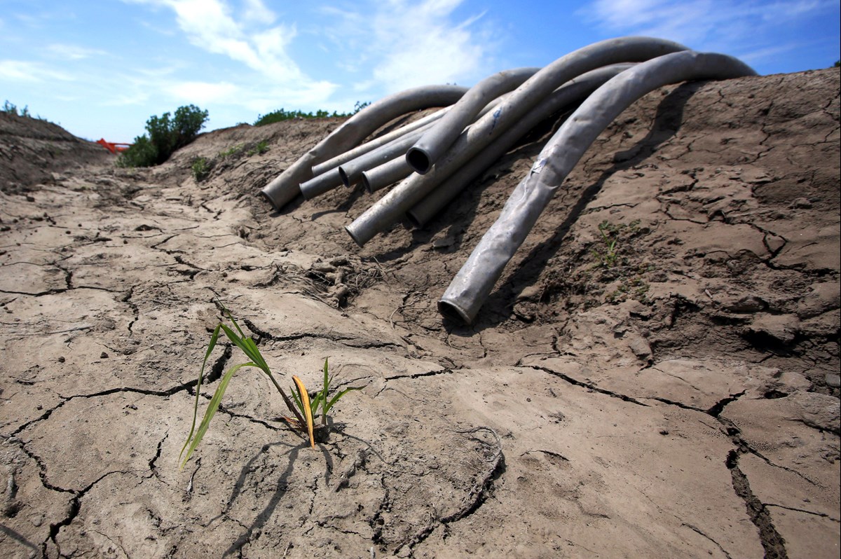 This May 18, 2015 file photo shows irrigation pipes along a dry irrigation canal on a field near Stockton, Calif.AP Photo/Rich Pedroncelli, File
Now the reality of dealing with less water is hitting us, and it’s a challenge across the West. We’ve got population growth, a lot of agriculture and a lot of development. Our demands are exceeding our supply, and those all strain our system.
Is there a way to manually refill or replenish groundwater?
To some extent. There are investments through the state government in something called managed aquifer recharge [MAR.] There’s been some MAR planning, MAR mapping and MAR activities taking place throughout the state, which includes determining which portions are the best to actually recharge aquifers.
The way this works, basically, is you allow rivers or streams to overflow into floodplains. Those floodplains are sometimes built with a lot of rocks near the surface, a lot of really coarse material, so the water can seep into the ground deeper and recharge the aquifer. The rates [of recharge] that you can actually get with managed aquifer recharge are probably on the lower end of what we actually use in California, probably about 10% or so. But we do have the [SGMA] to really pull our groundwater use across the state into sustainable levels. That included a provision on the subsidence at the surface; that needs to also be halted. There is enforcement and encouraging support by the state for reduction of groundwater use, so we can have a long-term positive future and maybe just use what gets replenished every year.
Forecasts have called for a “super El Niño” which could bring a lot of wet weather to California. What kind of an impact could that have on our groundwater?
We can get big rains in El Niño. It’ll hit mountains [or] the valley, and it’ll run right into streams and reservoirs, and they can’t all be held back. That water doesn’t have time to really penetrate deep into the ground and it’ll just flow back into the ocean, and at the end of the day we end up not actually capturing that much of it. The best story for us is actually when we get a lot of snow. That snow acts as a kind of water reserve, a huge reservoir that fills the entire Sierra Nevada mountains. It’ll melt slowly through the spring and summer, and that gradual trickle will recharge the aquifer quite nicely.
Now, all of that being said, I do have to clarify that historically, we don’t always get a lot of wet weather during El Niño years. If you look back at all the El Niños over the past century or so, only about half of those have actually delivered substantial, increased rainfall to California. That depends on something that happens in the atmosphere called an “atmospheric ridge.” It acts as a barrier or a blockade to that ocean water, and it doesn’t get to come in. I think it’s about a 50-50 chance with El Niño, but fingers crossed we do get some water, and a lot of that is snow this winter. That would be perfect for recharging aquifers.