
It’s the first week of November, which means I’ve commented on and complained about the end of daylight savings at least 10 times over the last six days.
Among my grumblings, I’ve been thinking about how the early sunsets will impact my hiking schedule, as I often hit the trail in the later afternoon to take advantage of the sun. The winter time change may help me avoid sitting in rush hour traffic on my way to a trailhead, but like every year, it takes some getting used to.
I’d recommend giving yourself plenty of time in the day to make your way to Palomar Mountain State Park in North County for this week’s hike. The drive is about an hour and a half from central San Diego, with the park near the boundary between San Diego and Riverside counties. But the hike is well worth the journey to get there.
This column is the second installment in a three-part series about hiking many of the state park’s trails. A few weeks ago, I wrote about a 3.5-mile moderate loop that takes hikers to Boucher Hill and a fire lookout tower. It was just one section of a roughly 10-mile loop that I completed.
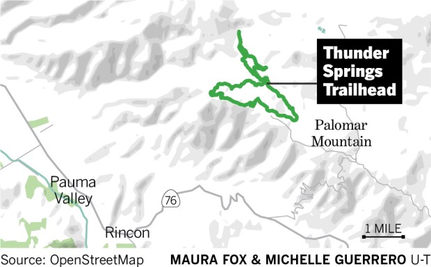 A 4-mile moderate loop at Palomar Mountain State Park. (Maura Fox and Michelle Guerrero / The San Diego Union-Tribune)
I’m dividing my hike into three columns so that hikers can fully take in the different trails at Palomar Mountain State Park, as well as make their hike as long or as short as they’d like.
Note that there is a $10 day use fee to enter the state park, and dogs are not allowed on trails. Consider consulting a trail map before and during your hike. There are also signs posted along the trails that help give hikers a sense of direction.
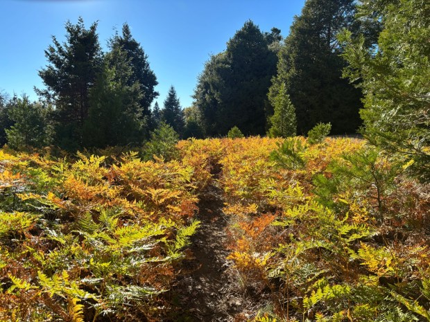 The Chimney Flats Trail as hikers head northwest, after crossing the paved road. (Maura Fox / The San Diego Union-Tribune)
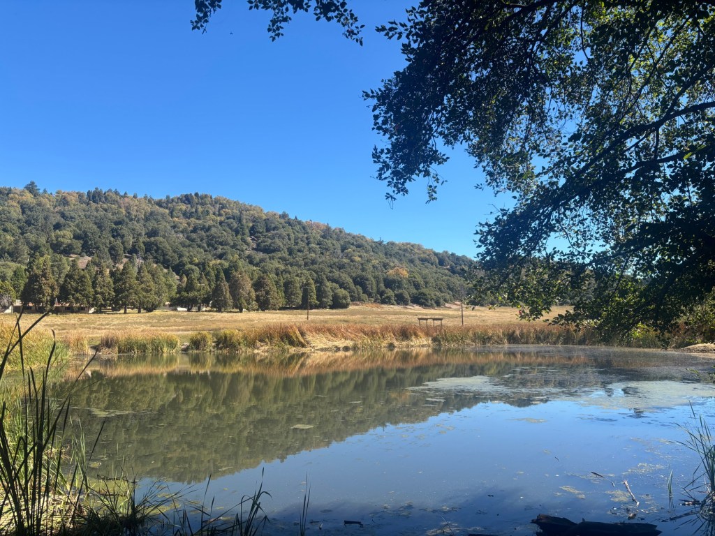
Begin this roughly 4-mile moderate loop at Doane Pond, located off Doane Valley Road. Hikers can drive there through the park’s main entrance on State Park Road. There is a parking lot, restroom and a few picnic tables. Hikers will begin walking on a trail on the eastern side of the pond. As the path wraps around the pond, it will meet with the Thunder Springs Trail, which heads southeast.
Take the Thunder Springs Trail for about a mile as it gradually climbs above Doane Creek to the east, shaded and surrounded by a range of tall oak, pine and cedar trees.
The trail transitions into the Chimney Flats Trail, which travels northwest up an incline for roughly a mile before coming to a paved road. Hikers should cross the road, where the trail continues on the other side.
In this section of the hike, as the trail ran parallel and relatively close to the paved State Park Road, a deer and fawn were spotted munching on the grass in an open field. Once they saw us, they sprang away, but for a moment we stood and watched them in peaceful silence.
After hiking about 2.5 miles, hikers will reach an intersection with Scott’s Cabin Trail. This route leads to the Silvercrest Picnic Area if you go south, but for this hike, follow the route north for about half a mile before intersecting with the Cedar Trail.
The Cedar Trail connects with the Adams Trail, which was included in my hike at Palomar Mountain that I wrote about in the last column. But to complete this hike’s loop, head east down the Cedar Trail for another half-mile before reaching the Doane Pond where you started.