
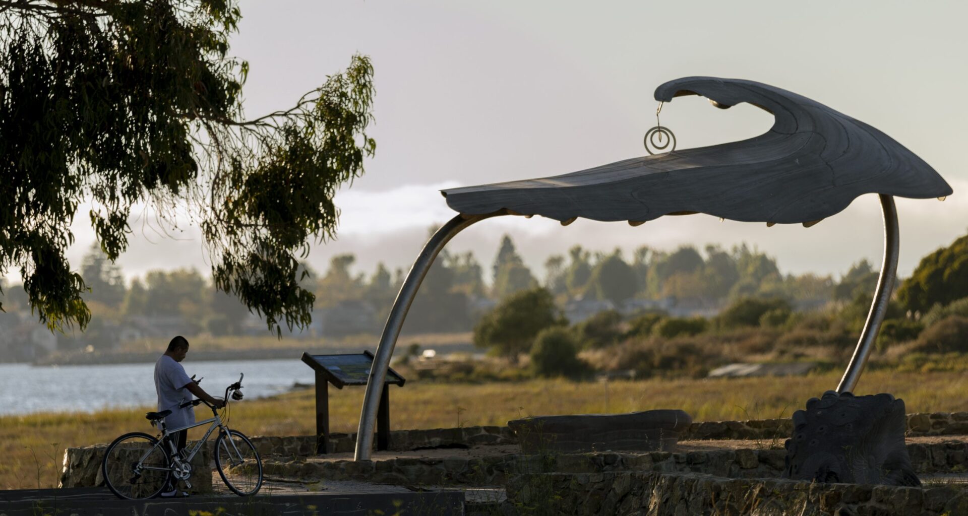
The Martin Luther King Jr. Shoreline in East Oakland, home to wildlife including snowy egrets, great blue herons, and a range of sandpipers, terns, and grebes, has long been accessible mainly to drivers. A new city project aims to change that by making it easier for pedestrians, cyclists, and transit riders to enjoy its pathways and beautiful views of the San Leandro Bay.
At a meeting of the Bicycle and Pedestrian Advisory Committee last Thursday, Oakland Department of Transportation staff said they were looking to add a shared-use path on the south side of 66th Avenue, from San Leandro Street to Oakport Street, along with new signal crossings and a couple of new AC Transit bus stops at a park trailhead. The shoreline has multiple staging areas, from the Tidewater Boating Center near High Street at its western end to Martin Luther King Jr. Grove near Hegenberger Road, to the east. But one of the main entrances — and the only one near a BART stop — is near the Garretson Point Staging Area, off of 66th Avenue.
 A egeret at dusk in the Martin Luther King Jr. Regional Shoreline, Aug. 24, 2026 in Oakland. Credit: David M. Barreda
The project would remove some parts of the area’s current infrastructure, such as the southbound ramp onto the freeway at the end of 66th Avenue, to reduce interactions between speeding drivers and pedestrians, and one or two driving lanes on southbound 66th Avenue to make way for a shared-use path. The path would allow people to walk or cycle more easily from San Leandro Street, where the Coliseum BART is located, to the park less than a mile away.
“It takes a great deal of coordination and review from Caltrans in order to close that ramp,” said OakDOT’s Jane Mei, a city planner. “ There is currently a pedestrian crossing over the middle ground near the area where basically people press a button, the yellow light flashes, and maybe the cars stop, maybe they don’t.”
 A bicyclist exits Martin Luther King Jr. Regional Shoreline and crosses at the entrance to I-880 South on Aug. 24, 2026 in Oakland. Credit: David M. Barreda
The initiative, known as the 66th Avenue BART to Bay Trail Project, has been in the works for some time and gained momentum in 2021, when the East Oakland Neighborhoods Initiative community plan identified it as a top community priority. Other studies, including the East Oakland Mobility Action Plan and the Martin Luther King Jr. Shoreline Access Study, followed, with OakDOT receiving a total of $3.3 million from regional and state funders in subsequent years to design the road changes.
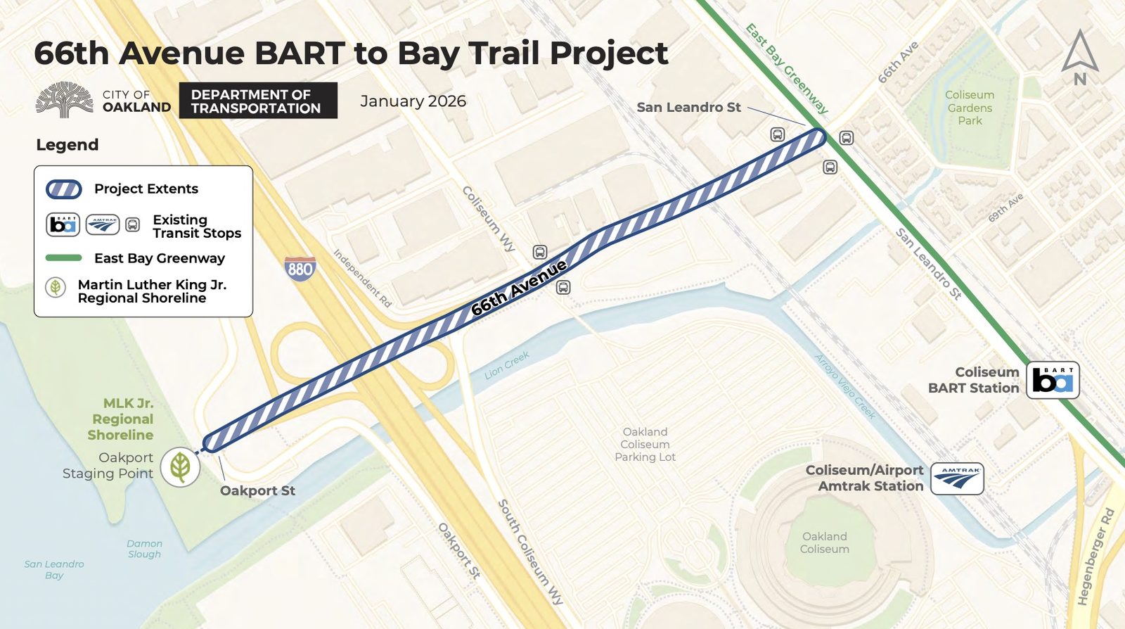 Planned road changes on 66th Avenue will connect Martin Luther King Jr. Regional Shoreline to the developing East Bay Greenway, along San Leandro Street. Credit: OakDOT
Some residents of Oakland don’t even know the park exists because it’s partially obscured by the huge freeway next to it, I-880, and the prominent Oakland Coliseum complex. While the park’s paths are populated by cyclists and dog walkers and its shoreline by anglers, one of the recent studies found that a full one-third of deep East Oakland respondents didn’t know it existed. Another found that a quarter of those surveyed would be more interested in visiting the shoreline if free transportation were available.
The studies found no meaningful pedestrian or bike access to the park and noted a failure by local transit agencies to establish a dedicated bus stop serving low-income people living within a few miles of the park. The only routes that go near MLK Shoreline are the 1 and 40 lines that run along Bancroft Avenue and International Boulevard and the 73 and 40 lines that run along 73rd Avenue.
Reaching the park without driving typically entails either walking along a narrow, dangerous sidewalk on the 66th Avenue bridge, which crosses the freeway, or cycling alongside fast-moving drivers on Oakport Street. Walking from San Leandro Street to the park means crossing three sets of train tracks, including active ones.
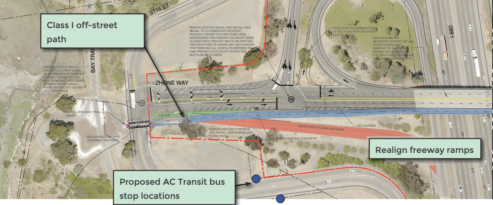 Under the Oakland Department of Transportation plan, the end of 66th Avenue near the shoreline will be redesigned to reduce dangerous interactions with speeding drivers. Credit: OakDOT
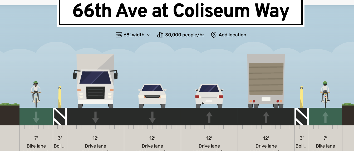 A cross-section mockup made by Bike East Bay’s Robert Prinz of what redesigned lanes at 66th Avenue and Coliseum Way could look like. Credit: Robert Prinz
OakDOT staffers said at the meeting that the current plan involves widening the pedestrian and vehicle bridge.
Mei and another OakDOT staffer, Chase Fowler, said at the BPAC meeting that the city is preparing to begin a design update and that OakDOT expects to sign with the engineering and design consultant in February. Finalizing the design and coordinating with the Union Pacific Railroad and the state transportation agency, Caltrans, will take several years, they said, so construction may not begin until 2030.
“ We only have an estimate right now for the construction of the project, so it’s out of date, but even that estimate was $12 to $15 million, said Fowler. “We don’t have any construction funding secured for the project right now.”
 The 66th Avenue bridge would be transformed as part of the 66th Aveenue BART to Bay Trail project, seen here from Martin Luther King Jr. Regional Shoreline, Aug. 24, 2026 in Oakland. Credit: David M. Barreda
At the BPAC meeting, Bike East Bay advocate director Robert Prinz thanked the OakDOT team for their work on the project but urged them to implement interim measures on a shorter timeline, including traffic-slowing and pedestrian and bike improvements on 66th Avenue during the expected paving improvements.
“I know the Major Projects Division is separate from the Paving Division, but can you remind them there is an upcoming paving project on the paving schedule occurring in 2028-ish? I really don’t wanna see that happen without something happening alongside that with this project,” he said. “Maybe even use this as an opportunity to pilot some ideas that you might have for more significant infrastructure changes.”
The Martin Luther King Jr. Regional Shoreline is a deceptively large 748-acre park and natural preserve. The park connects to the Garretson Point Trail behind several Port of Oakland-owned business parks, many of which are occupied by car dealers. If pedestrians walk southeast from the park, they can reach the El Cerrito Creek Trail, the Arrowhead Marsh pier, and even the Doolittle Bay Trail next to the Oakland Airport, all along the Oakland coastline.
 The wetlands of Martin Luther King Jr. Regional Shoreline, Aug. 24, 2026 in Oakland. Credit: David M. Barreda
“*” indicates required fields