
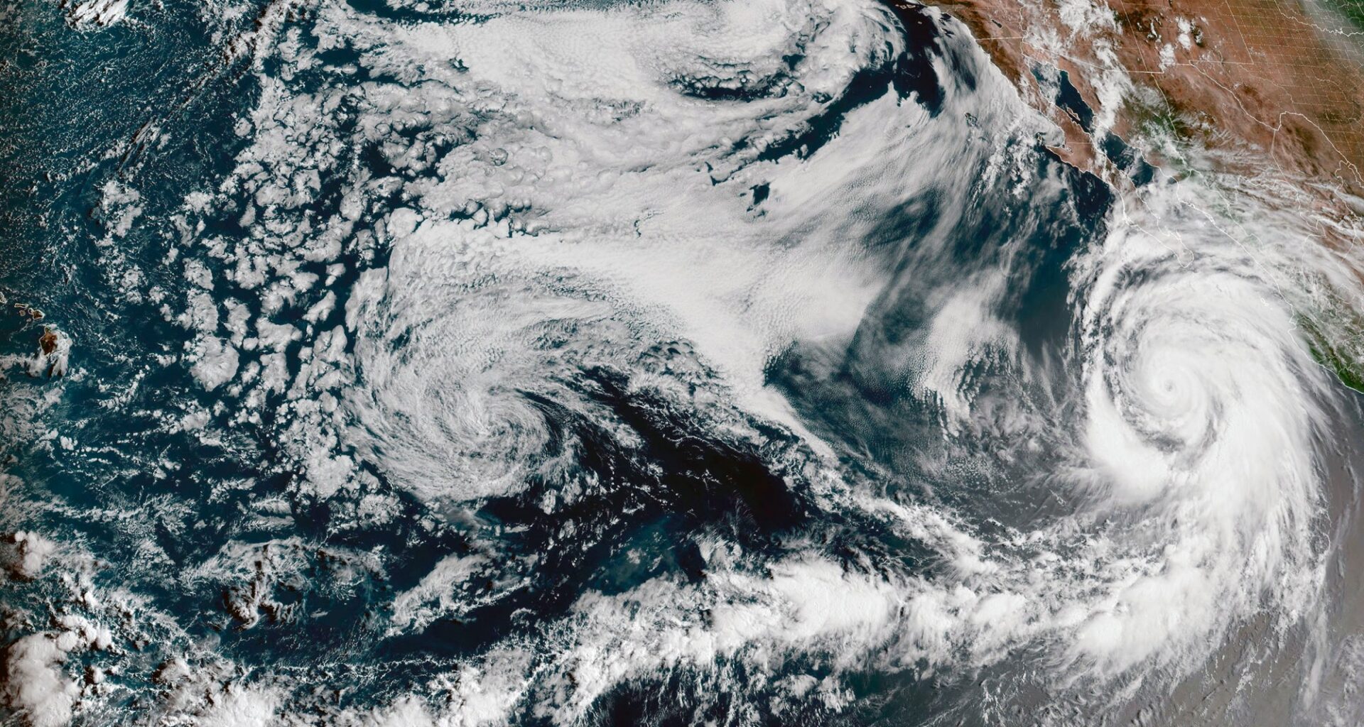
The National Weather Service says it’s studying whether an El Niño-enhanced tropical storm that’s developing off southwest Mexico will curve to the north-northwest and hit San Diego County with heavy rain and big waves over the Labor Day weekend.
Forecast models indicate that the system, which will be known as Marie when it’s more fully defined, is most likely to head straight out to sea below the tip of Baja California.
But scientists note that the ocean is unusually warm and will pick up additional heat from El Niño, a coupling that could result in the system angling more toward land. It’s also possible that Marie will grow into a large hurricane, increasing its ability to throw off rain at great distances.
The situation is causing a bit of unease because scientists believe one of the strongest El Niños on record will hit Southern California this fall and winter and Marie may be a sample of what’s to come.
The emerging storm represents “a roll of the dice situation,” said Jay Cordeira, an atmospheric scientist at UC San Diego’s Scripps Institution of Oceanography. “There’s a low probability that the system would come our way. But it could happen because the water is so warm.”
He noted that the sea-surface temperature exceeded 80 degrees last week at a buoy off northern San Diego County. That’s at least eight degrees above normal.
The weather service says the potential risks from Marie include “the risk for coastal flooding as astronomical high tides will occur the week of Labor Day.” Tropical swells are roughly forecast to arrive Saturday and Sunday, coinciding with high tides of up to 6½ feet.
“Anticipated wave heights will depend on the track of the storm, so these remain uncertain. It is still way too early to discuss expected rainfall totals,” the weather service noted. However, even with a storm track farther out to sea, “tropical moisture may still be funneled into the area during Labor Day Weekend.”
The situation is also being closely monitored by Surfline, the Huntington Beach-based marine forecasting service.
“While there is some uncertainty on the would-be Marie’s longer-range track, it will be on a northwest track in the shorter term (next 2-3 days),” said Kevin Wallis, a Surfline forecaster.
“Marie will be a large to potentially very large tropical cyclone on a favorable track for SoCal swell production mid to late this week. Good chance we’ll see a strong southeast to south-southeast angled swell build through the coming weekend, which could be the largest tropical swell of this active season.”
Tropical storms rarely make a direct hit on San Diego. But it happens. Hilary rolled ashore as a tropical storm on Aug. 20, 2023, bringing heavy rain and wild winds that affected virtually all of Southern California.